
-
0:46

Crowds gather for Fins and Feathers Fest at La Porte City Fairgrounds
-
0:46

Paramount School of Excellence hosts teacher fair
-
2:30

Voting advocacy, peaceful demonstrations and donations: South...
-
2:04

Warming to start the week, Showers and storms by Tuesday
-
2:10

Cool, but calm, today
-
1:23

City of South Bend presents an ’Age-Friendly Plan’ to better...
-
0:54

South Bend Venues Parks and Arts hosts ’Adult Recess’
-
2:27

Why Aneyas Williams turned down the transfer portal and stayed...
-
2:21

Bourbon community rallies around Triton boys’ basketball team...
-
5:02

Dave Matthews shares details about LLC bankruptcy filings
-
1:00

Warming up this weekend before more storms next week
-
1:46

A chilly and calm start to the weekend

Saturday will be a wild, warm and windy day. Highs will spike near 80 and wind gusts top 30 mph out of the south. The approaching weather-maker will bring a line of rain, possible thunderstorms late Saturday afternoon and evening. The severe threat is low, but given the already windy forecast a cell doesn’t need much for isolated damaging wind. The end of the weekend is fair and quiet.
Tonight: Cloudy, scattered showers, low 64. 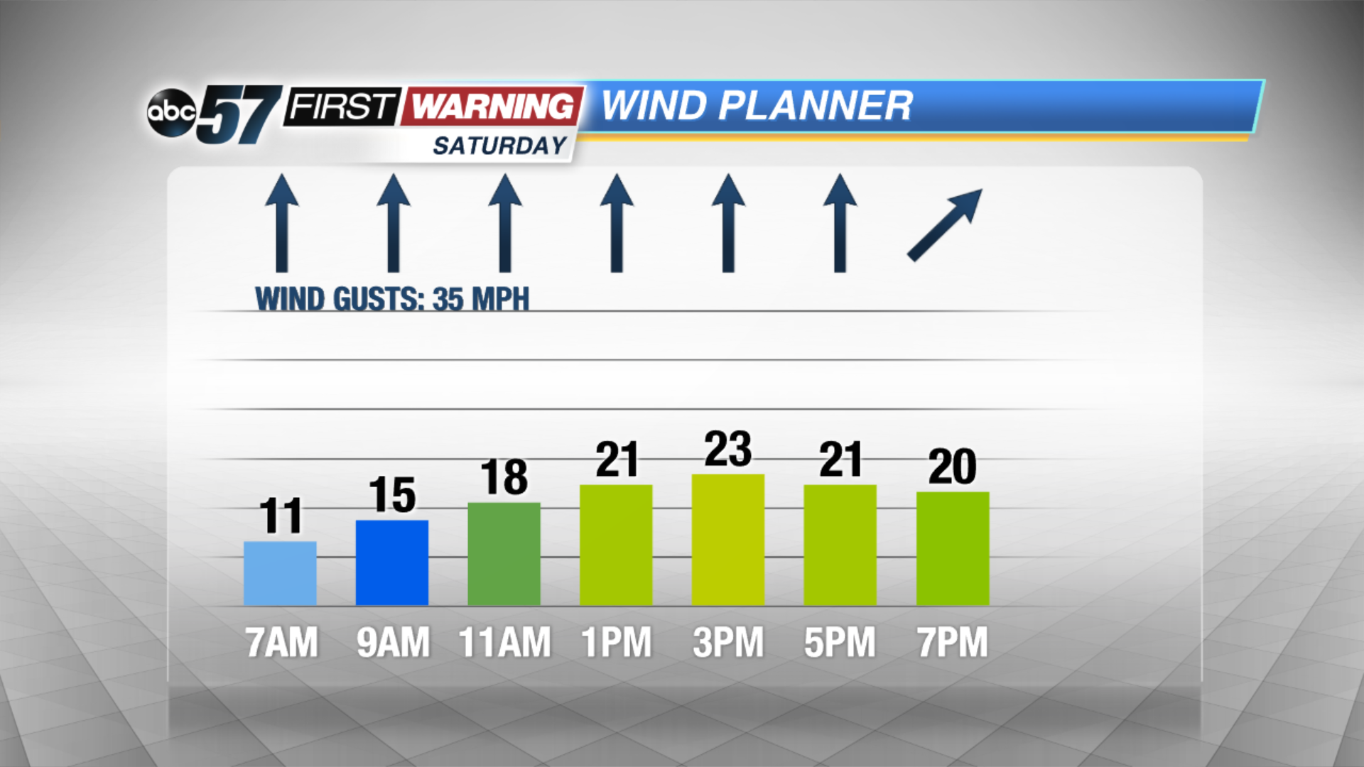 Wind gusts likely to top 30 mph Saturday afternoon
Saturday: Warm and windy, afternoon/evening showers and storms, high 80.
Sunday: Mostly sunny with highs of 76.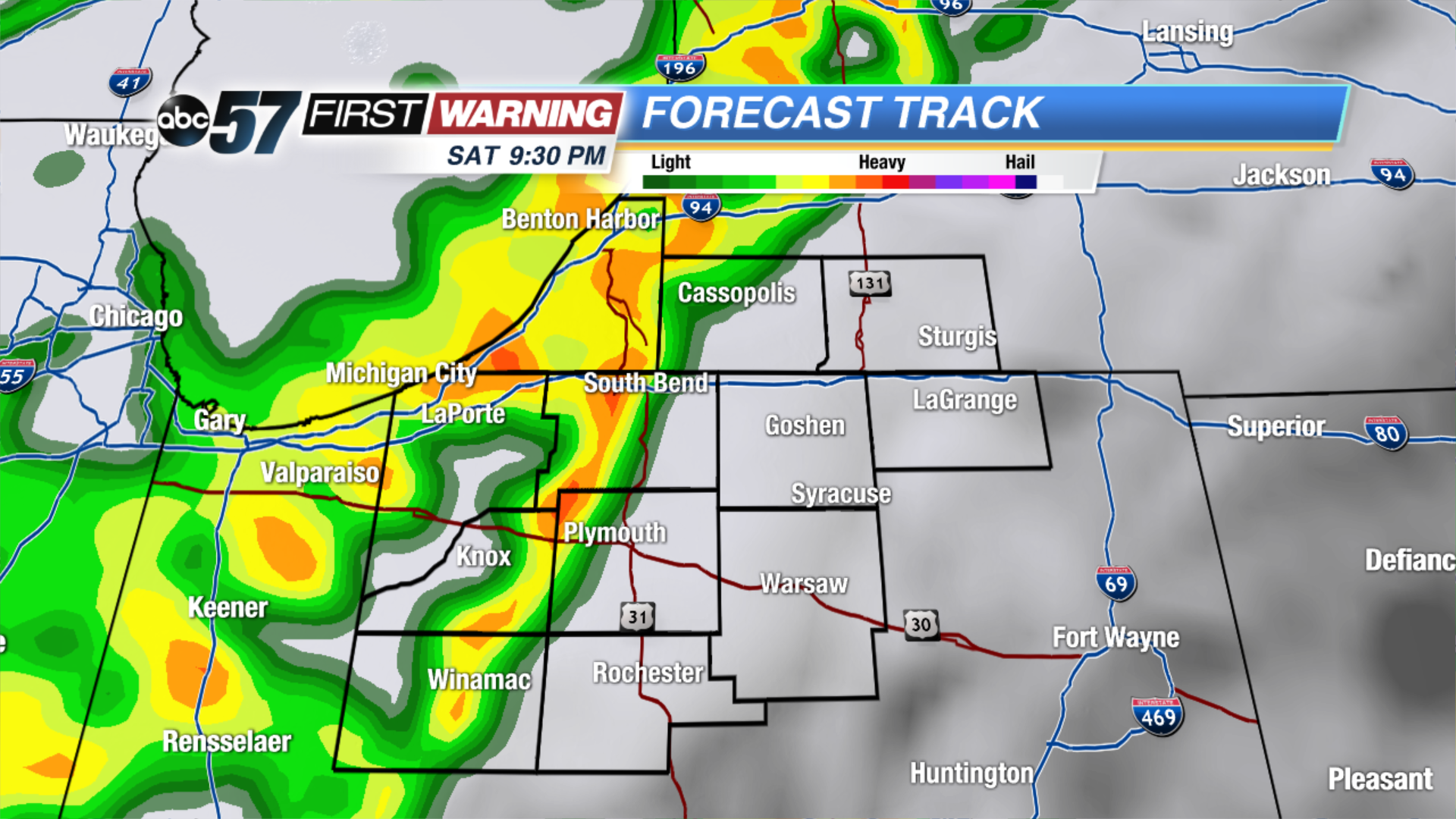 A line of showers / storms is likely Friday afternoon/evening
Monday: Sunny, highs in the upper 70s.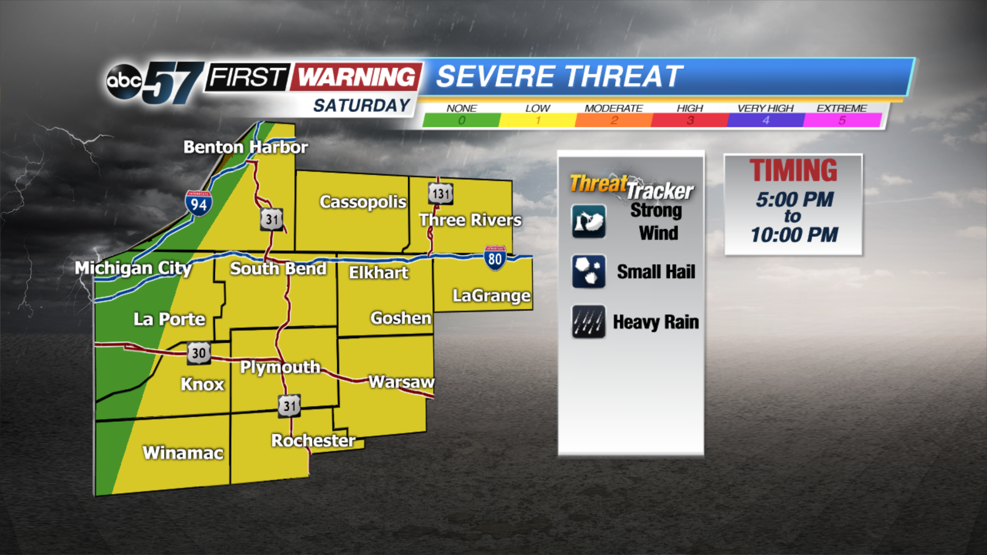 Severe threat is low but not zero, storms likely after 5 PM.