


ABC57 First Warning Neighborhood Weather
Tuesday, April 7th, 2020
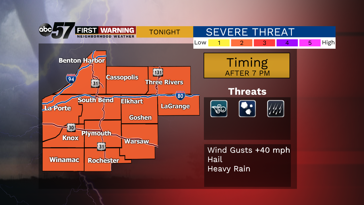
Temperatures continue to rise today, topping out at 72 degrees for the first time in 2020! After morning thunderstorms, clouds will break up some this afternoon. More storms are possible later in the evening. A couple of stronger storms with gusty wind and hail cannot be ruled out.
Daytime highs only slightly drop for Wednesday, giving us another beautiful day! A strong cold front will move through Wednesday night though, bringing rain and much colder air. We will finish out the remainder of the week in the mid 40s. Easter weekend rebounds slightly into the low 50s with a chance of rain/mix on Easter.
Today: AM Showers / Late evening storms. High 72.
Tonight: Storms possible early. Low 50.
Wednesday: Partly sunny. High 69.
Thursday: Partly to mostly cloudy. Breezy. High of 46.