
-
1:30

Country music star Jake Owen to play at Blue Gate Performing...
-
1:51

Warm and sunny stretch with a few showers possible this weekend
-
0:30

Prayer vigil held for domestic violence victim in South Bend
-
1:10

Bristol Town Council votes in favor of annexation of 500 acres...
-
0:52

Official ribbon cutting for The Delta neighborhood in Elkhart
-
1:08

Traveling or booking a trip soon? Here’s what to know
-
0:27

Elkhart Police Department investigating a hit and run on Cassopolis...
-
2:40

Recovery efforts continue after EF-1 tornado devastated Edwardsburg
-
1:22

The March rollercoaster continues
-
0:55

Mishawaka High School Theatre presents ’Chicago! Teen’
-
2:25

Local chef showcasing her food at Pacers game
-
3:46

Local farmers concerned war with Iran will impact fertilizer

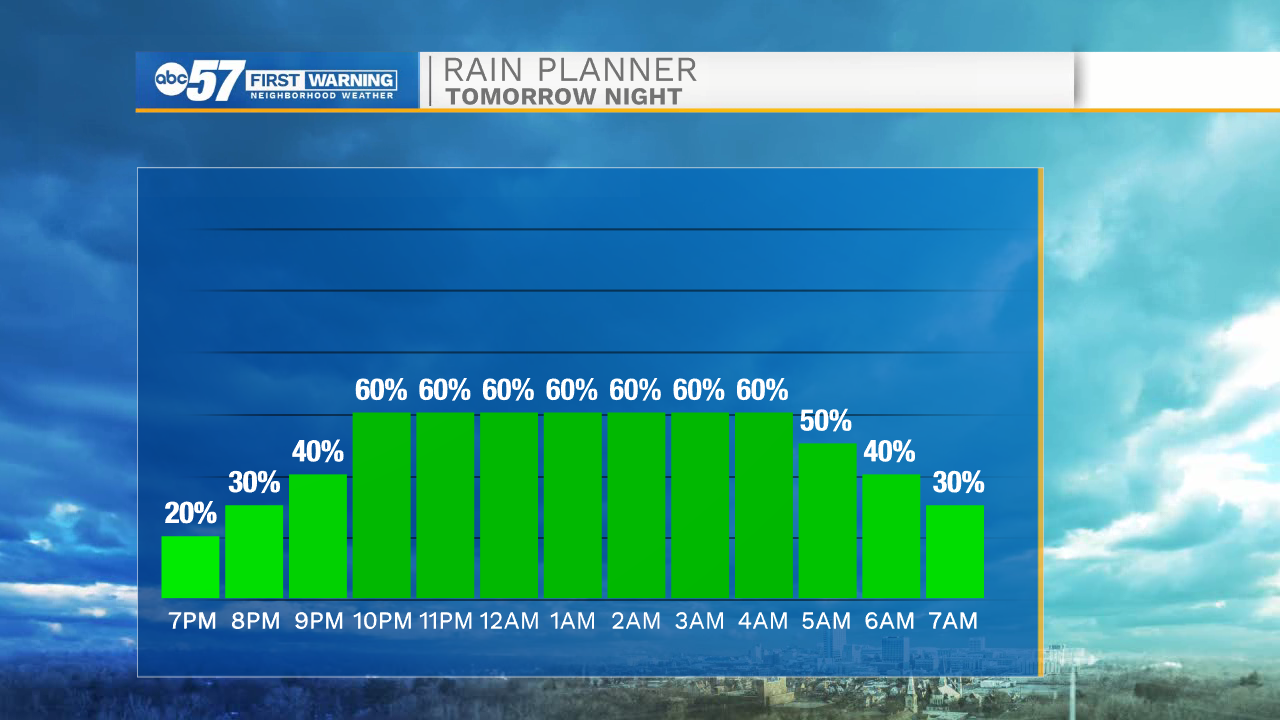
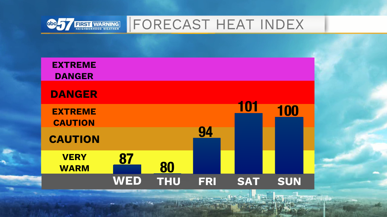
The humidity continues to rise Wednesday as temps near 90. Scattered rain showers are likely Wednesday evening starting after 7:00 p.m. The severe threat remains very low but a few embedded thunderstorms are possible, with stronger wind gusts. Showers clear Thursday morning. Extreme heat in is the forecast through the weekend, high in the 90s and a heat index 95 to 100.
Tonight: Clearing. Low 65.
Tomorrow: Mostly clear to partly cloudy. Evening showers/storms. High 88.
Thursday: Showers ending, partly cloudy. High 84.
Friday: Mostly sunny. High 88.
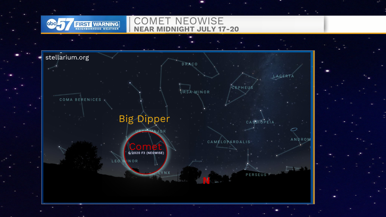
Best possible viewing of comet Neowise comes this weekend
Sign up for the ABC 57 Newsletter