
-
2:16

Notre Dame’s CJ Carr embraces growing expectations while leading...
-
2:34

Injuries sideline key linebackers as Notre Dame leans on depth...
-
0:58

U.S. Army increases maximum enlistment age from 35 to 42
-
2:08

Large hail, damaging winds and tornadoes possible Thursday
-
1:40

Nicholas Stanley appears in court, prosecutors push to prevent...
-
3:18

Expert breaks down high gas prices and factors impacting price...
-
2:08

Westview community rallies around boys’ basketball team headed...
-
2:06

The threat for severe weather has increased
-
2:16

More sunshine today with a severe risk tomorrow
-
0:32

Granger residents share input on proposed S.R. 23 roundabout
-
2:59

Seven local boards unanimously approve fire territory merger...
-
2:05

JobSpark helps inspire career exploration for middle school students

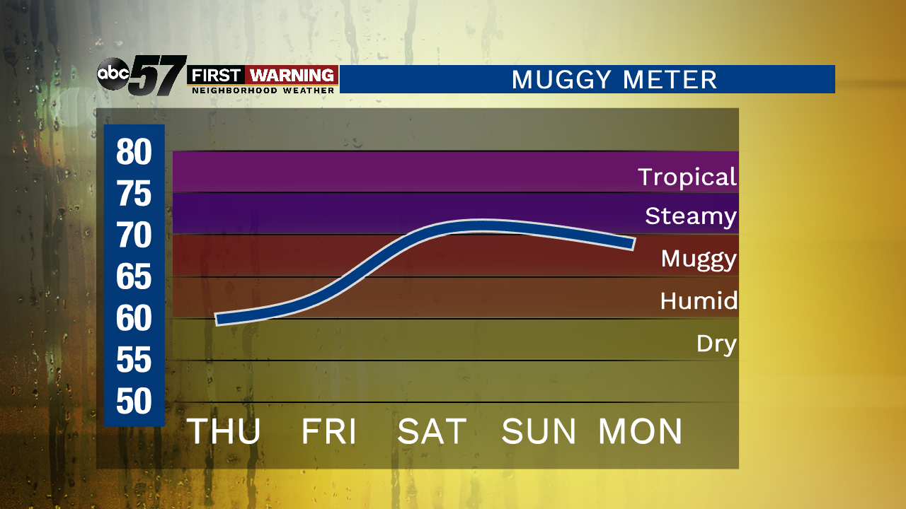
It’s cooler today and comfortable with some sunshine! There is still an isolated shower chance but most should stay dry. Clouds increase tomorrow with showers and thunderstorms possible after midday. That chance of rain lingers into Saturday along with the heat and humidity going up. Daytime rise to the mid-80s for the weekend with a chance of rain again Sunday. It is not a washout though. The pattern remains active through Tuesday before we see a stretch of sunshine.
Today: Partly cloudy, isolated shower possible, high of 77.
Tonight: Partly cloudy, low of 58.
Friday: Increasing clouds, shower/storm possible after midday, high of 78.
Saturday: Partly to mostly cloudy, showers/storms possible, high of 84.
Sign up for the ABC 57 Newsletter