
-
0:58

Cookies and Canvas for the Heart raises awareness for children’s...
-
2:07

Most residents have power restored following high winds
-
0:44

26th annual St. Patrick’s Day Parade takes over Downtown South...
-
2:42

Active weather arrives Sunday
-
3:22

Calm today, storms return Sunday
-
2:58

Thousands of people across Michiana experienced power outages...
-
1:13

Earl Wigfall holds Detective Trivia Night for Sheriff campaign
-
1:50

Preparations underway for South Bend’s annual St. Patrick’s...
-
0:24

CAVA set to open in Mishawaka
-
1:16

Groundbreaking project underway for housing development
-
0:52

Jefferson Boulevard renamed to kickoff St. Patrick’s Day festivities
-
0:35

Congressman Rudy Yakym on Iran conflict

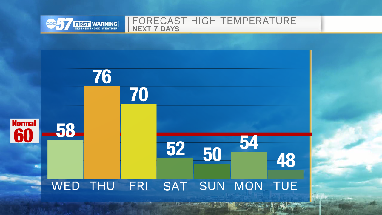
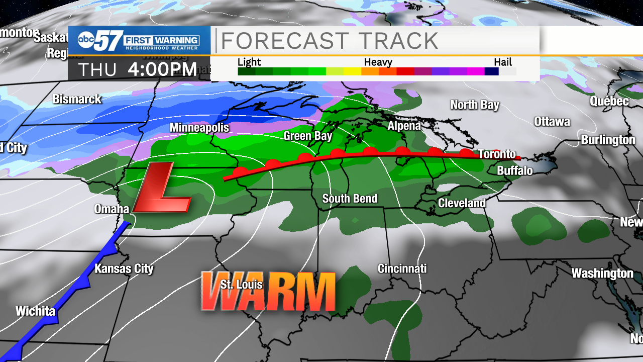
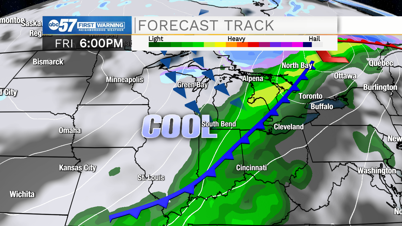
Showers end before sunrise Wednesday with another fair afternoon. Showers return early Thursday morning as the warm front surges northward, temperatures rise quickly and skies clear after it passes. Friday will be the day of dramatic change. A high near 70 at or before noon, then temperatures crash as the cold front cuts through in the afternoon. Rain, even some thunder and gusty wind arrive with the cold front. The weekend is cool again with highs in the low 50s.
Tonight: Scattered showers, cloudy. Low 50.
Wednesday: Mostly cloudy. High 58.
Thursday: Partly cloudy, warm and breezy. High 76.
Friday: Temperatures fall from 70 midday. Rain / T-showers with gusty wind.
Sign up for the ABC 57 Newsletter