Warming up with storms possible mid-week
By: Emily Kennedy
Posted: Apr 30, 2018 3:26 AM EDT

-
2:00

Annual Studebaker car show takes over Ironwood Plaza
-
0:55

Beautiful weekend expected
-
1:05

Truly wonderful conditions
-
0:41

One person left with serious injuries after high-speed pursuit...
-
2:15

Fort Wayne Tin Caps put an end to the SB Cubs winning streak
-
1:21

This weekend is the annual Hall of Heroes Comic Con
-
0:46

Elkhart Police Department respond to shots fired call at the...
-
3:55

ABC57 speaks with Cass County Commissioners, Judge and Interim...
-
2:48

Common Council to consider appeal options following South Bend...
-
0:52

South Bend seniors explore local parks, event centers, and available...
-
1:51

Mentone Egg Fest celebrates 80th year
-
4:58

New reactions after Notre Dame releases findings of priest sex...

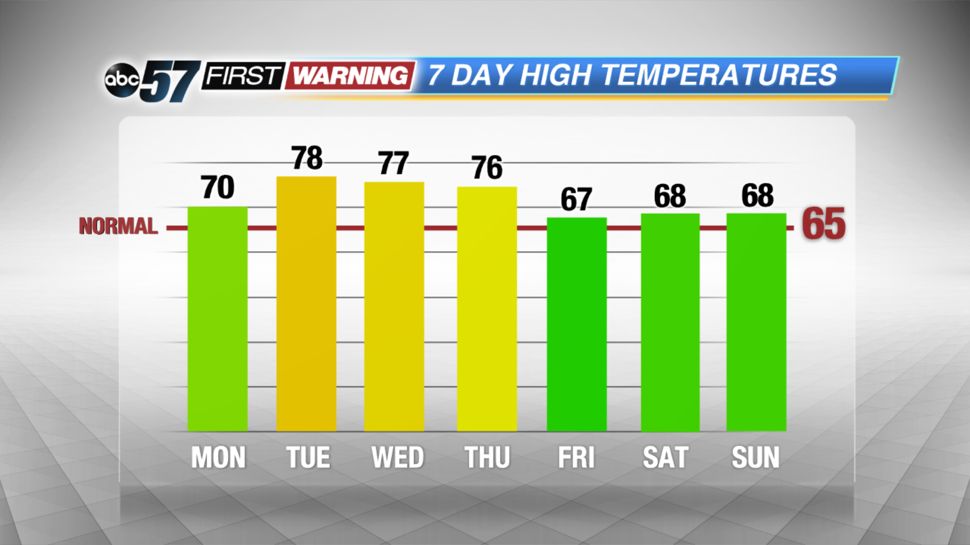
Plenty of sunshine today with highs reaching near 70F! The sunshine lasts through tomorrow and you can plan on it being even warm as highs top out in the upper 70s. The humidity starts to build back in on Wednesday with clouds increasing. Showers and storms move in after midday with more rain and thunderstorms lasting through Thursday. Temperatures cool back down into the 60s by Friday but skies brighten back up over the weekend.
Today: Sunny, high of 70.
Tonight: Clear, low of 52.
Tuesday: Mostly sunny and breezy, high of 78.
Wednesday: Increasing clouds, showers and storms after midday, highs in the mid-70s.
Sign up for the ABC 57 Newsletter