Wet snow showers begin this evening lasting into Thursday
By: Emily Kennedy
Posted: Feb 5, 2020 3:07 AM EDT

-
1:23

City of South Bend presents an ’Age-Friendly Plan’ to better...
-
0:54

South Bend Venues Parks and Arts hosts ’Adult Recess’
-
2:27

Why Aneyas Williams turned down the transfer portal and stayed...
-
2:21

Bourbon community rallies around Triton boys’ basketball team...
-
5:02

Dave Matthews shares details about LLC bankruptcy filings
-
1:00

Warming up this weekend before more storms next week
-
1:46

A chilly and calm start to the weekend
-
1:00

NIPSCO workers rally in South Bend for new contract
-
1:53

Severe weather threat is over, MUCH colder Friday
-
3:43

South Bend Mayor James Mueller delivers 2026 State of the City...
-
0:52

Family and friends of Adrian Cruz voice frustration in sentencing...
-
2:13

Potawatomi Zoo prepares for opening day with new attractions

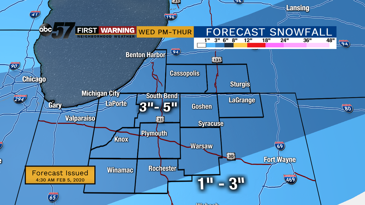
Wednesday, February 5th, 2020
We’ll see a little bit of sunshine before midday but then the clouds move in with the snow not far behind. Snow showers pick up mainly after 5pm. The heaviest snow is expected tonight into Thursday morning. Many areas will see snow around 3” with isolated amounts up to 5”. This will likely lead to slow commutes Thursday morning. A slight chance of snow again on Friday otherwise it’s a fairly quiet weekend.
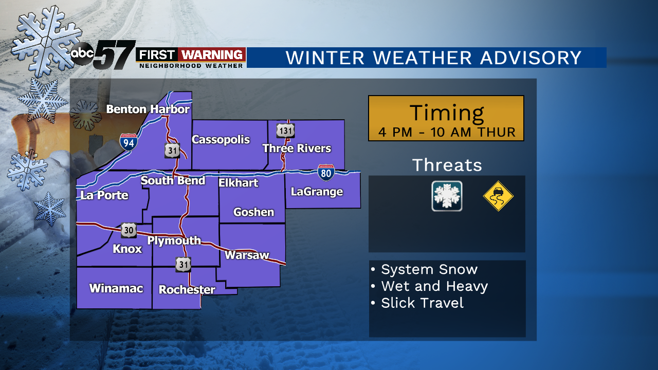
Today: Mostly cloudy, PM snow. High 33.
Tonight: Snow showers. Low of 26.
Thursday: AM snow, PM flurries. High 32.
Friday: AM flurries then mostly cloudy day. High 33.
Sign up for the ABC 57 Newsletter