
-
2:30

Voting advocacy, peaceful demonstrations and donations: South...
-
2:04

Warming to start the week, Showers and storms by Tuesday
-
2:10

Cool, but calm, today
-
1:23

City of South Bend presents an ’Age-Friendly Plan’ to better...
-
0:54

South Bend Venues Parks and Arts hosts ’Adult Recess’
-
2:27

Why Aneyas Williams turned down the transfer portal and stayed...
-
2:21

Bourbon community rallies around Triton boys’ basketball team...
-
5:02

Dave Matthews shares details about LLC bankruptcy filings
-
1:00

Warming up this weekend before more storms next week
-
1:46

A chilly and calm start to the weekend
-
1:00

NIPSCO workers rally in South Bend for new contract
-
1:53

Severe weather threat is over, MUCH colder Friday

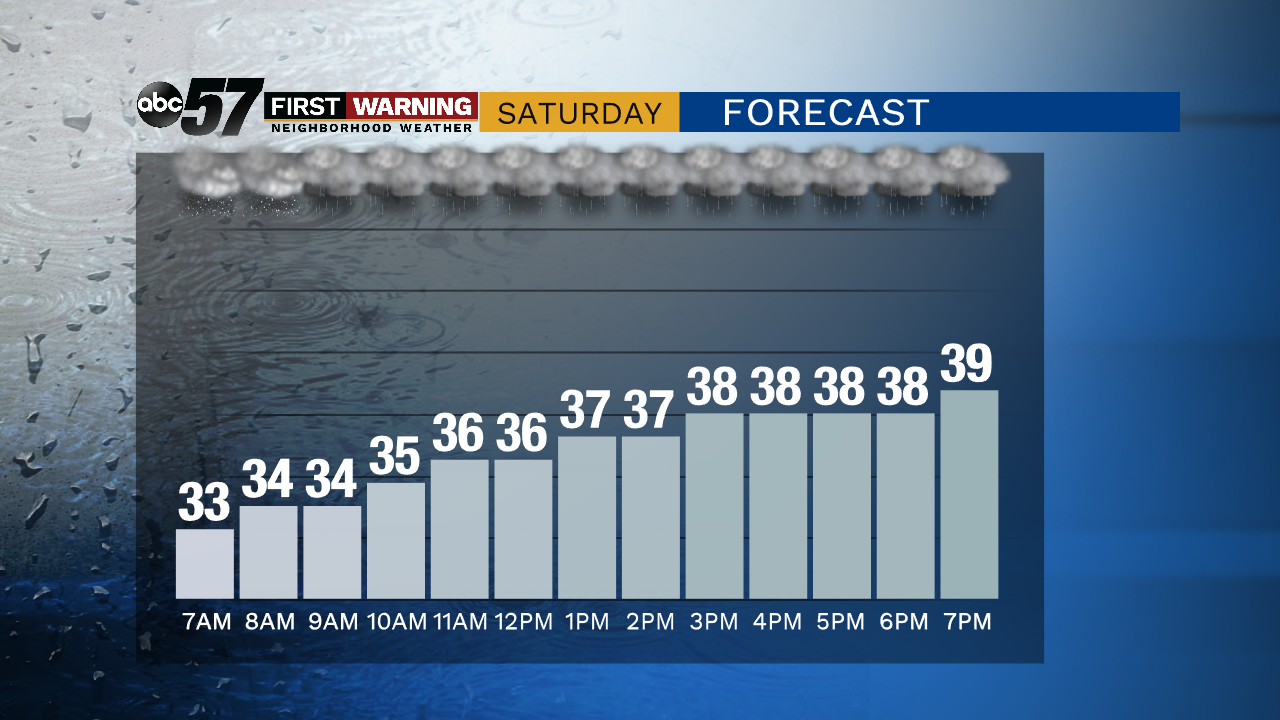
The weekend is wet and breezy as our next fall storm moves through. This will not be windy as our last storm but it may be wetter. Rain is likely most of Saturday and the wind picks-up into Sunday. Sunday rain showers changes to a wet rain/snow mix as temperatures fall. A few flurries are possible Monday then the pattern stays relatively quiet.
Tonight: Cloudy with a wintry mix late. Low of 34.
Saturday: Rainy, slow warm-up to 40 just before midnight.
Sunday: Temperatures falling from the low 40s, afternoon rain/snow showers
Monday: Mostly cloudy with a chance of L.E. rain/snow showers. High of 38.
Sign up for the ABC 57 Newsletter