Windy, wet start to Labor Day; drying out this afternoon


It was a windy, wet start to Monday as a cold front passes Michiana. Temperatures have stalled in the low to mid 70s most of the morning, and there likely won't be much of a warm up this afternoon. The high today is 73 degrees.
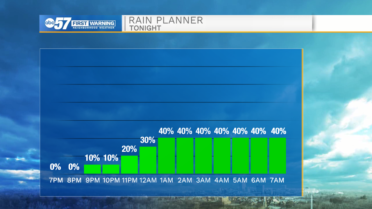
A few more isolated showers are possible through noon, although many will stay dry during this period. Conditions improve this afternoon-- most stay dry and clouds break up slightly. Overnight, there are more rain and thunderstorm chances. Temperatures dip into the upper 50s overnight.
Tuesday there are scattered showers and thunderstorms. There are isolated shower chances Wednesday and Thursday. Friday looks dry to end the week. Daytime highs this week stay in the mid 70s.
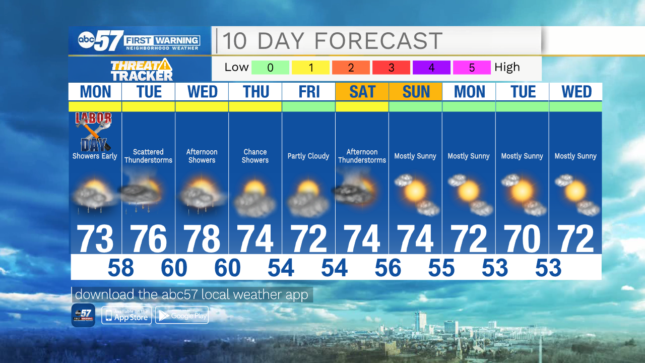
Labor Day Monday: AM showers. Partly cloudy afternoon. High 73.
Tonight: Scattered showers and thunderstorms. Low 58.
Tuesday: Scattered showers and thunderstorms. High 76.
Wednesday: Partly cloudy with afternoon showers. High 78.