Winter Outlook 2019


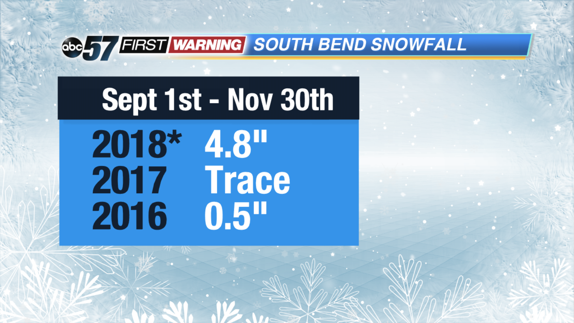
SOUTH BEND,IND -- With South Bend has receiving nearly five inches of snow, the snow season has had its most impacting start in three years and November isn’t over yet. Is this a bellwether for Winter 2019 or just an abnormal early cold snap?
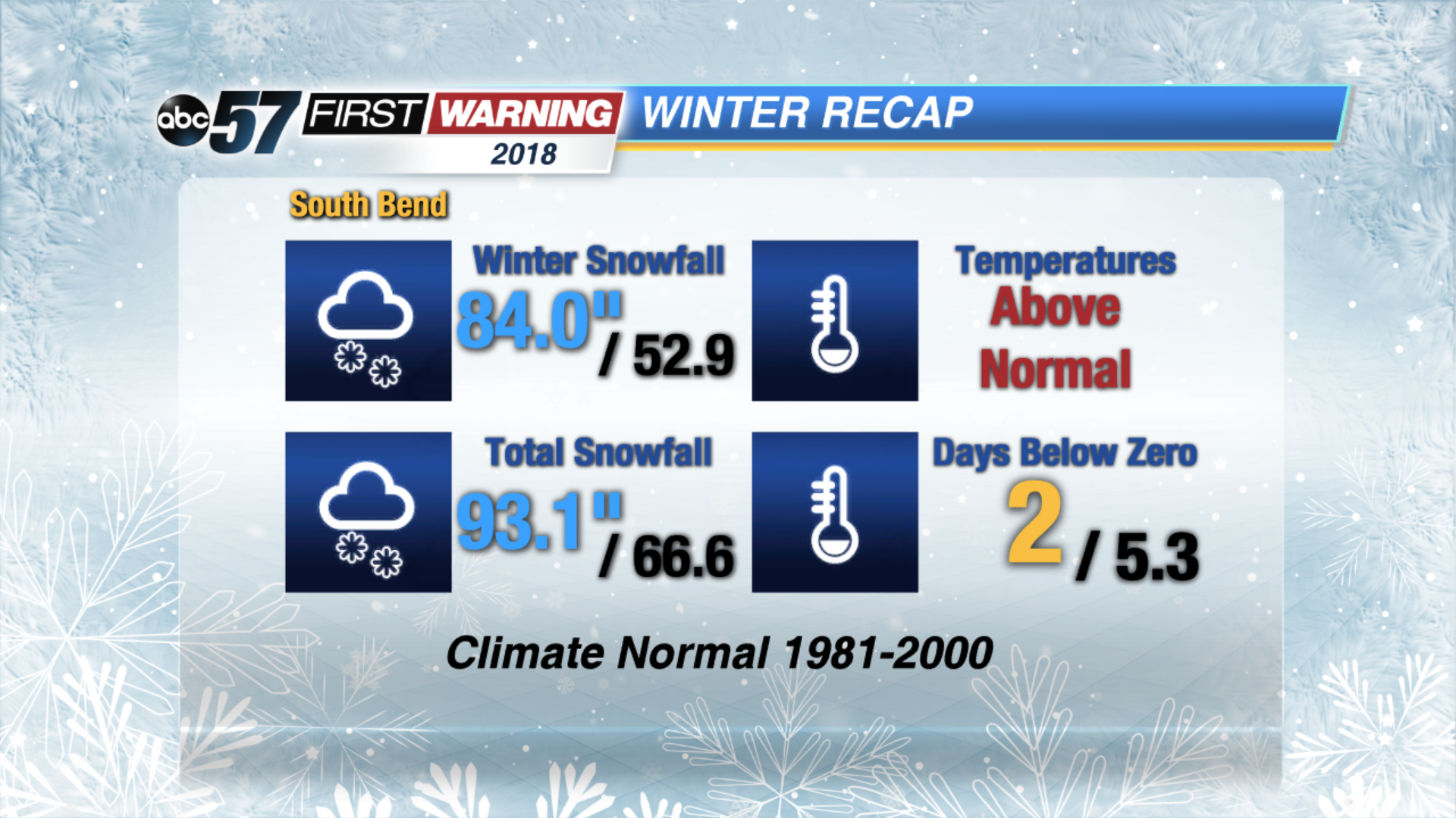
Last winter was a big snow year, at least in the final totals; it was a top ten snow year with over 90 inches but not a particularly brutal winter. There were warm spells that melted the snow and few nights that fell below zero.
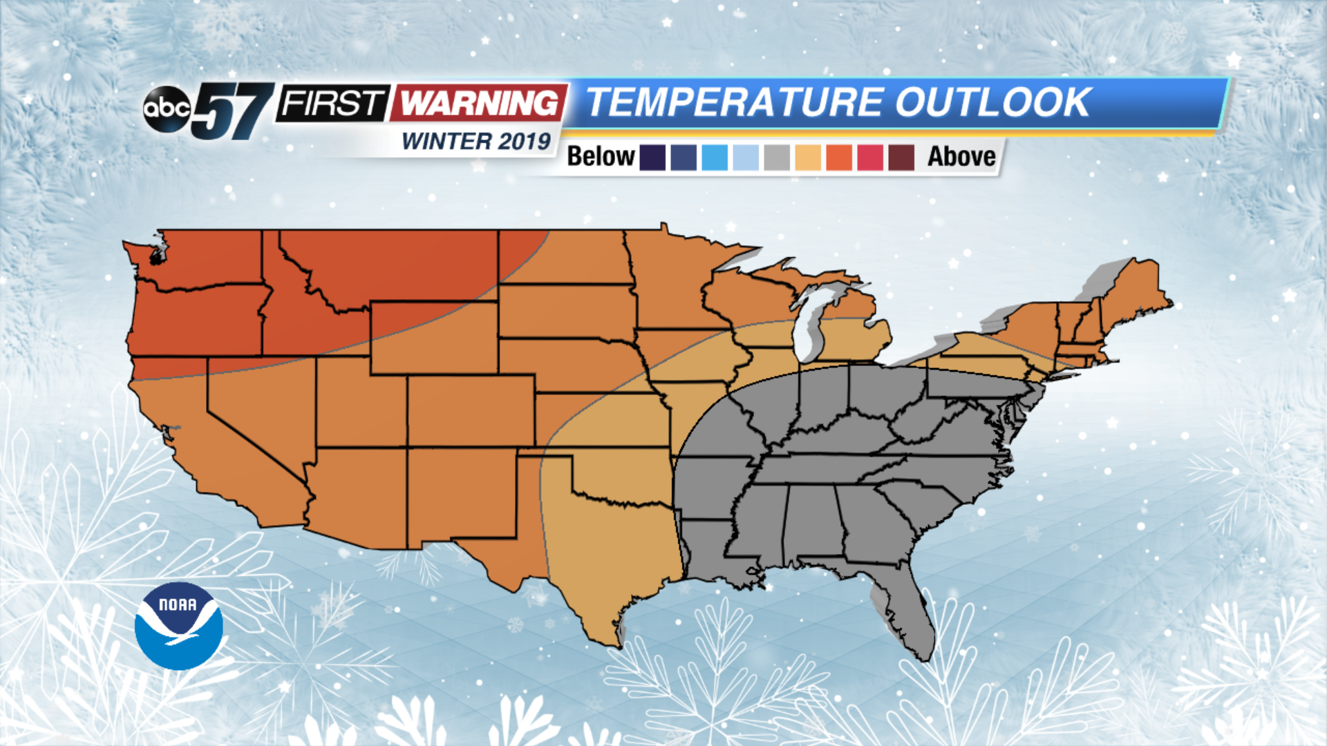
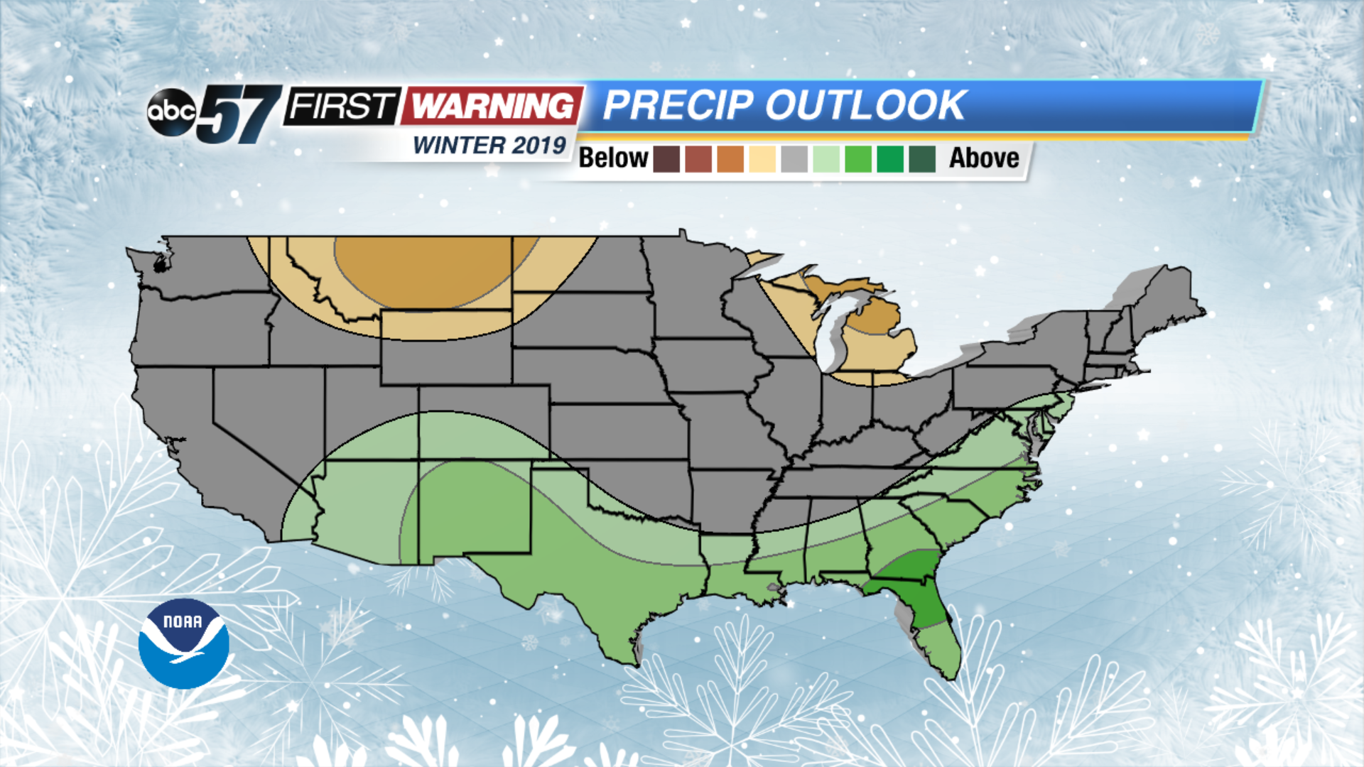
This year the Climate Prediction Center (CPC) is predicting warmer than normal conditions for much of the county and a trend towards wetter weather across the southern United States. This is a textbook El Nino forecast.
This may end up being a good forecast for winter as a whole but does little to explain what’s happening early. First, El Nino hasn’t happened yet. We’re waiting for the tropical circulation in the equatorial pacific to change. So our weather is not being influenced by El Nino as of November. It’s been influenced by smaller time scale events like the Arctic Oscillation. A topic we covered more in depth in last year’s outlook.
Not all El Nino’s are the same, timing and strength of an El Nino event are big factors. If El Nino conditions happen by mid-January versus mid-February can be a big factor, also weak versus strong events.
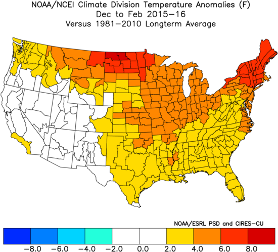
Strong El Nino’s, like winter 2015 reflect the “textbook” conditions forecast by the CPC.
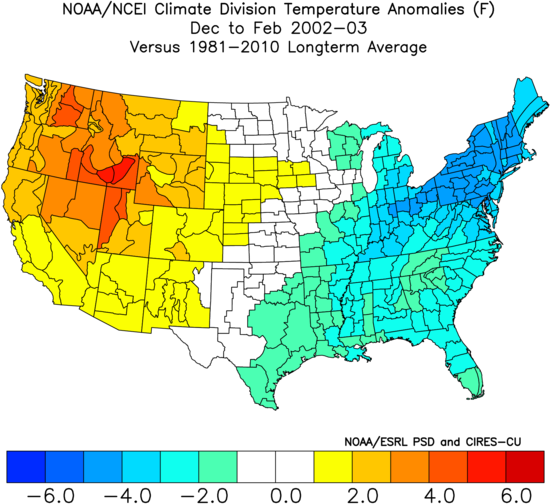
However weaker events don’t have much of a direct influence compared to other long and short range influences. Winter 2003 was an El Nino year but considered to be weak and had a much different result.
You can learn more about our local winter climatology in this video from the National Weather Service of Northern Indiana.
Another thing to point out when forecasting on the seasonal scale is what can be predicted with some certainty. You can see a pattern that shows prevalence for above or below normal temperatures / precipitation but you can’t see the actual detailed weather systems months in advance.
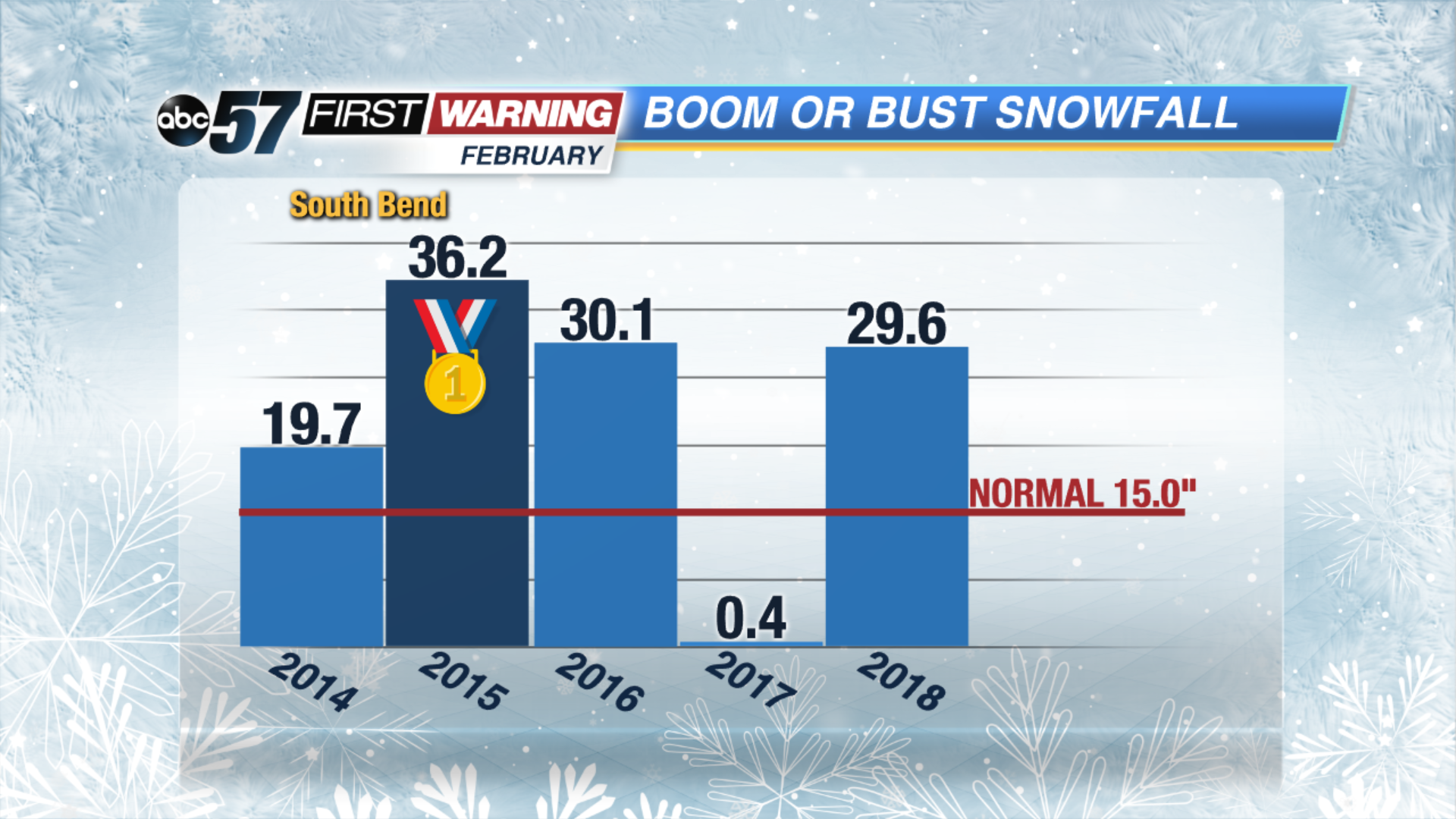
There’s been an interesting trend in February snowfall over the past five years. It has been boom or bust, enough to tilt our season snow totals, after having fairly mundane winters to-date. Last year and February 2015 were some of the snowiest on record; the latter being the all-time record.
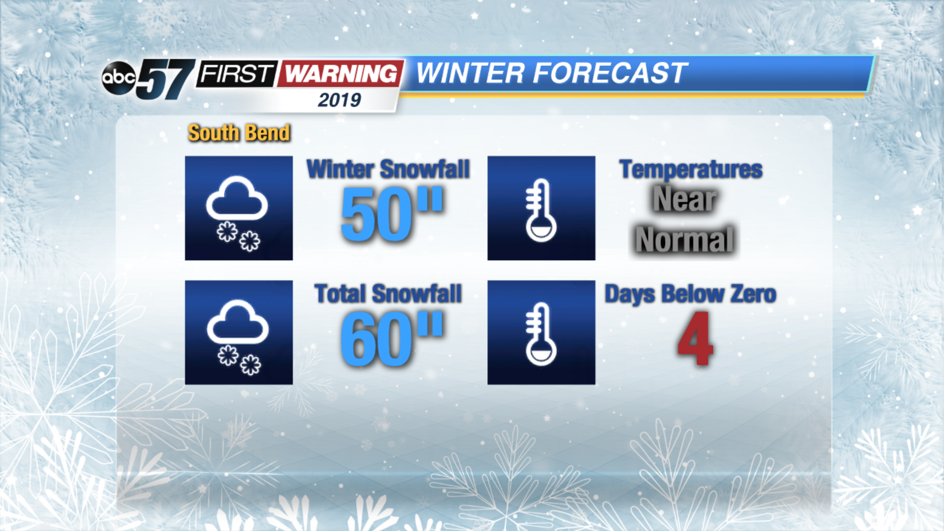
Given current and future trends we are forecasting a winter that might end up being pretty normal by the numbers. Cold and possible snowy weather is likely to continue into early December. Beyond that it will be wait-and-see as to when/if El Nino starts to influence the pattern. Most long range models are still hinting towards warmer than normal conditions that would likely mean less snow or at least a lesser snow impact. However we live in lake effect country and that’s always a big x-factor. If the forecast El Nino comes on by mid to late winter, then the end of the season may turn milder and drier, an ‘early’ end to the season.
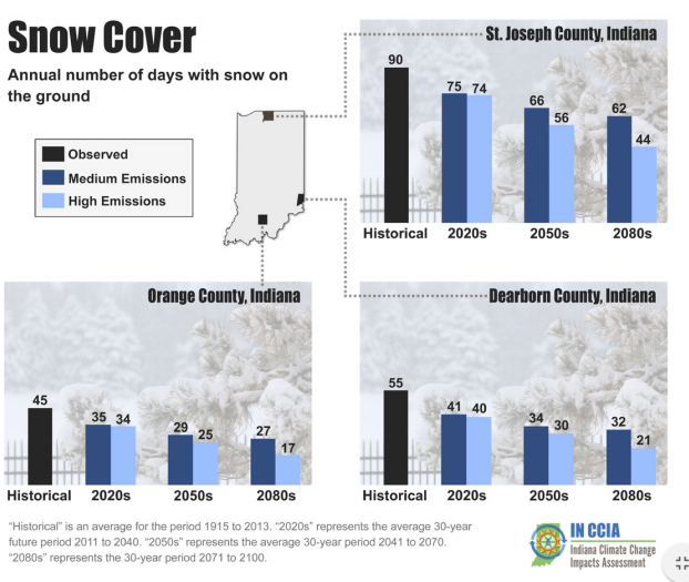
Winter outlooks are always a good time to talk about our changing climate. A new report from Purdue University forecasts significant change to the winter season over the next 50 to 100 years.
Winter recreation will likely be sparser as the climate warms. Fewer days with lasting snowpack, that number of days could be cut in half for St. Joseph County.
You can read the full report here.