-
4:58

Notre Dame releases external findings detailing sexual abuse...
-
3:05

South Bend Police Tapes ordered to be destroyed after 14-year...
-
0:12

Excavator catches fire at demolition site of old Elkhart County...
-
3:25

Beloved board game comes to life at the Morris Performing Arts...
-
1:06

Nothing but sun and warm weather this weekend
-
2:10

Last one to Mentone Egg Fest is a rotten egg
-
0:46

A peaceful sunrise on the last May weekday
-
0:39

Lakeville water tower demolished, piece by piece
-
1:13

New tennis courts dedicated to the memory of a teenage tennis...
-
3:33

Interim Cass County Prosecutor Sarah Scoggin sworn in days before...
-
2:41

Goshen wrestling coach Jim Pickard to be inducted into state...
-
1:54

This week’s ABC57 Cub Reporter is Medley Graft

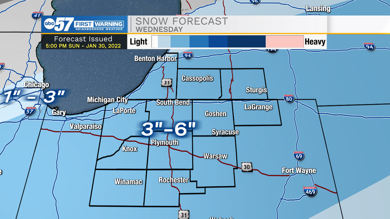
Fair weather lasts through Tuesday evening, then an impactful winter storm is likely to bring heavy snow to the area. The tricky part to this storm will be the rain and warm(ish) weather at the start, and when will it come to an end. There is high confidence for a snowy Wednesday, widespread three to six inches. But will it keep snowing Thursday, and if it does will it be heavy? That’s the lingering question, latest trends point to a yes on snow continuing Thursday, which could mean an additional six inches of snow. The cold returns for the weekend.
Tonight: Mostly cloudy with some clearing toward morning. Low 14.
Tomorrow: Mostly sunny. High 32.
Tuesday: Increasing clouds, rain by the evening. High 42.
Wednesday: Snowy, temperatures falling from 30.