
-
1:03

Lighter rain expected into the afternoon
-
1:04

Non-severe storms expected
-
1:16

Showers start this morning
-
1:59

Mac & Cheese festival turns Four Winds Field into a kitchen
-
0:45

Michiana Spring Clay tour encourages people to try and take a...
-
2:56

Fresh Cuts, Fresh Starts: Re-Entry Program Gives Back in Elkhart
-
0:53

Jr. Irish Memorial Day invitational celebrates veterans and active-duty...
-
1:15

Another rain chance this holiday weekend
-
0:46

Holiday weekend starts rainy
-
1:13

South Bend West Side Memorial Day Parade Preview
-
0:48

Three Rivers Menards partially reopens after suffering extensive...
-
1:53

Reactions from race fans at Plymouth Motor Speedway to the passing...

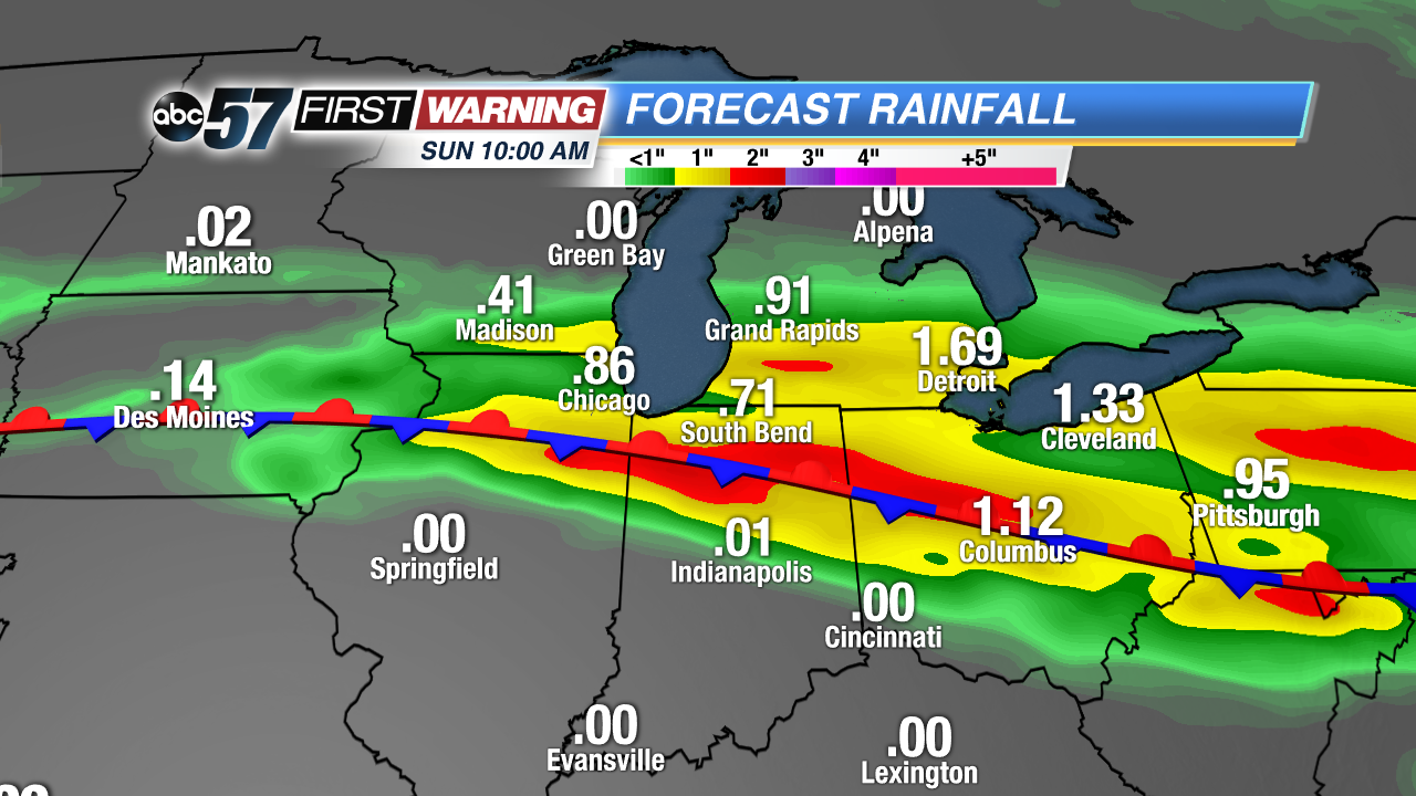
Cool and rainy start to the weekend. Round of showers and thunderstorms are likely Saturday, with the heaviest rain threat Saturday night into early Sunday, storms may also have large hail. Minor flooding is a concern as some areas could see more than two inches or rain through Sunday morning. Mother’s day will be a bit milder and drier and clouds break in the afternoon. The pattern is warmer but still stormy next week.
Tonight: Few showers and storms possible, low of 48.
Saturday: Scattered thunderstorms, high of 62.
Sunday: AM showers then becoming partly cloudy, high of 68.
Monday: Partly cloudy, chance of showers, highs near 80.
Sign up for the ABC 57 Newsletter