Yet another wintry system heading for Michiana
Posted: Feb 18, 2019 10:55 AM EDT
It is beginning to sound like a broken record, but another wintry system is heading for the Midwest and Great Lakes. Like many of the systems we've dealt with this winter, this one won't be overly impressive or extreme. However, it will interfere with at least one commute. That would be Wednesday morning's drive to work and school. As of now, it looks like the impacts from snow, wind, reduced visibility, and freezing rain will remain "low."
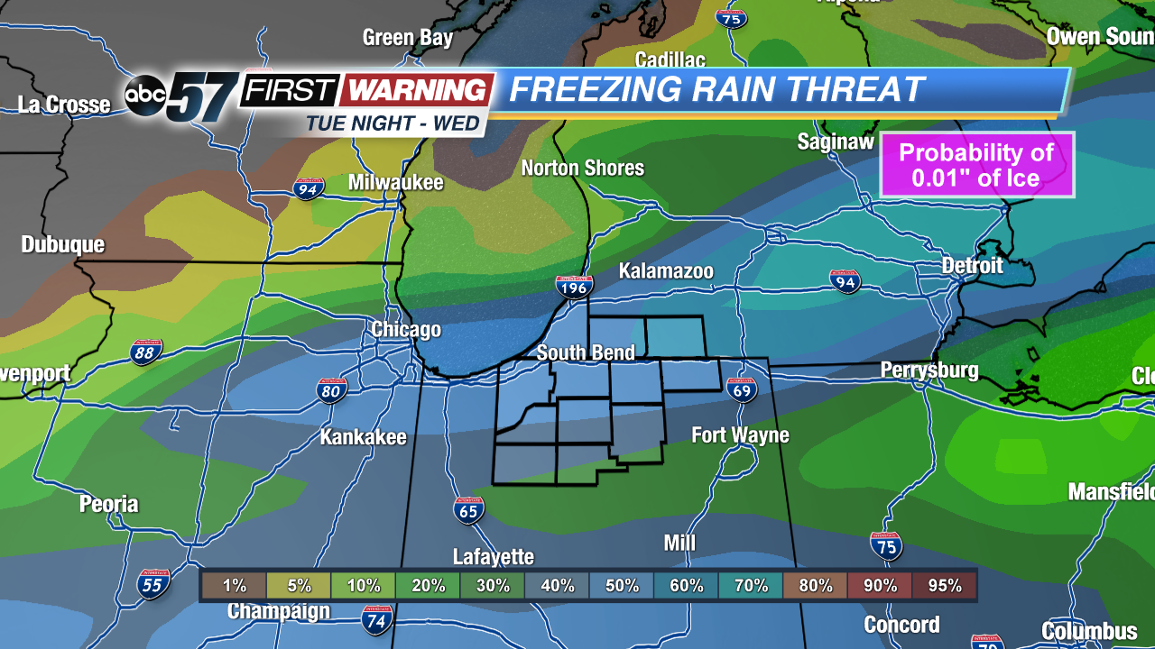
Let's start with the freezing rain potential Tuesday night and Wednesday. According to the Weather Prediction Center, the probability of at least .01" of ice (a light glaze) is running at 40-60% for Michiana. Areas with the best chance at seeing some ice are Cass and St. Joseph Counties in Michigan and Elkhart and LaGrange Counties in Indiana. Timing for any freezing drizzle/rain would be 7 a.m. - 1 p.m. Wednesday.
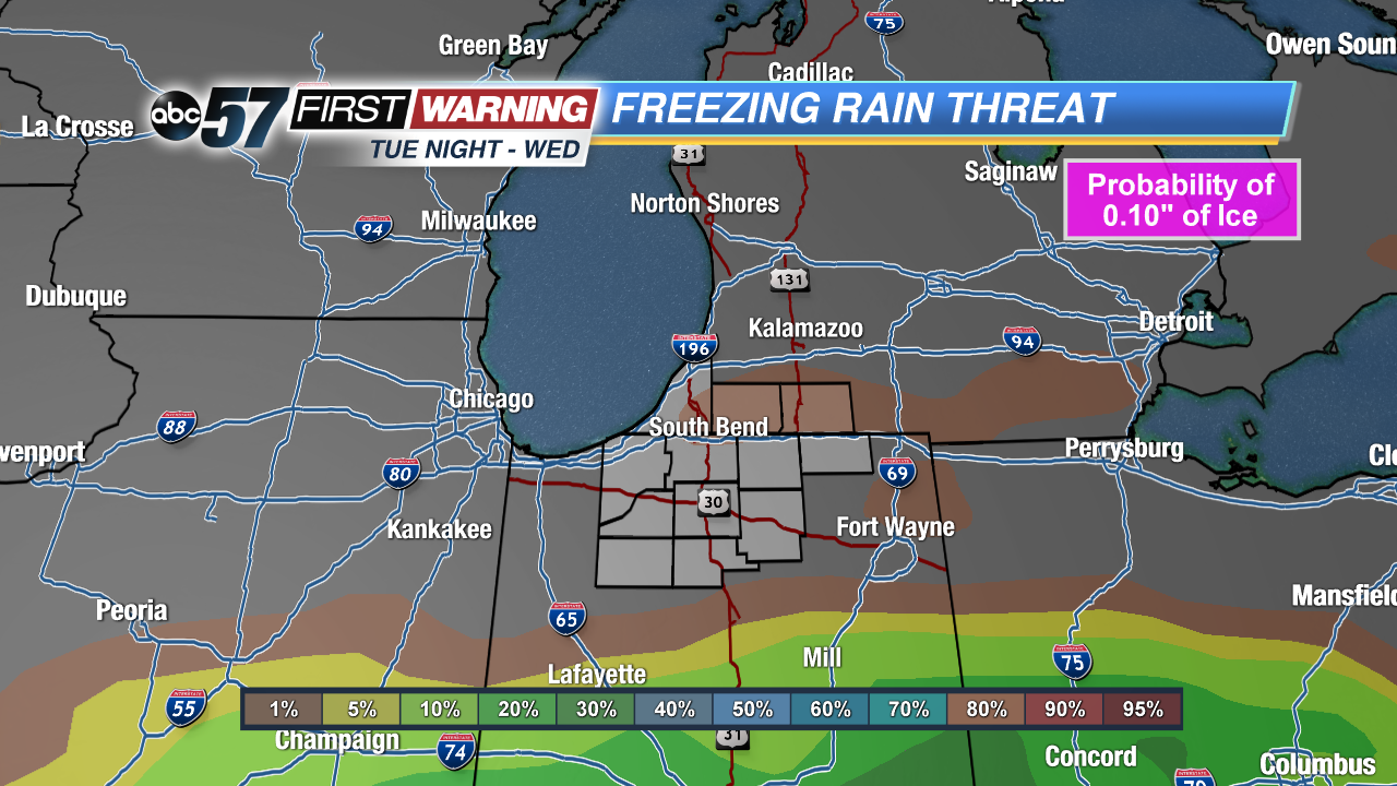
Significant icing is not expected, though. Once you jump up to the probability of .1" of ice, chances drop to less than 5%. That is the good news regarding this particular system. The amounts won't be impressive, but the timing may be problematic.
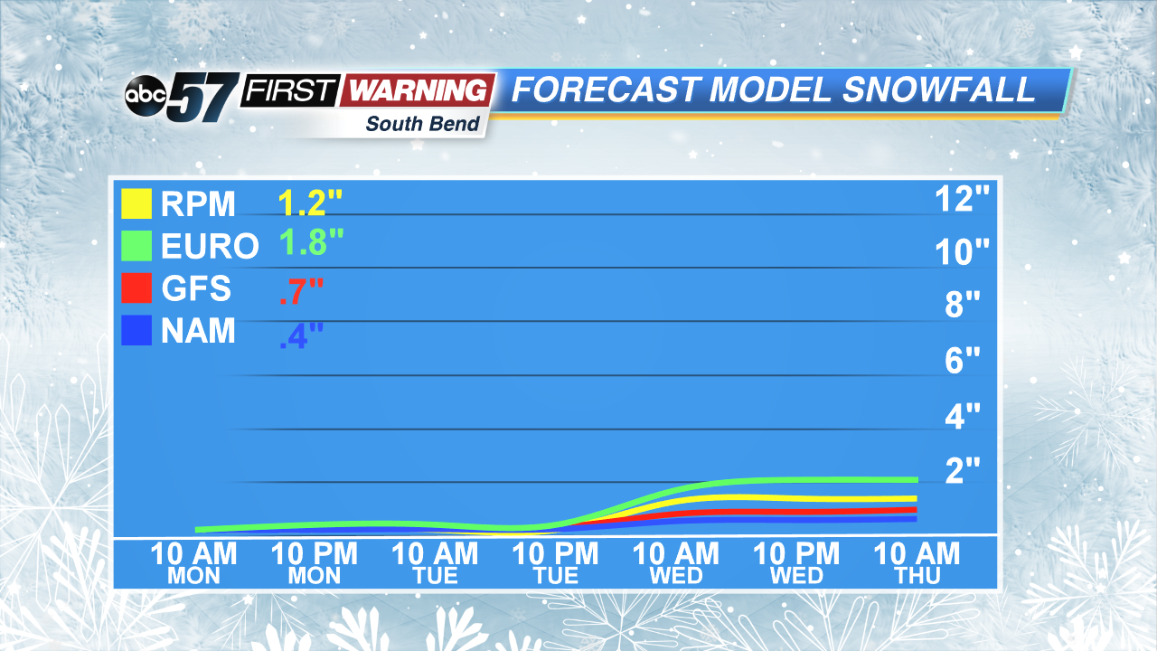
Let's switch to the snow potential. Snow will likely be the main precipitation type after 2 a.m. Tuesday night. It will move in from the south and overspread most of the region through the overnight and early morning hours of Wednesday. It won't fall heavily by any means, but it could be steady at times as it moves in. By lunchtime Wednesday, precipitation, if any at all, will likely be light freezing drizzle or plain light showers as temperatures push above 32°. Before temps climb above freezing, though, upwards of 1/2" to 2" of snow cannot be ruled out in spots. That could have a minor impact on Wednesday morning's commute. So, once again, be on the lookout for possible delays and give yourself a little extra time on Hump Day!


