Tonight, a line of rain is likely this evening by 8:00 PM and temperatures plummeting from 50 to the 20s after midnight. There is some slight concern of a flash freeze but the gusty wind helps dry roads.
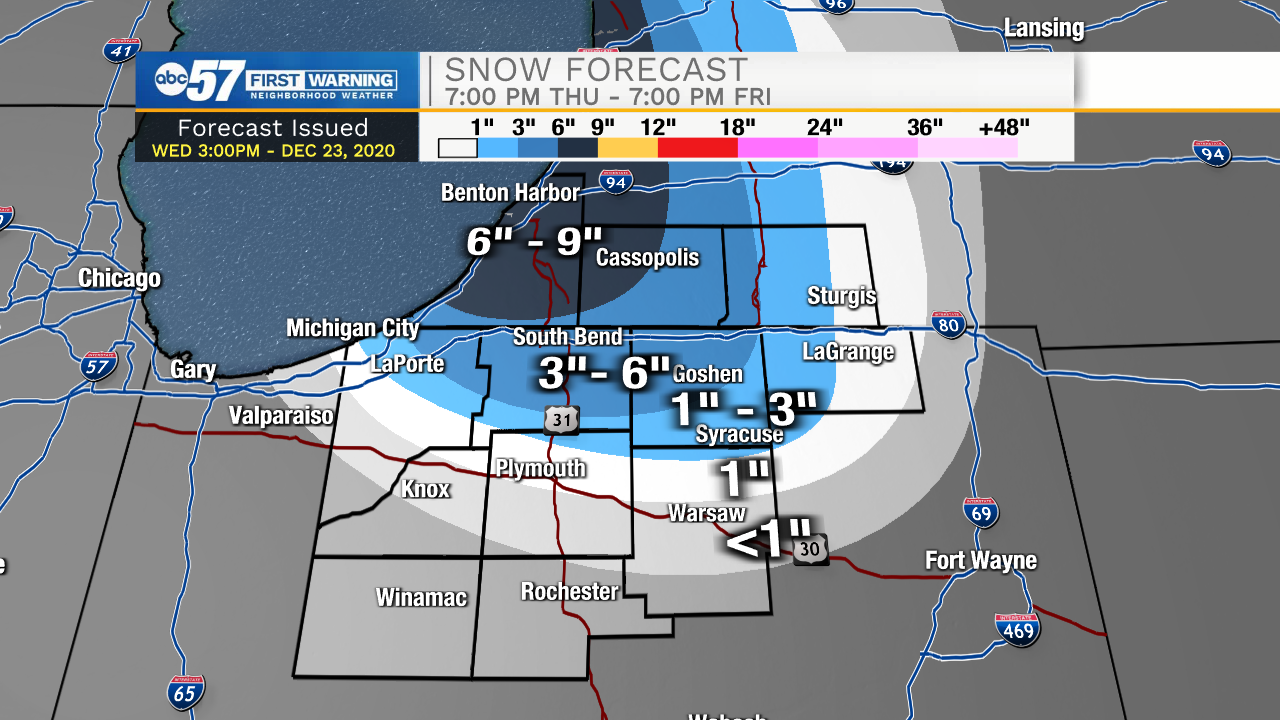
A White Christmas is likely for most the area as the lake effect snow machine ramps-up early Friday morning. Much of Thursday is cold and quiet, then snow showers gradually 'turn-on' Thursday evening, as temps fall into the teens and the wind backs to the northwest. This event has a short but potent window for snowfall, with most snow falling between 3:00 AM and 9:00 AM Christmas morning, when conditions are most favorable. The worst travel will be before 10:00 AM Friday, especially close to Lake Michigan. Christmas Day is cold, struggling to break 20 but temperatures rise into the 40s by Sunday.
Tonight: Rainy and breezy. Low 20.
Thursday: Cold, breezy. Lake effect snow begins in the evening High 22.
Christmas Day: Morning snow showers. Cold. High 22.
Saturday: Partly cloudy. High 34.