


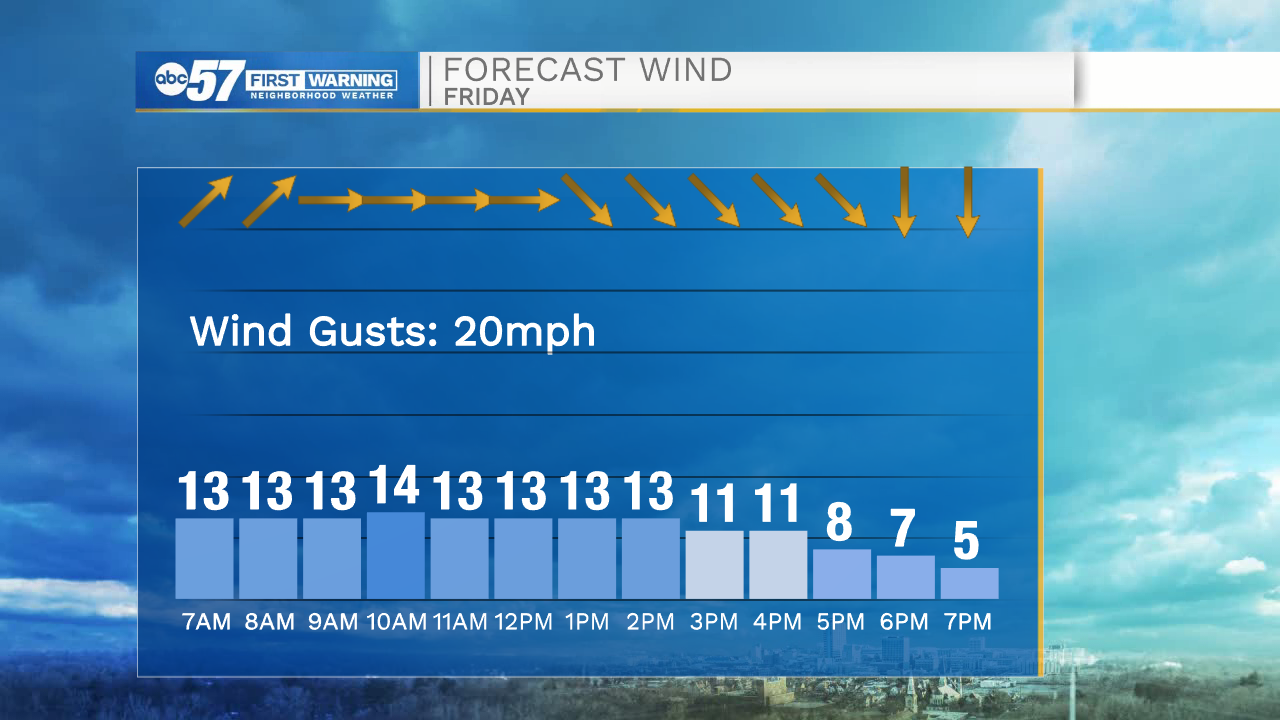
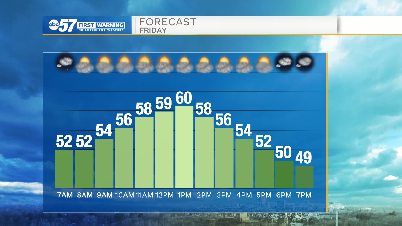
Winds will finally start to dwindle later this morning, but a slight breeze will stick with us throughout the day. A cold front looks to move in this afternoon, keeping temperatures in the upper 50s and lower 60s. Tomorrow morning lows will drop into the upper 30s. Saturday will be mostly dry, but then rain chances increase into early Sunday morning. A few snow showers are possible Sunday morning as temperatures drop to near freezing. Rain activity will linger into Sunday afternoon and evening.
More rain chances are in the forecast for next week. A second system will move in Tuesday and stick with us through Wednesday. A few snow flurries and rain showers will be likely. We look to catch some dry weather just in time for Thanksgiving, but then another round of showers are possible into next weekend.
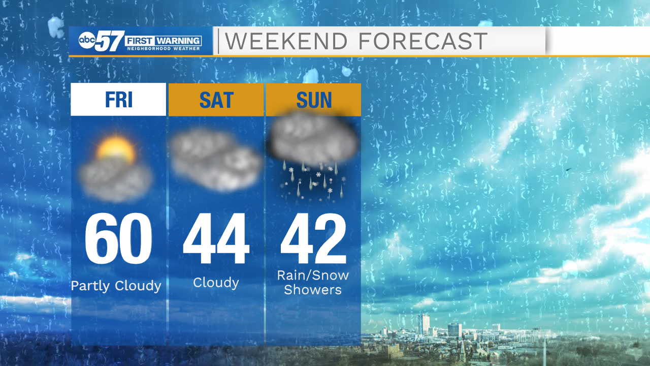
Today: Partly cloudy. High 60.
Tonight: Cloudy. Low 37.
Tomorrow: Cloudy. High 44.
Sunday: Showers/flurries. High 42.