A little warm-up midweek, may cause more slick spots
By:
Tom Coomes
Posted: Jan 11, 2022 5:51 PM EDT

-
2:44

Warmer, breezier, and cloudier than yesterday
-
0:46

Crowds gather for Fins and Feathers Fest at La Porte City Fairgrounds
-
0:46

Paramount School of Excellence hosts teacher fair
-
2:30

Voting advocacy, peaceful demonstrations and donations: South...
-
2:04

Warming to start the week, Showers and storms by Tuesday
-
2:10

Cool, but calm, today
-
1:23

City of South Bend presents an ’Age-Friendly Plan’ to better...
-
0:54

South Bend Venues Parks and Arts hosts ’Adult Recess’
-
2:27

Why Aneyas Williams turned down the transfer portal and stayed...
-
2:21

Bourbon community rallies around Triton boys’ basketball team...
-
5:02

Dave Matthews shares details about LLC bankruptcy filings
-
1:00

Warming up this weekend before more storms next week

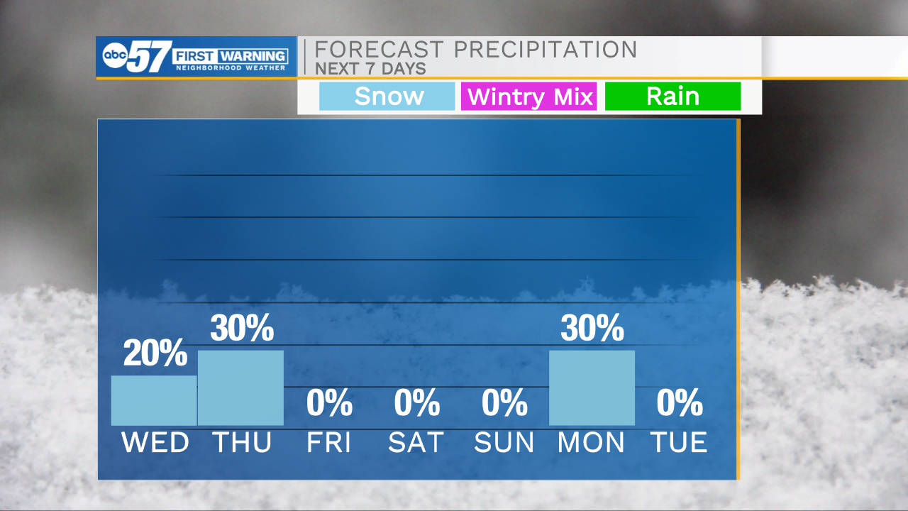
Temperatures rise above freezing Wednesday, before light rain/snow showers develop into the evening. The impact is low, but with a frozen ground, anything wet, will freeze, creating slick spots. Light snow is also possible Thursday morning, most likely flurries. The snowpack most likely maintains through the weekend as temperatures drop. The chance of snow this weekend is decreasing, and we may have to wait until Monday for a chance of snow.
Tonight: Partly cloudy, breezy. Low 26.
Wednesday: Mostly cloudy, evening rain/snow. High 38.
Thursday: AMFlurries. High 36.
Friday: Mostly cloudy. High 30
Sign up for the ABC 57 Newsletter