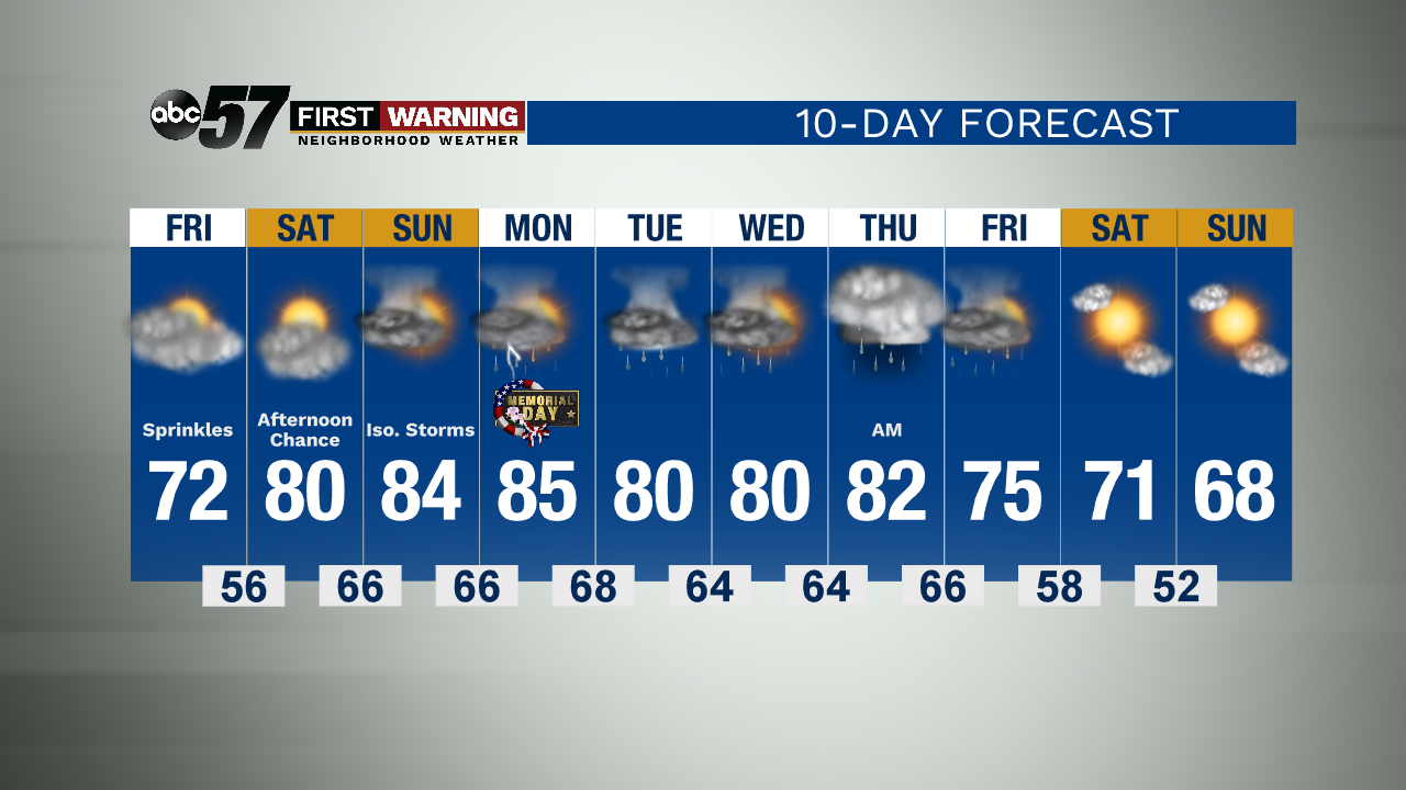
A quiet, dry end to the week; warming to 80s this weekend


A mostly cloudy but dry day to end the week today. Temperatures Friday afternoon reach the low 70s. There is a slight chance we could see a few sprinkles of rain, but most of the day is dry.
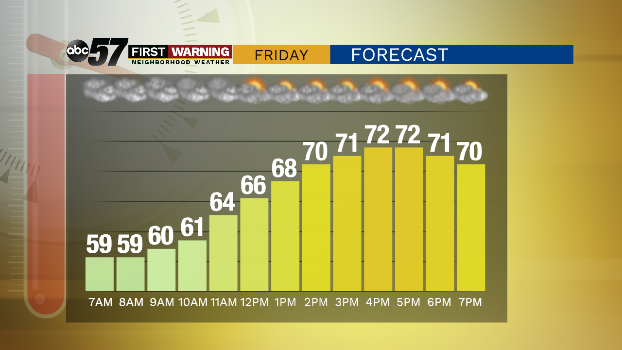
Overnight is mostly cloudy with lows in the mid 50s.
Over the weekend, it will begin to feel more like summer. Warmer, more humid air returns. With that air, there are chances for thunderstorms in our forecast.
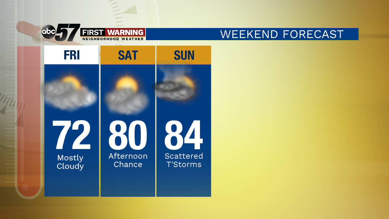
The weekend starts with partly cloudy skies Saturday. There is a chance for rain showers in the afternoon, and isolated thunderstorms are possible overnight Saturday. Don't let that ruin the start to the holiday weekend-- there is plenty of time during the day Saturday to get outside and maybe even see a little sunshine.
Most of Sunday looks like it will be dry, but there are chances again for afternoon and evening thunderstorms. Temperatures will warm to the 80s both days this weekend.
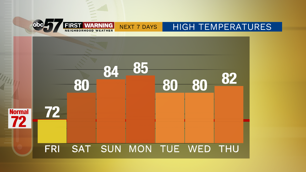
It will continue to feel like summer as we head into next week. There are more chances for rain and thunderstorms through most of next week.
Today: Mostly cloudy. High 72.
Tonight: Mostly cloudy. Low 56.
Saturday: Partly cloudy. Late afternoon showers, isolated evening storms. High 80.
Sunday: Scattered afternoon storms. High 84.