
-
0:49

Celebrating St. Patrick’s Day at Corby’s Irish Pub
-
1:58

The Free Market promotes sustainable shopping
-
3:27

Federal judge temporarily blocks RFK Jr.’s vaccine policy changes...
-
1:02

Chicory Cafe celebrates St. Patrick’s Day with corned beef...
-
2:43

City of Elkhart, EPA, IDEM prepare for removal of contaminated...
-
2:58

South Bend goes green for St. Paddy’s Day at Fiddler’s Hearth
-
2:32

St. Joseph County boards, City of Mishawaka, approve Memorandum...
-
2:40

More than just fighting fires: Warsaw fire official helps with...
-
1:38

Snow Wednesday, rain Thursday, mild Friday
-
2:11

Snow wrapping up today, returns tomorrow
-
4:39

The Morris debuts its 2026-27 season lineup
-
2:25

Lake effect snow through this morning

Monday and Tuesday evening may not be the best for sky-watchers with clouds likely 10:00 PM to Midnight
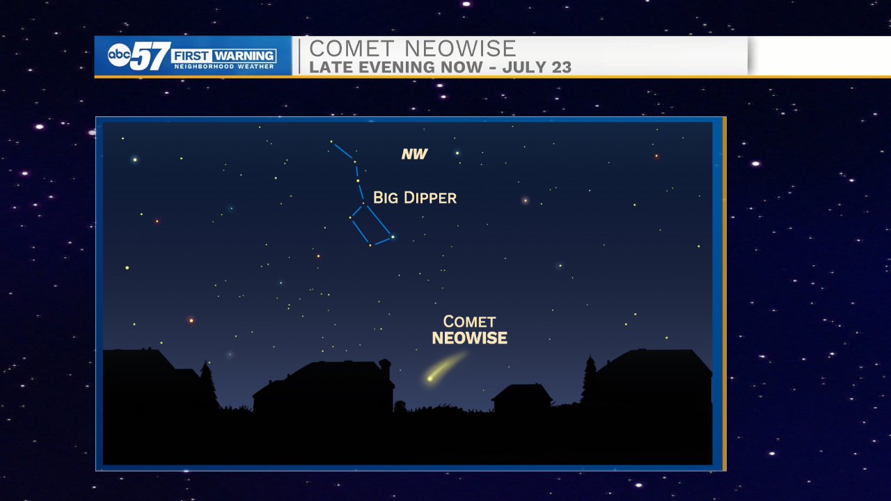
SKYWATCHERS: Comet NEOWISE gracing the night sky
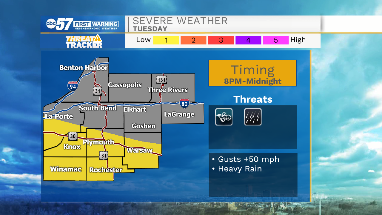
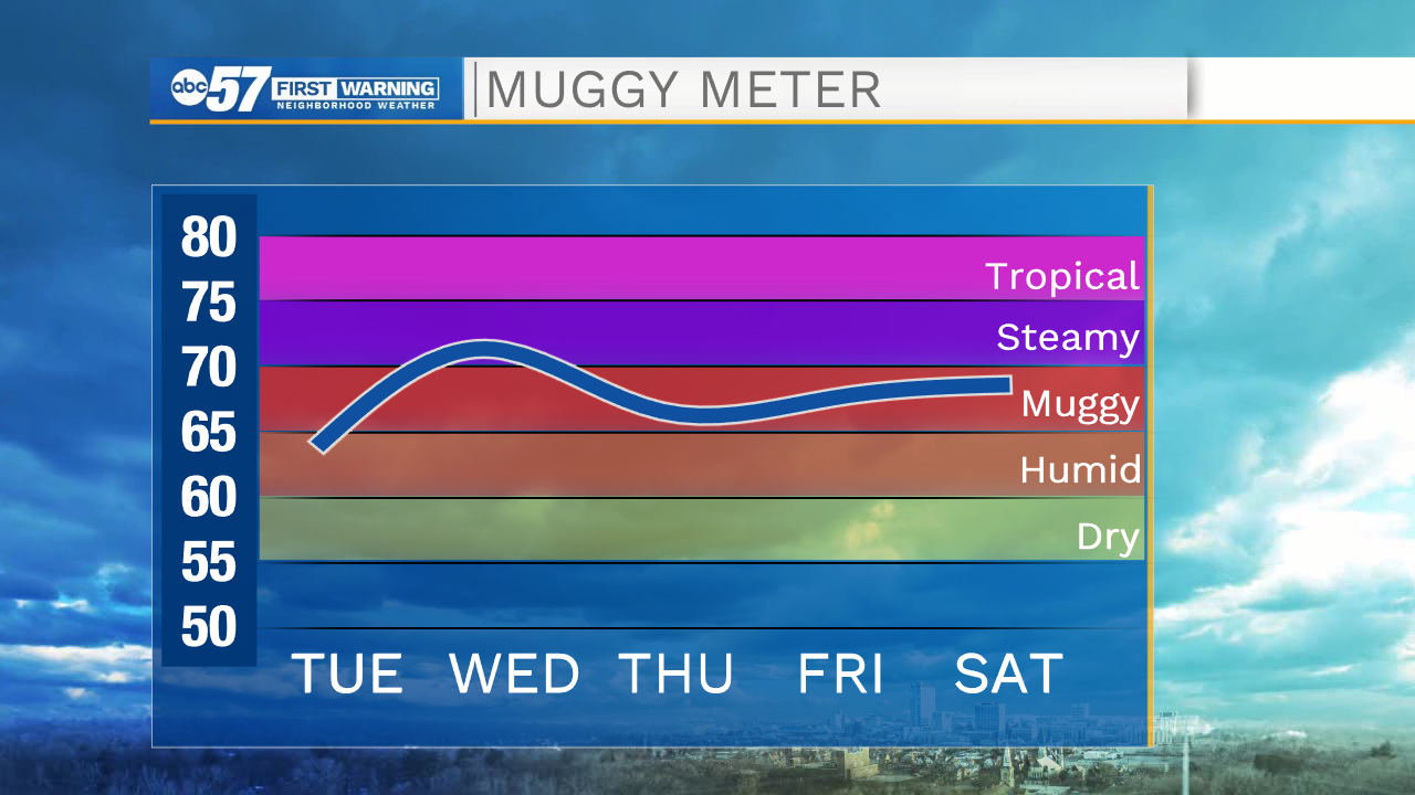
A very typical summer pattern this week, highs in the mid-80s, lows mid-60s with a chance of showers / storms. Clouds build Tuesday as a front drapes across the area, scattered showers / storms a likely by evening and a few showers may reform Wednesday. The end of the week is drier, temperatures warm back towards 90 this weekend.
Tonight: Partly cloudy. Low 62.
Tuesday: Partly cloudy. PM showers/storms. High 84.
Wednesday: Partly cloudy. Isolated showers / storms. High 84.
Thursday: Mostly sunny. High 82.
Sign up for the ABC 57 Newsletter