
-
2:16

More sunshine today with a severe risk tomorrow
-
0:32

Granger residents share input on proposed S.R. 23 roundabout
-
2:59

Seven local boards unanimously approve fire territory merger...
-
2:05

JobSpark helps inspire career exploration for middle school students
-
2:01

MPHPL launches new bookmobile to extend library access
-
2:17

Will Pauling shines, Jadarian Price shows versatility at Notre...
-
2:55

Notre Dame’s Pro Day gives 16 seniors one more shot to impress...
-
2:57

South Bend residents voice concerns over proposed pedestrian...
-
3:03

Prices at the pump continue to rise across Michiana
-
1:35

Warming up before storms arrive Thursday
-
1:06

Alliance for the Great Lakes publishes ’Data Center Playbook’
-
2:06

Staying sunny until Thursday

ABC57 First Warning Neighborhood Weather Forecast
Monday, May 3rd, 2021
It's a rainy start to the day but it will dry up for the afternoon. Another round of showers and storms moves in late this evening. An isolated part of the system could be strong enough to produce strong wind gusts. Pockets of heavy rain are more likely. Scattered shower then last on and off through much of Tuesday. The system moves out Tuesday night, leaving us with some sunshine on Wednesday. It's a quiet end to the work week and a little cooler. The weekend starts out with sunshine and mild temperatures but another round of rain moves in for Sunday.
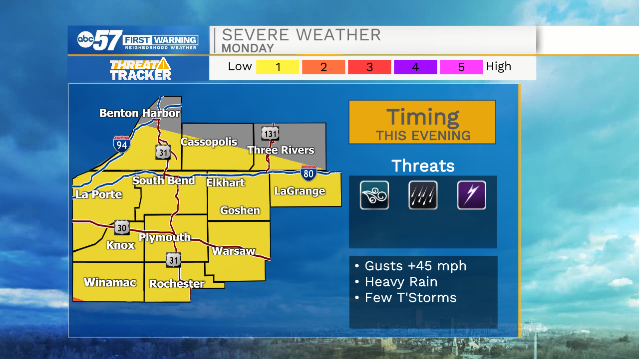
Today: AM rain. Dry afternoon. PM rain/thunderstorms. High 72.
Tonight: Scattered showers and storms. Low 50.
Tuesday: Scattered showers. High 58.
Wednesday: Partly cloudy, High 60.