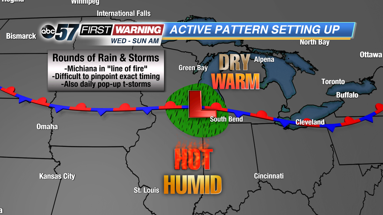
Enjoy Wednesday and the first half of Thursday if you are not a fan of summertime heat and humidity. A stationary boundary will set up shop across the Lower Great Lakes by Thursday evening and hang around the area thru Sunday afternoon. Those north of the frontal boundary will see more cloud cover, cooler temperatures and more rain and storms. If the boundary sets up north of us, we will see hot and humid conditions with chances for rain and thunderstorms. As of now, it looks like those south of the Toll Road have the best chance of seeing temps well into the 80s and high humidity. However, the entire region will be in the "line of fire" for periodic rain and storm chances.
The problem with these types of summertime set-ups is that it is very difficult to pinpoint exactly when the best chances of widespread rain and thunderstorms are. Numerous factors go into determining the who, what, when, where, why, and how regarding the best rain chances. In most cases, forecast models are pretty good at agreeing on when rain and storms are expected. Sometimes, though, there are too many "fine" details involved for models to get a good grasp on the situation. Thus, there is a significant amount of disagreement and variability among them. That is especially true of the scenario setting up here by late Thursday.
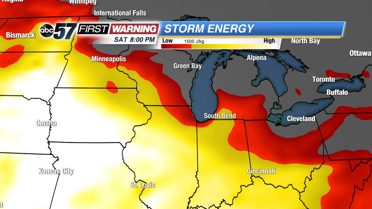
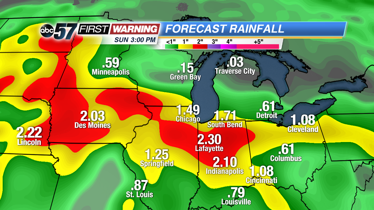
No two models agree on the timing of the best rain and storm chances during the Thursday to Sunday time period. Those kinds of details are usually not ironed out until the day of. In other words, determining the exact time period with the highest rain and storm chance on Friday will be easier and more possible by Thursday night, if not Friday morning. What we do know is that it will rain at some point between Thursday and Sunday. It will likely rain multiple times. And, due to the heat, humidity, moisture, and storm energy in place, the rain could be heavy and lead to instances of flooding. There is also a chance of strong to severe weather with each wave/complex of rain and storms that pushes through the region. A significant severe weather event is not expected, but damaging winds and hail could accompany the very heavy rain threat depending on how the situation evolves.