
-
2:13

More strong storms likely this evening
-
2:15

The ingredients for severe weather
-
2:14

Why summer travel prices may spike due to the ongoing war in...
-
1:49

Heavy rain, high winds, and hail are main severe concerns today
-
1:26

Amidst several rounds of storms, some could be severe today
-
0:34

South Bend Community Review Board hosts open discussion on youth...
-
2:19

INDOT walks through a proposed diverging diamond intersection...
-
1:08

Notre Dame’s Leonard Moore highlights student success and raises...
-
1:05

Mayflower Bridge set to close beginning April 6
-
0:21

Colfax Avenue eastbound lane closed for water and sewer work
-
0:46

Madison Street closed for lifestyle district project
-
4:11

Non-profit organization provides deep dive into Blackstone, a...

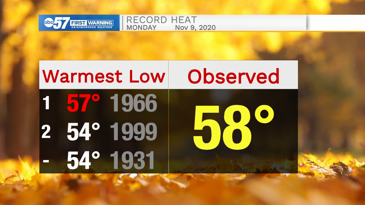
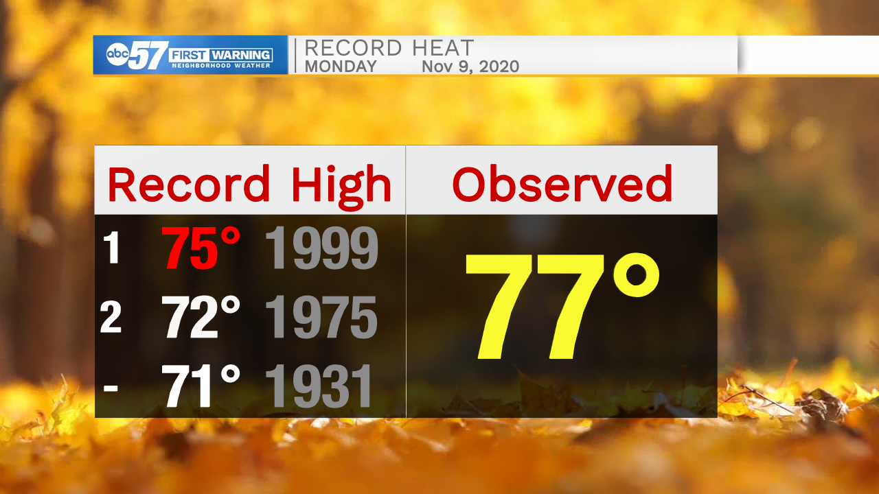
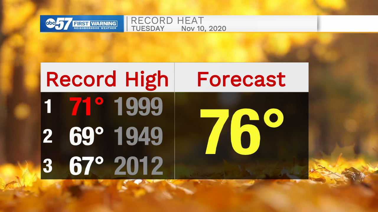
Record warmth continues Tuesday. A mild morning low in the 60s and highs in the mid-70s will shatter records. This is the 4th warmest start to November on record and once Monday and Tuesday's data are finalized it could make a run closer to the warmest.
A cold front will cut through Tuesday night brining rain, possibly some thunder but severe weather is unlikely. The rest of the week and extended forecast are cooler but with temperatures ranging between a high of 55 and low of 35 over most of this stretch, it's still mild for mid-November.
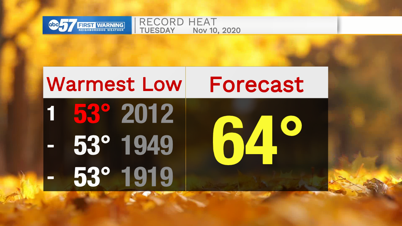
Tonight: Partly cloudy. Breezy. Low 64.
Tuesday: Mostly cloudy and windy. Evening showers. High 76.
Wednesday: Sunny. High 48.
Thursday: Sunny. High 54.
Sign up for the ABC 57 Newsletter