
-
0:44

South Bend High School Music Festival highlights student talent
-
1:55

South Bend house fire possibly caused by lightning
-
2:26

Flooding remains a threat into Wednesday
-
0:40

Baxmeyer defends actions amid solar farm bond debate
-
2:11

Southwest Michigan Cares Fund reaches over $70k as families still...
-
1:35

Severe weather threat ending across Michiana
-
0:51

SJCPD responds to AG’s appeal of lawsuit dismissal
-
2:13

More strong storms likely this evening
-
2:15

The ingredients for severe weather
-
2:14

Why summer travel prices may spike due to the ongoing war in...
-
1:49

Heavy rain, high winds, and hail are main severe concerns today
-
1:26

Amidst several rounds of storms, some could be severe today

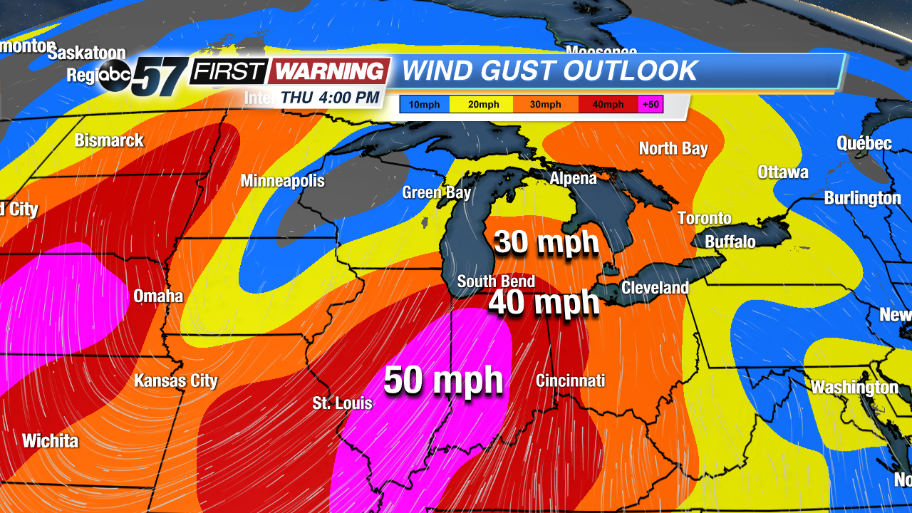
Fair weather continues through Tuesday before our next spring storm brings more wind and rain. Wednesday will see an increasing chance of rain, the most widespread and heavy arriving Wednesday night into Thursday. Thursday the strongest wind will gust, topping 50 mph. Temperatures will also spike, reaching the 50s Wednesday and 60s Thursday.The warm-up doesn’t last as temperatures return to the 30s and 40s this weekend.
Tonight: Mostly clear, low of 24.
Tuesday: Sunny, high of 48.
Wednesday: Scattered showers, becoming breezy, high of 55.
Thursday: Windy, gusts topping 50 mph, rain showers, high of 66.
Sign up for the ABC 57 Newsletter