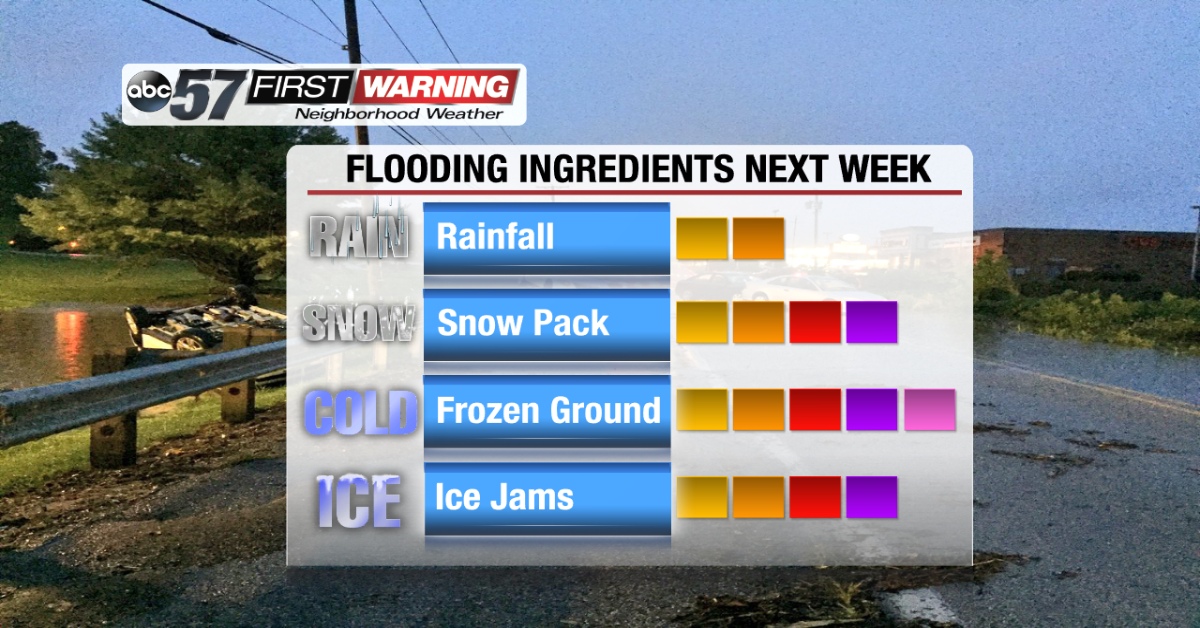
We have flipped the calendar to February, a month that featured devastating, historical flooding just a year ago. Many saw the worst flooding ever recorded thanks to several inches of rain, snow pack and a frozen ground. It was the perfect recipe for significant river flooding in Michiana. Fast forward to February 1, 2019. We have a deep snow pack, a frozen solid ground and rain in the forecast.
 Total possible rainfall thru Friday, February 8th.
That is likely an alarming sentence to anyone who lives in an area prone to flooding. The big difference between this year and last is the amount of rain we are expecting. Fortunately, as it looks now, total rainfall over the next six days does not look overly impressive. We're talking around an inch to possibly a little more in spots.
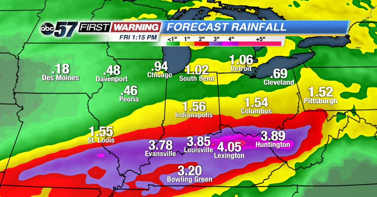
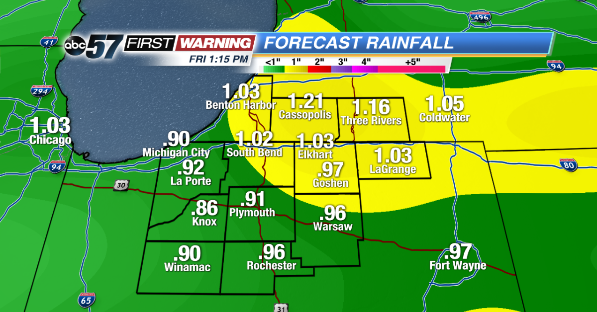
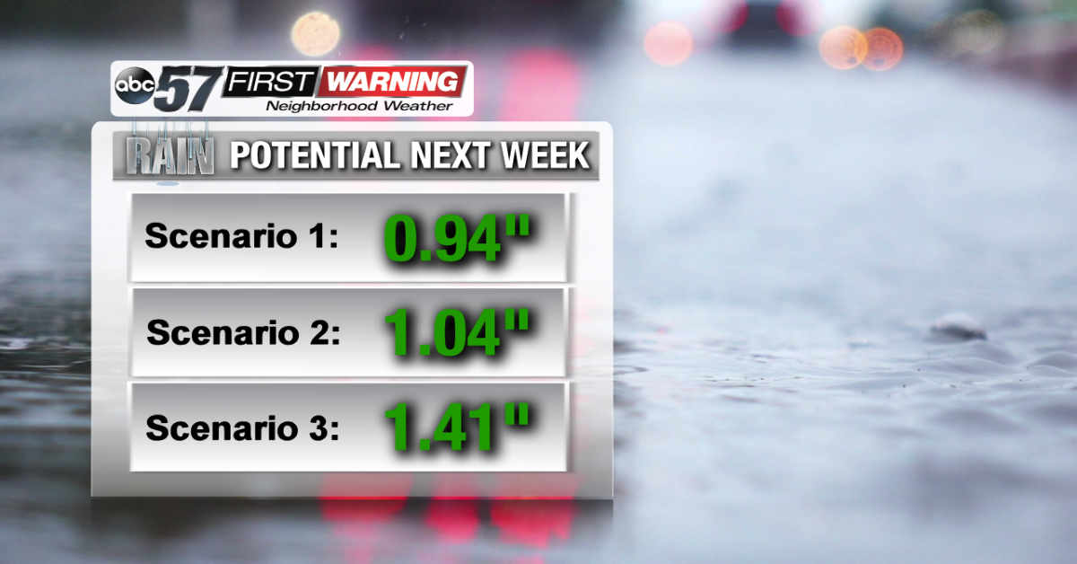 Forecast total rainfall thru Friday, February 8th, according to our 3 long-range forecast models.
When we dissect all of the available information, there really is nothing suggesting a significant rainfall event in Northern Indiana and Southwest Lower Michigan. All of the forecast models our meteorologists use are spitting out values under 2" across the board. That is good news. Areas more likely to see a significant amount of rain during the upcoming warm-up will be to our south. Southern Missouri, Illinois, Indiana, Ohio, and all of Kentucky are at-risk for receiving upwards of 2-5" of rainfall by February 8th. That includes:
•Indiana: Bloomington, Evansville
•Illinois: Carbondale, Effingham, Mount Vernon
•Missouri: Cape Girardeau, Poplar Bluff
•Ohio: Cincinnati, Dayton, Portsmouth
•Kentucky: Louisville, Lexington, Bowling Green, Paducah, Covington
Adding an inch or so of rain to our snow pack and frozen ground over roughly a 5-day span shouldn't be a big problem. Of course, that does not mean there won't be flooding or issues. Any time it warms up and rain falls in the winter, there's a risk of river rises, lowland flooding and minor city flooding. Something we may see more of over the coming days are ice jams. When rivers freeze over and thaw, the ice cracks and splits apart, creating chunks of ice that flow down the river. That in itself can be a headache, especially for those who live along rivers.
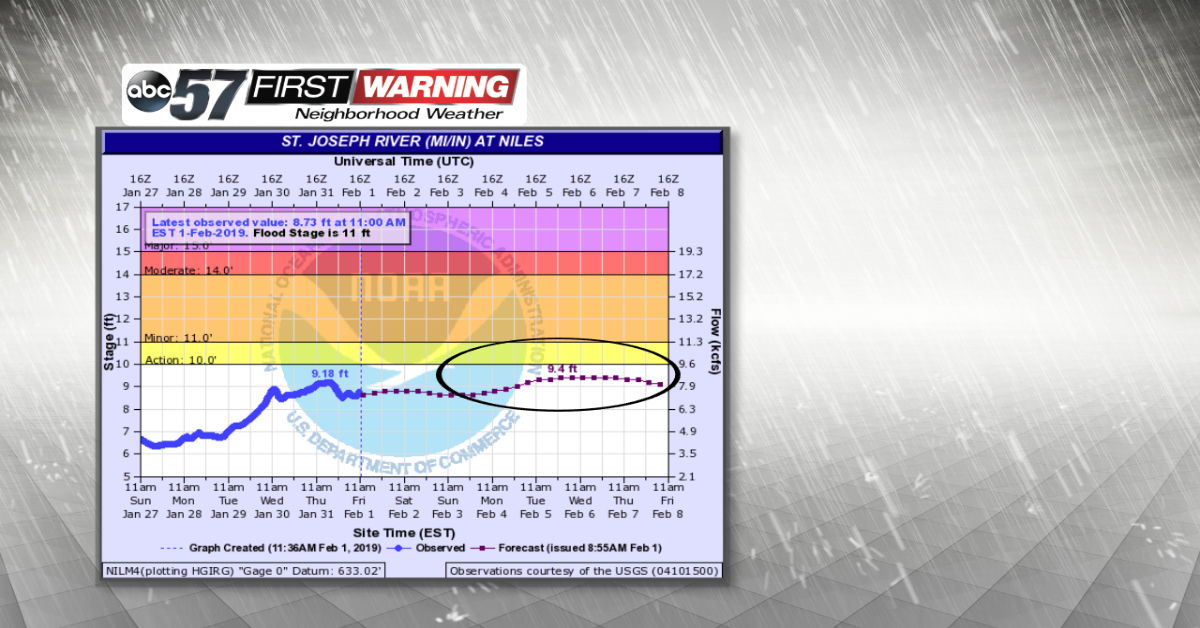
Even with the threat of ice jams on Michiana rivers, the overall risk of flooding beyond the "Minor" level is quite
low. As it stands now, the National Weather Service has all area rivers staying below or just above "Action Stage," which is the lowest threat level (Action - Minor - Moderate - Major). Regardless, it appears as though conditions will be supportive of at least minor street flooding, noticeable river rises, ice jams, lowland flooding, and instances of basement flooding. If you live in a flood-prone area, officials say it's important to prepare for a flooding event.