Saturday, November 9th, 2019
The quiet weather continues tonight through Sunday. Take advantage of the dry skies and daytime highs in the 40s Sunday because it all comes crashing down on Monday.
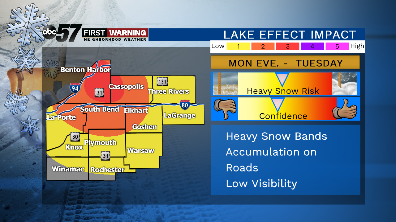
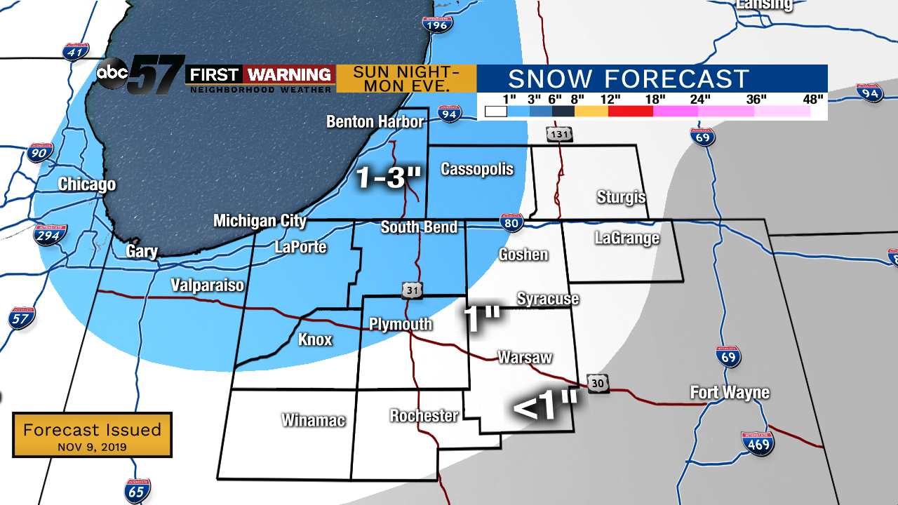
The cold front moves through Sunday night, bringing a chance of light snow into Monday morning. Most will only see 1-2” of snow from it with an isolated 3” total possible. As the cold air rushes in, record breaking cold is likely on Tuesday as highs top out in the mid-20s. The lake effect snow will start after midday Monday as the winds start to shift out of the NW. This is when we will see our highest snowfall totals in our typical lake effect zone. The breezy conditions are going to make it feel even colder. We slowly start to warm back up past Wednesday.
Tonight: Partly to mostly cloudy. Low of 35.
Sunday: Mostly cloudy, isolated shower possible . High of 46.
Monday: Cloudy with AM system snow, followed by L.E. snow. Breezy. High of 30.
Tuesday: Mostly cloudy with L.E. snow showers. Breezy and cold. High of 24.
Wednesday: Partly cloudy, breezy. High of 27.