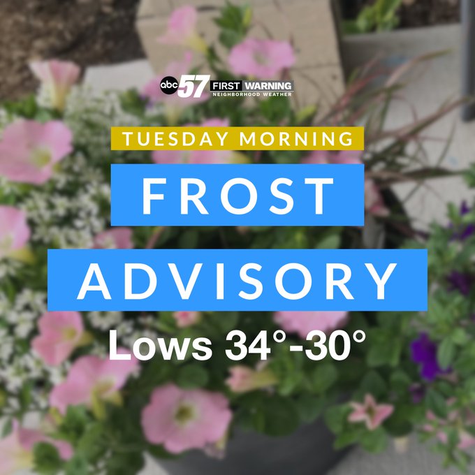
Frost: Clearing, calming and cooling tonight. Lows drop into the mid, possibly nearing the freezing mark. Bring in any potted plants, cover or water any plants in the ground that might be susceptible to the cold.
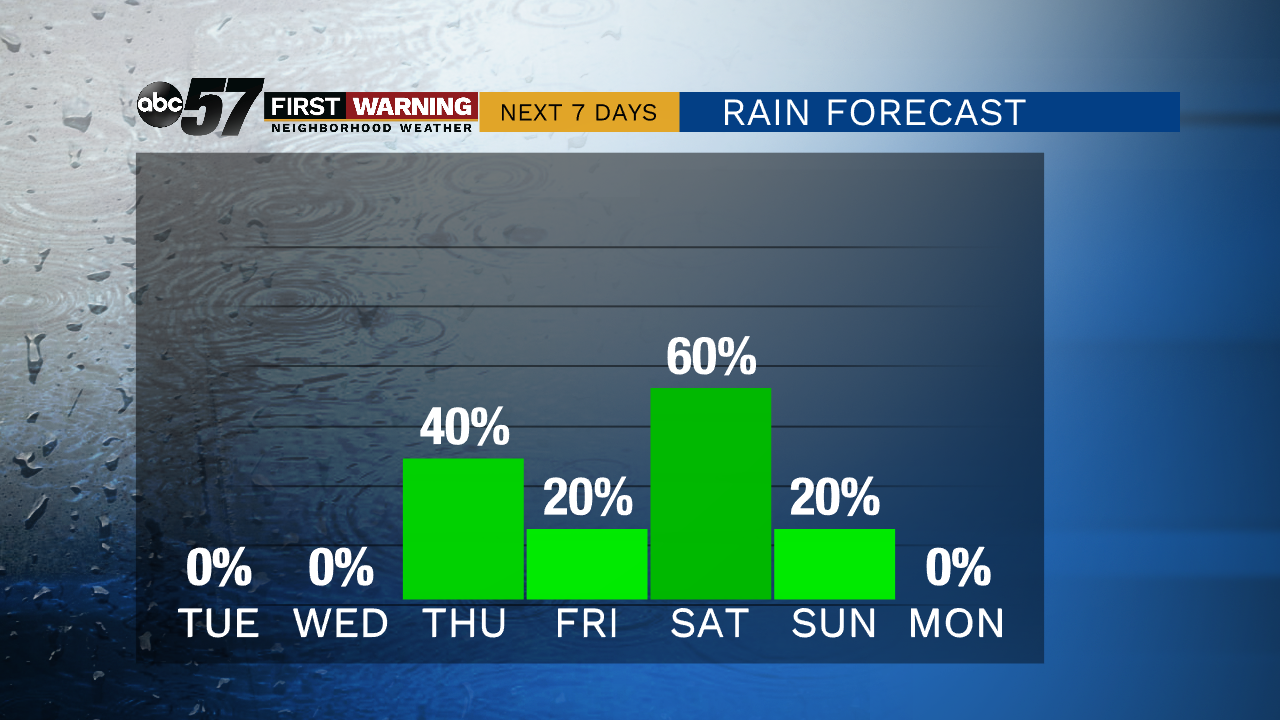
The warm-up begins midweek with fair weather, temperatures gradually warm to 70 by Thursday. The end of the week and weekend is mild but also wet. A few rounds of rain are likely, possibly thunderstorms. A this time severe weather is not expected. There is a chance of rain Thursday through Sunday, Thursday and Saturday look to be the wettest period. In total upwards of two inches of rain could fall this week. Next week looks extremely mild and sunny. The first 80 degree day of 2020 is possible before Memorial Day.
Tonight: Mostly clear. Low of 34.
Tuesday: Mostly sunny. High 57.
Wednesday: Mostly to partly sunny. High 62.
Thursday: Scattered t-showers. High of 70.