


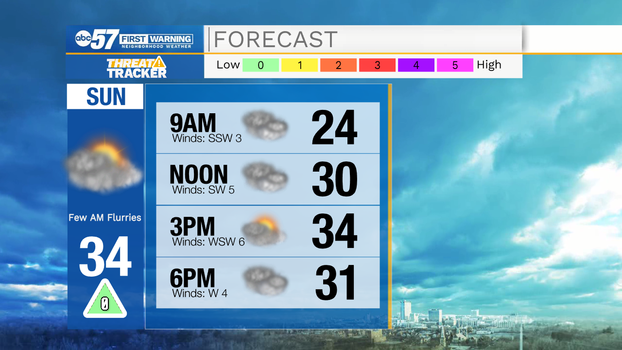
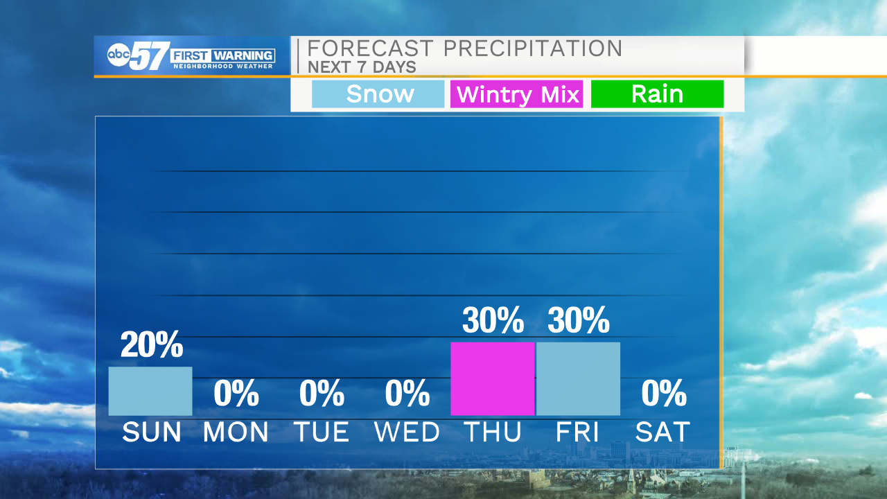
Clear skies remain in the forecast for tonight, but as we work our way into the morning hours tomorrow clouds will increase. Lows tomorrow morning will drop into the low 20s. Tomorrow by mid-afternoon a few snow flurries are possible. Temperatures will top out in the mid 30s. Monday, Tuesday, and Wednesday will remain dry next week with partly to mostly cloudy skies. Thursday afternoon rain chances return with high temperatures hitting the upper 30s. Behind the rain, cold air will move into Michiana, turning precipitation over to snow showers as we head into next weekend. High temperatures next weekend will only hit the upper 20s to lower 30s.
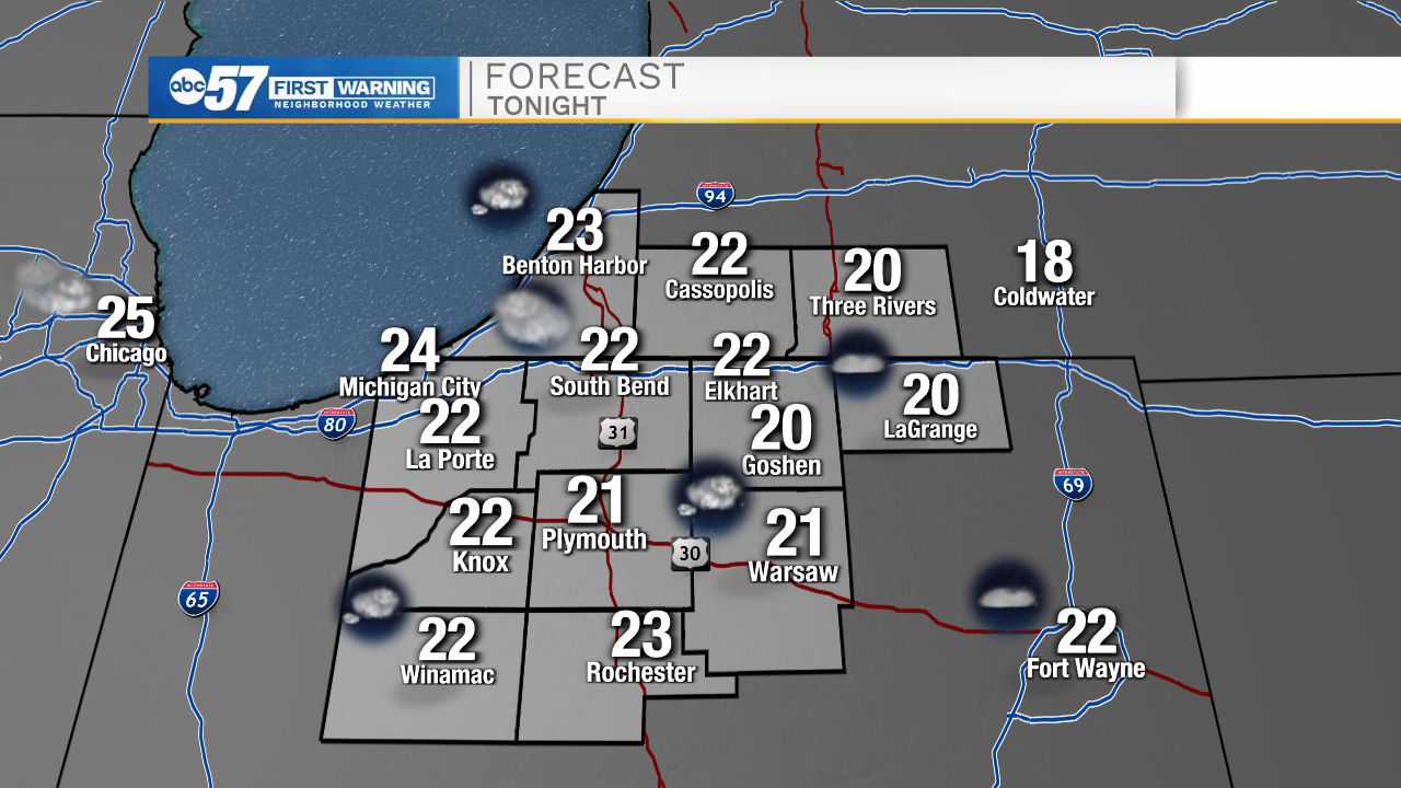
Tonight: Mostly clear/partly cloudy. Low 22.
Tomorrow: Partly to mostly cloudy. High 34.
Monday: Partly to mostly cloudy. High 32.
Tuesday: Partly cloudy. High 34.