
-
0:32

Granger residents share input on proposed S.R. 23 roundabout
-
2:59

Seven local boards unanimously approve fire territory merger...
-
2:05

JobSpark helps inspire career exploration for middle school students
-
2:01

MPHPL launches new bookmobile to extend library access
-
2:17

Will Pauling shines, Jadarian Price shows versatility at Notre...
-
2:55

Notre Dame’s Pro Day gives 16 seniors one more shot to impress...
-
2:57

South Bend residents voice concerns over proposed pedestrian...
-
3:03

Prices at the pump continue to rise across Michiana
-
1:35

Warming up before storms arrive Thursday
-
2:06

Staying sunny until Thursday
-
0:58

Goshen City Council amends DORA rules amid community concerns
-
1:20

SB Common Council adopts Downtown 2045 Plan

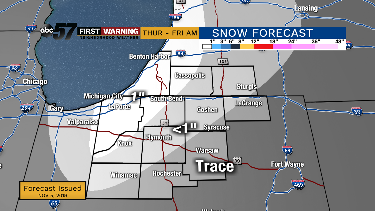
Clouds increase Wednesday, the warm side of the system may bring some drizzle along with highs nearing 50. The cold side brings a wintry mix as temperatures fall to the 30s Thursday. Lake effect snow could bring light accumulation to the grass and raised surfaces through early Friday. There will be an even colder blast of air early next week.
Tonight: Partly cloudy. Low of 30.
Wednesday: Mostly Cloudy. High of 48.
Thursday: Mix/snow showers. High of 36.
Friday: Partly cloudy. High of 34.
Saturday: Mostly sunny. High of 42.
Sign up for the ABC 57 Newsletter