
-
1:17

VERY foggy first few hours of the morning
-
1:57

A local taste brings New Carlisle community together on race...
-
0:45

Pancakes help raise funds to support the Alzheimer’s Association
-
1:03

Lighter rain expected into the afternoon
-
1:04

Non-severe storms expected
-
1:16

Showers start this morning
-
1:59

Mac & Cheese festival turns Four Winds Field into a kitchen
-
0:45

Michiana Spring Clay tour encourages people to try and take a...
-
2:56

Fresh Cuts, Fresh Starts: Re-Entry Program Gives Back in Elkhart
-
0:53

Jr. Irish Memorial Day invitational celebrates veterans and active-duty...
-
1:15

Another rain chance this holiday weekend
-
0:46

Holiday weekend starts rainy

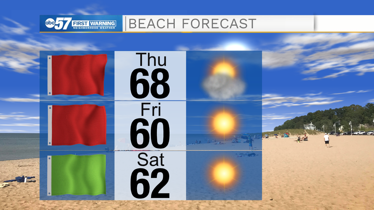
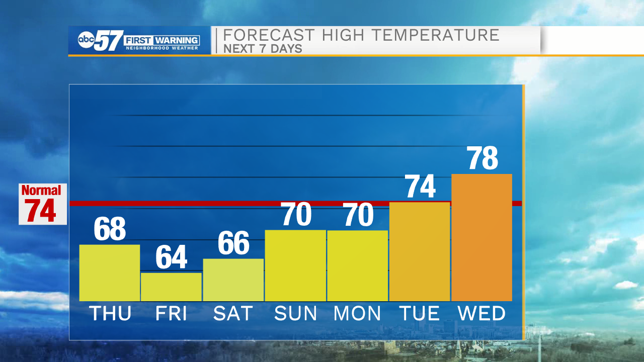
Partly cloudy skies will hang around this morning, but then turn sunny by this afternoon. High temperatures today will top out in the upper 60s. Tomorrow, temperatures in the morning will drop into the mid 40s. Make sure to have the heavier coat handy. Saturday morning will be even colder with lows dropping into the upper 30s to lower 40s. This weekend looks cool, dry, and sunny! Next week the dry streak continues with sunny to mostly sunny skies and temperatures warming back into the mid 70s. Right now, low rain chances are in the forecast for next Wednesday night and Thursday, but could potentially be dropped if models keep trending dry.
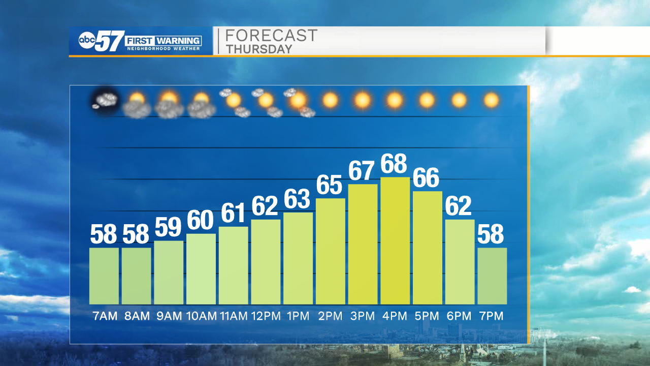
Today: Mostly sunny. High 68.
Tonight: Clear. Low 44.
Tomorrow: Sunny. High 64.
Saturday: Sunny. High 68.