Cold Tuesday, more lake effect snow


System snow tapers down this evening, accumulation up to an inch is possible overnight. As temperatures drop into the single digits, slick roads and ice will be the main concern through Tuesday morning.
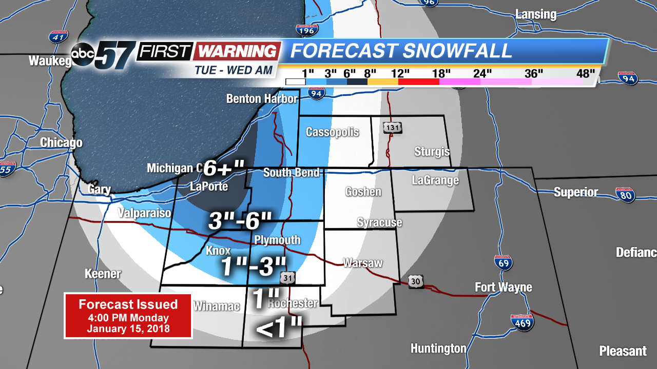
Tuesday will be a cold and for some a snowy day. Highs struggle to break 20 and lake effect snow showers will ramp-up across Berrien and LaPorte county. Most of Tuesday is snow-free but lake effect will develop Tuesday evening and continue through Wednesday morning. The highest totals of more than six inches are likely west of South Bend.
After Wednesday temperatures warm, with another big melt in the forecast for the weekend. Highs will push 50 on Sunday with rain in the forecast. Plan for a wet but milder weekend.
Tonight: Light snow, low of 5.
Tuesday: Mostly cloudy with lake effect snow showers, high of 20.
Wednesday: Lake effect ending, partly cloudy, high of 20.
Thursday: Mostly sunny, highs in the upper 20s.