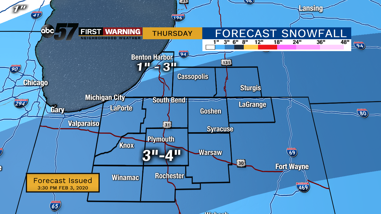
Light rain/ drizzle Tuesday turning into a rain/snow mix, then light snow by evening. As temperatures drop Tuesday night, some roads could be slick. Wednesday afternoon is cloudy but dry, then there is light snow in the evening. Overnight Wednesday into Thursday is the highest chance for snow. At this point, around 3 inches of wet snow are possible across Michiana. High temperatures each of these days will be in the low 30s.
Tonight: Cloudy and rain showers. Low 40.
Tuesday: Rainy, then a rain/snow mix by evening. Temperatures fall throughout the day to the upper 20s. High 40.
Wednesday: Snow showers. High 32.
Thursday: Snow showers, especially in the morning. High 32.
Wednesday night - Thursday morning will be the next focus for wintry weather. So far there's good agreement on the track of this storm.

With any winter storm track, a shift of just 25 miles could move the heaviest snow band north or south.
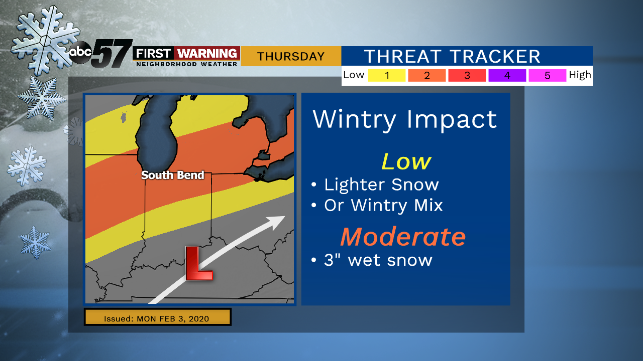
Temperatures are also key, near 32° would mean a wet, compacting snow. As of Monday the most intense band looks to slice across the area. Most falls before 9 AM Thursday.