


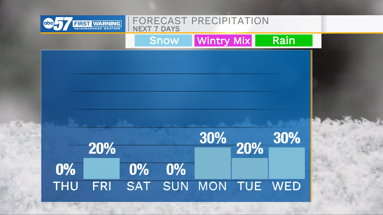
This morning temperatures are in the mid 20s so bundle up before heading out the door. This cold air mixed with some fog/mist, could lead to a few slick spots on the roadways, so leave your self a little extra time for the morning commute. High temperatures today will top out in the mid 30s. Tonight A few flurries look to build into Michiana and could stick around through lunchtime tomorrow. These will be very isolated with no accumulation expected. Weather will stay mostly quiet, but turn cold heading into the weekend. Lows will drop closer to the single digits with highs in the 20s both Saturday and Sunday. Lake effect snow showers will move into Michiana on Monday, right now impacts look very low. Highs will warm into the 30s through the first half of next week.
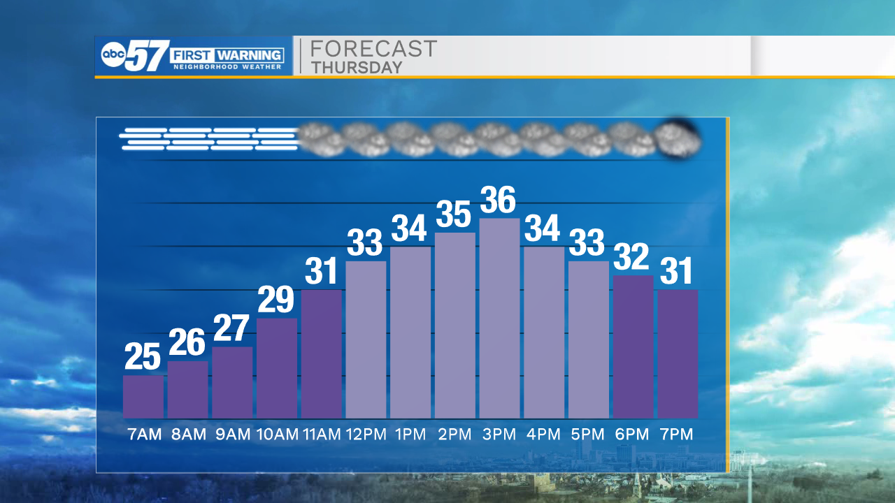

Today: Cloudy. High 36.
Tonight: Mostly cloudy/flurries. Low 22.
Tomorrow: AM flurries/Mostly cloudy. High 30.
Saturday: Partly cloudy. High 22.