
-
1:06

Mishawaka Fieldhouse features Adidas 3Striped basketball tournament
-
2:48

Former South Bend Cub Nico Hoerner reflects on path to Chicago...
-
1:00

Medieval times return to Plym Park with the Renaissance Faire
-
2:15

South Bend celebrates Kids to Parks Day with bike-riding workshop
-
2:43

Cubs clobber White Sox in first game of ’Crosstown Classic’
-
2:00

South Bend Police Department honors the fallen
-
0:52

St. Joe/Benton Harbor Rotary holds ribbon-cutting ceremony for...
-
2:25

Irish lacrosse head to NCAA quarterfinals with Johns Hopkins...
-
3:09

Cubs, White Sox open first Crosstown Classic series of summer...
-
3:45

South Bend Cubs dedicate plaque to Indiana born composer of ’Take...
-
1:52

Concord fourth graders launch weather balloon following months...
-
4:55

Gus Macker 3-on-3 basketball tournament returns to Benton Harbor

Cool, cloudy and dreary describes the midweek. High temperatures will be running 10 to 15 degrees below normal, struggling to break the mid-60s. The difference in lake and air temps will produce lake effect clouds and rain bans. The northwesterly pattern finally ends Friday, milder and sunny weather returns for the weekend.
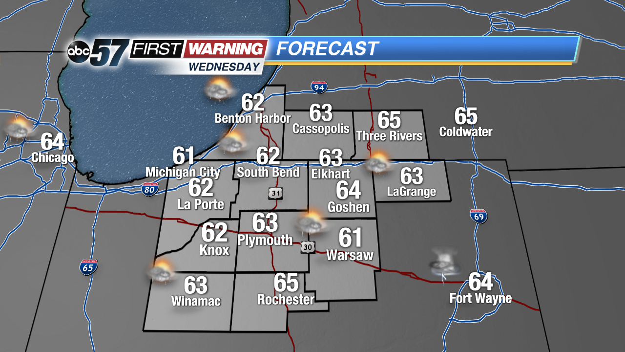 Highs struggle to mid the mid 60s Wednesday
Tonight: Partly to mostly cloudy, showers by morning, low 48.
Wednesday: Mostly cloudy, lake effect rain showers, high of 62.
Thursday: Partly cloudy, lake effect rain showers, highs of 64.
Friday: Mostly sunny, highs in the low 70s.
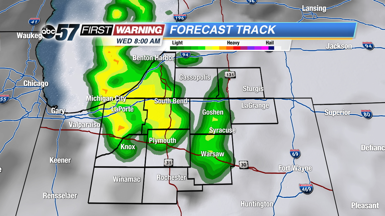 Lake effect rain bands start Wednesday morning
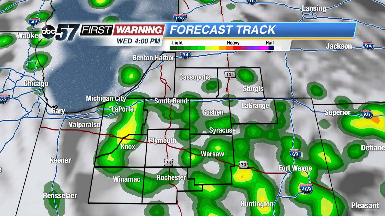 Lake effect showers continue but highly scattered through Wednesday
Sign up for the ABC 57 Newsletter