
-
3:17

Applications open for Fall Citizens Police Academy in South Bend
-
2:23

Elkhart County 4H Fair food vendors celebrate 50th year of business
-
2:16

Young football athletes learn about protecting their bodies,...
-
1:24

Storm track timing could be shifting
-
0:57

Unity Gardens brings music, food, and crafts for Westside BBQ...
-
1:50

Quiet evening, Storms after Midnight
-
0:57

Deer Creek Hunt Club throws a skeet shoot event for Deputy Jon...
-
1:44

Two rounds of storms Monday
-
1:07

Mini heat wave starts out the door
-
2:23

La Porte community rallies for Sammy Strong Benefit, raising...
-
1:57

The Potawatomi Zoo opens its gates to Zoo Nights Live
-
2:50

Carson Kvapil wins his first O’Reilly Auto Parts Series win...

Rain continues tonight and could turn into more of a wintry mix overnight. The wintry mix continues early Saturday morning, then rain most of the late morning and afternoon. By Saturday evening, we could see snow instead. Light snow continues into Sunday morning. Little accumulation is expected. Roads will remain above freezing, so there should be little impact for travel. Temperatures this weekend and next week will remain in the mid to upper 30s each day with overnight lows in the upper 20s.
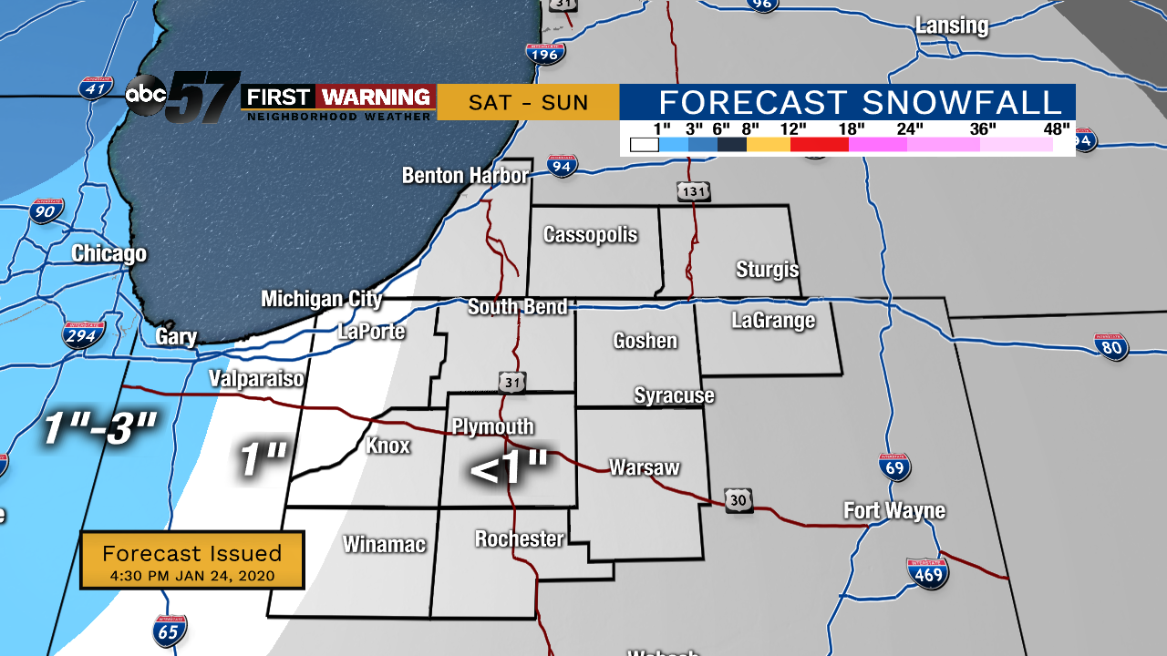
Tonight: Rain turns late to a wintry mix. Low 30.
Saturday: Wintry mix early, then mostly rain. Snow possible by evening. High 36.
Sunday: Snow in the morning, then cloudy. High 34.
Monday: Cloudy but dry. High 34.
Sign up for the ABC 57 Newsletter