


Highs over the weekend will climb into the mid-40s while skies stay dry and mostly to partly cloudy. Hopefully you can get outside over the weekend because temps crash hard starting Monday, thanks to the incoming system. Attention is still focused on early next week, with a cold front bringing a wintry mix changing over to snow late Sunday/Sunday night into Monday morning. Once the front clears Michiana, we’ll see a shift to L.E. snow around midday Monday. Lake effect chances continue through Tuesday night with drying conditions and slowly warming highs afterwards.
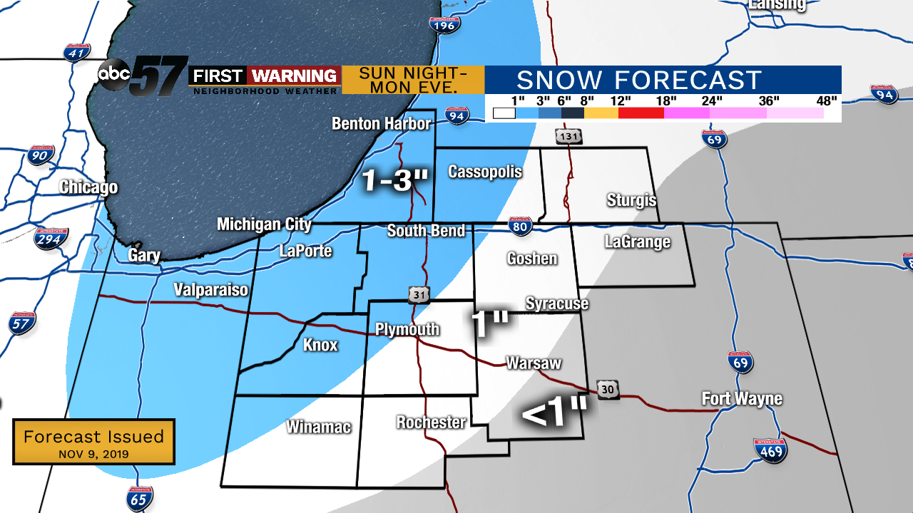 Potential snow totals ending Monday evening. More lake effect is likely, only adding to these numbers
Totals right now are focused on the early stages of the event: Sunday night through Monday evening. A widespread 1” can be expected for everyone with 1-3” totals for the NW half of Michiana. More snow in the L.E. zone Monday night through Tuesday night will continue to build upon these numbers.
Today: Partly sunny and breezy. High of 44.
Tonight: Partly to mostly cloudy. Low of 34.
Sunday: Mostly cloudy. Slight chance of rain showers to the north late. High of 45.
Monday: Cloudy with AM system snow, followed by L.E. snow. Breezy. High of 30.
Tuesday: Mostly cloudy with L.E. snow showers. Breezy and cold. High of 24.