
-
2:34

From Niles to South Bend: Jays 2 Keeps the Spirit Alive for basketball...
-
0:46

44th annual Tri Kappa Antique Show boosts charities and scholarships
-
1:48

Scattered showers this evening, Much cooler overnight
-
1:50

Showers and storms this afternoon
-
0:20

One person injured in shooting
-
0:36

Eddies Circuit Robotics holds competition Saturday
-
0:32

21st annual Nappanee Model Train Show
-
0:38

Local boys basketball team headed to IHSAA state finals
-
3:49

Midwest Meowfest brings kitten advocacy to attendees, new homes...
-
1:52

Mild tonight, showers tomorrow
-
1:43

Pleasant to start the weekend
-
3:06

Pulaski County weighs stricter solar rules amid resident concerns

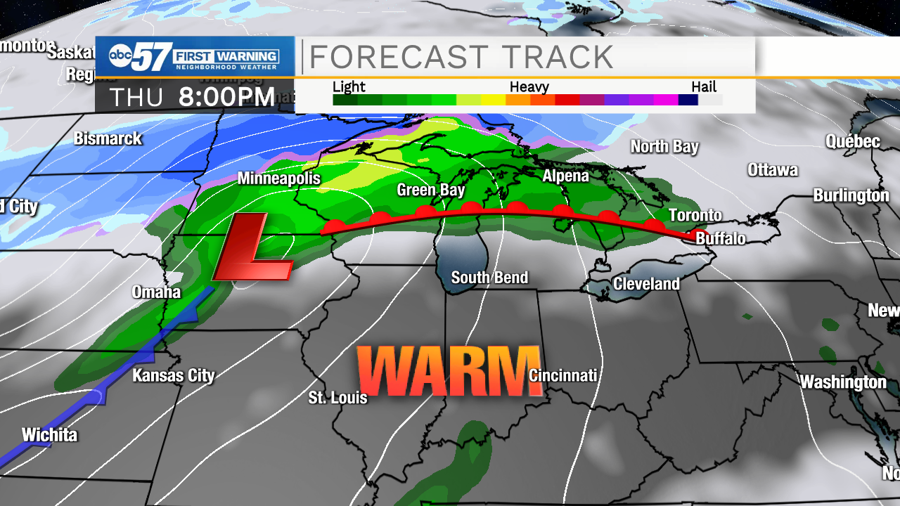
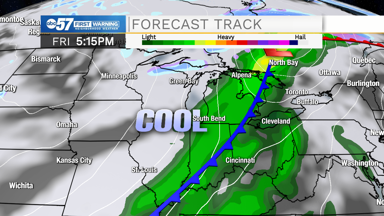
This week will be active, temperatures swing upwards with a few rounds of rain. The timing however is favorable for most daytime hours to be dry. Most the wet weather in the evening/overnight. Temperatures spike Thursday into the mid-70s ahead of a strong cold front that will bring widespread rain and possibly thunderstorms Friday. Temperatures crash again into the weekend, highs return to the 50s.
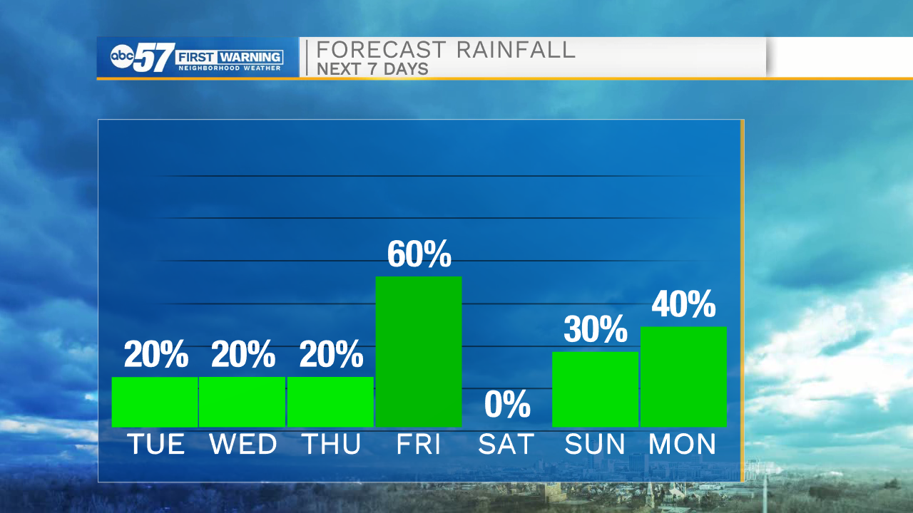
Tonight: Evening drizzle, mostly cloudy. Low 38.
Tuesday: Mostly cloudy. Evening showers. High 58.
Wednesday: Early shower possible then breaks of sun. High 62.
Thursday: Partly cloudy, mild and breezy. High 76.
Sign up for the ABC 57 Newsletter