
-
2:00

Annual Studebaker car show takes over Ironwood Plaza
-
0:55

Beautiful weekend expected
-
1:05

Truly wonderful conditions
-
0:41

High-speed pursuit ends in collision after driver flees police...
-
2:15

Fort Wayne Tin Caps put an end to the SB Cubs winning streak
-
1:21

This weekend is the annual Hall of Heroes Comic Con
-
0:46

Elkhart Police Department respond to shots fired call at the...
-
3:55

ABC57 speaks with Cass County Commissioners, Judge and Interim...
-
2:48

Common Council to consider appeal options following South Bend...
-
0:52

South Bend seniors explore local parks, event centers, and available...
-
1:51

Mentone Egg Fest celebrates 80th year
-
4:58

New reactions after Notre Dame releases findings of priest sex...

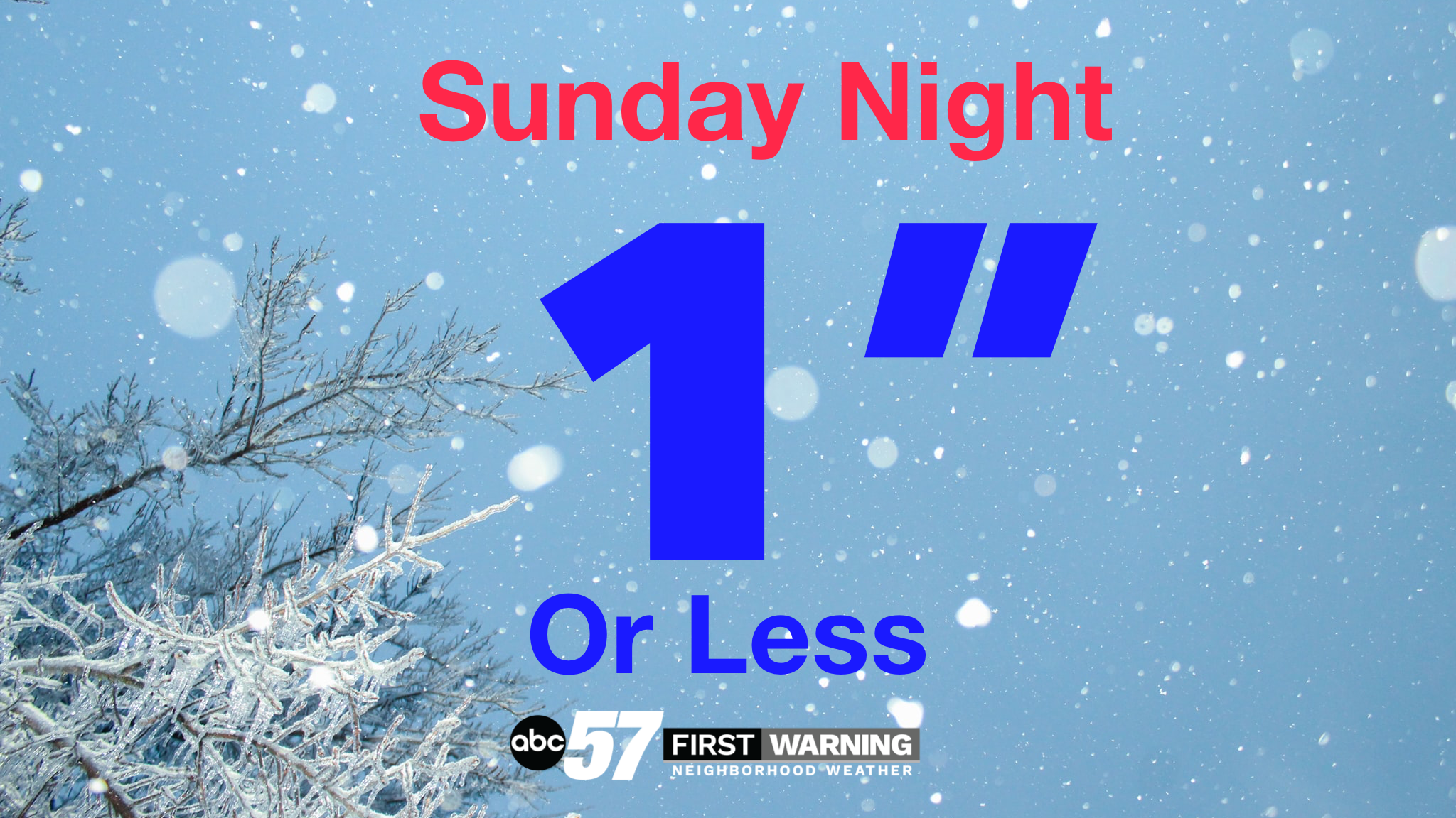
Broken cloud cover early Sunday otherwise another chilly and cloudy day. Rain / snow showers are likely Sunday evening, snow could accumulate on the grass, deck and roof but pavement will remain wet, an inch or less at most. Clouds break Monday and we begin an intermittent pattern of passing rain showers and partly cloudy skies every 24 to 36 hours. Temperatures continues to trend milder through much of next week with highs in the 50s
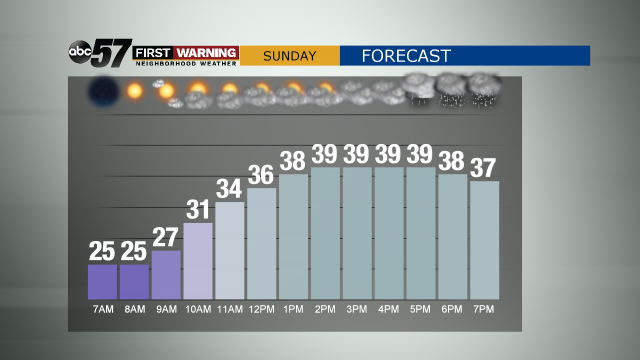
Tonight: Partly cloudy. Low 24
Sunday: Partly sunny early. Overcast and rain/snow mix in evening. High 42.
Monday: Early AM mix then partly sunny afternoon. High 45.
Tuesday: Rain likely. High of 52.
Sign up for the ABC 57 Newsletter