


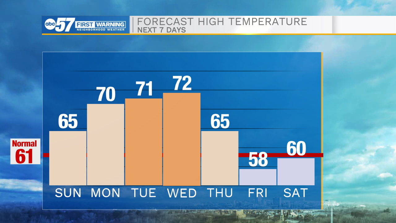
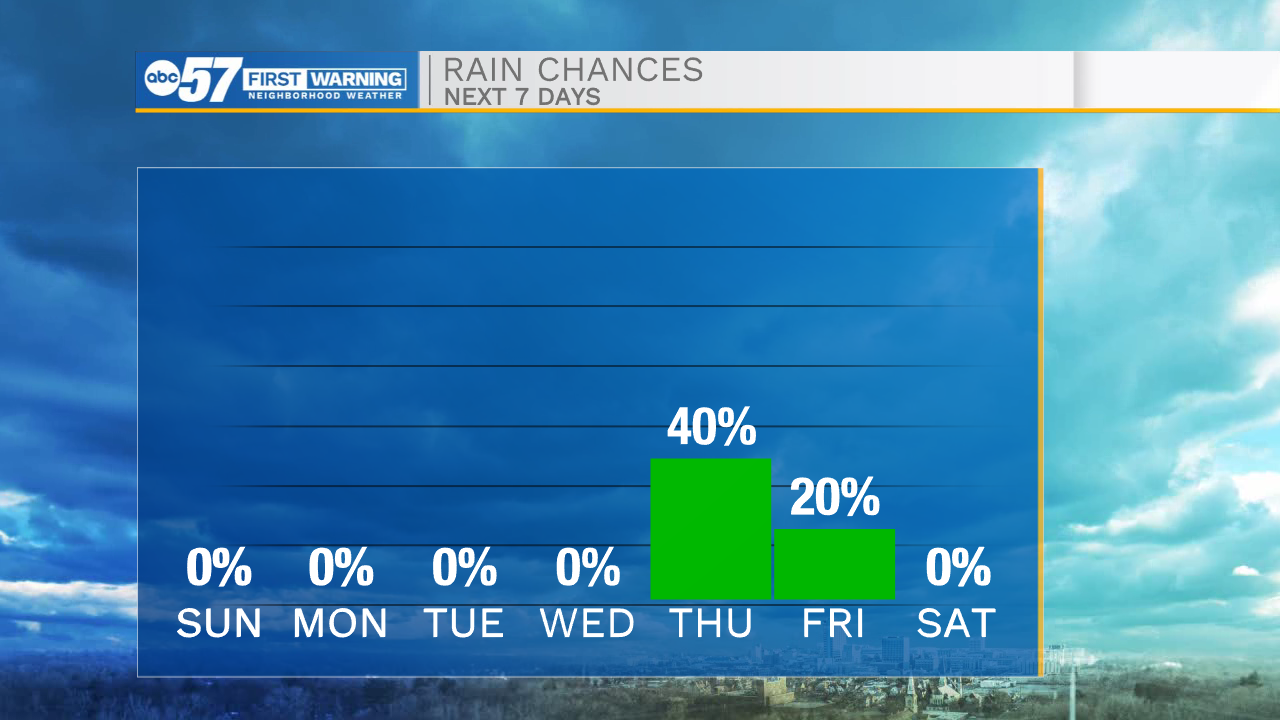
Partly to mostly cloudy skies will stick around through the evening hours. This will help to keep temperatures in the mid to upper 40s tomorrow morning. It will be a cold start to the day so bundle up before heading out the door. Winds will stay on the breezy side as well through tonight and tomorrow. Isolated wind gust will reach into the upper teens to lower 20mph range. We are tracking lots of sunshine for tomorrow afternoon with highs in the mid 60s. We will warm into the lower 70s for Monday, Tuesday, and Wednesday next week. Along with the 70s we are tracking more sunshine and dry weather. Our next chance for rain will arrive late Wednesday night into Thursday as a cold front moves through Michiana.
Tonight: Partly cloudy. Low 44.
Tomorrow: Mostly sunny. High 65.
Monday: Sunny. High 70.
Tuesday: Sunny. High 71.