
-
2:34

From Niles to South Bend: Jays 2 Keeps the Spirit Alive for basketball...
-
0:46

44th annual Tri Kappa Antique Show boosts charities and scholarships
-
1:48

Scattered showers this evening, Much cooler overnight
-
1:50

Showers and storms this afternoon
-
0:20

One person injured in shooting
-
0:36

Eddies Circuit Robotics holds competition Saturday
-
0:32

21st annual Nappanee Model Train Show
-
0:38

Local boys basketball team headed to IHSAA state finals
-
3:49

Midwest Meowfest brings kitten advocacy to attendees, new homes...
-
1:52

Mild tonight, showers tomorrow
-
1:43

Pleasant to start the weekend
-
3:06

Pulaski County weighs stricter solar rules amid resident concerns

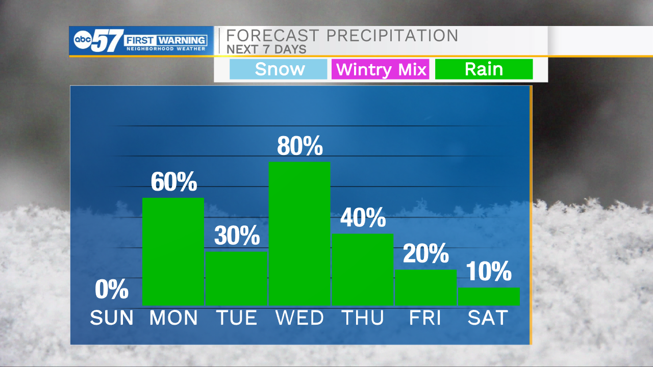
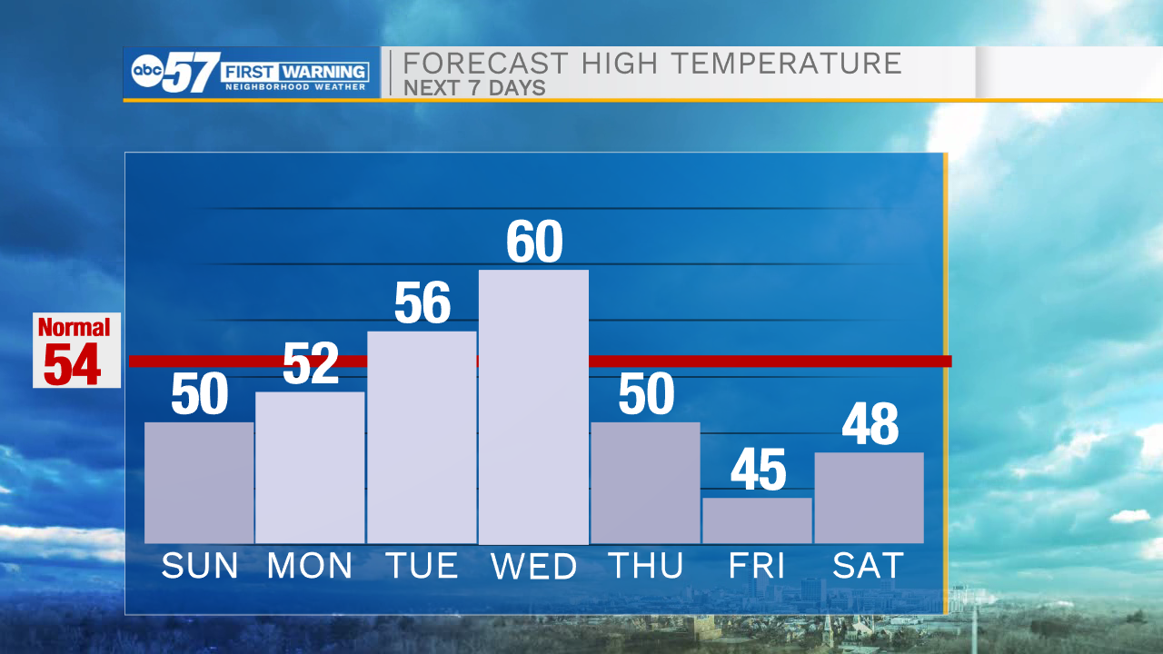
Rain showers will impact all of Michiana this evening, but then dryer weather returns for Sunday. Temperatures tonight will drop into the mid 30s. Highs tomorrow afternoon will top out in the upper 40s to lower 50s. Rain chances return late tomorrow evening and will stick around throughout most of Monday morning and early afternoon. This will start our wetter pattern for next week. Rain showers are possible everyday next week with the best chances arriving on Wednesday. Along with the rain, temperatures will stay on the warmer side with most places hitting the 50s and 60s. Low rain chances will stick around heading into next weekend.
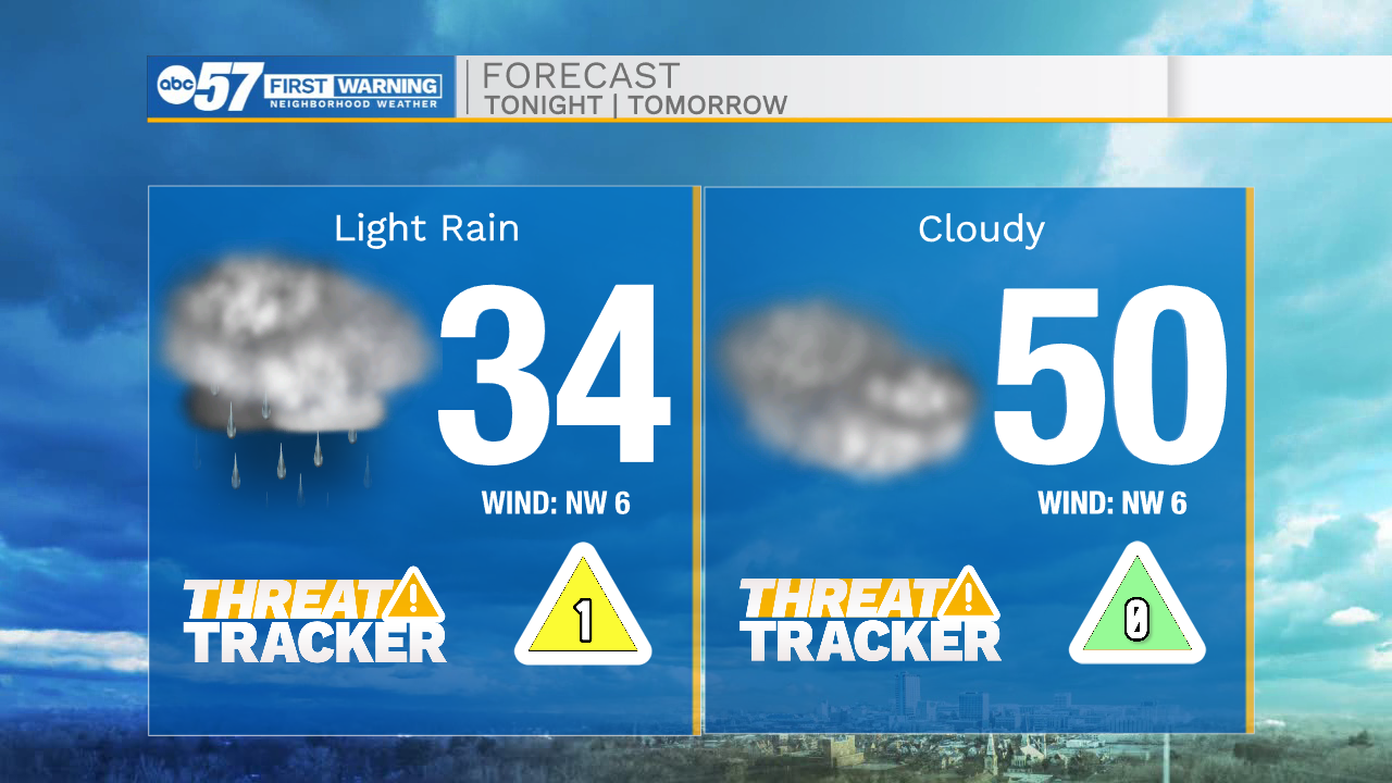
Tonight: Mostly cloudy. Low 34.
Tomorrow: Cloudy. High 50.
Monday: AM Scattered showers. High 52.
Tuesday: Isolated showers. High 56.