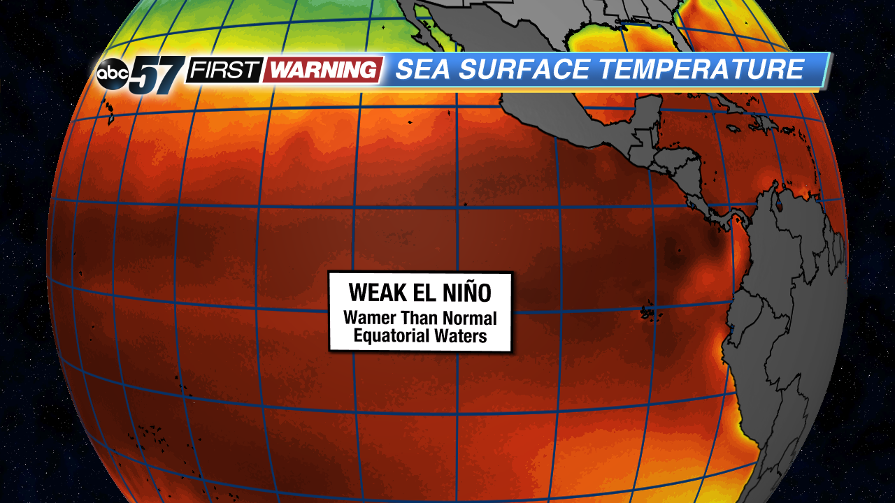
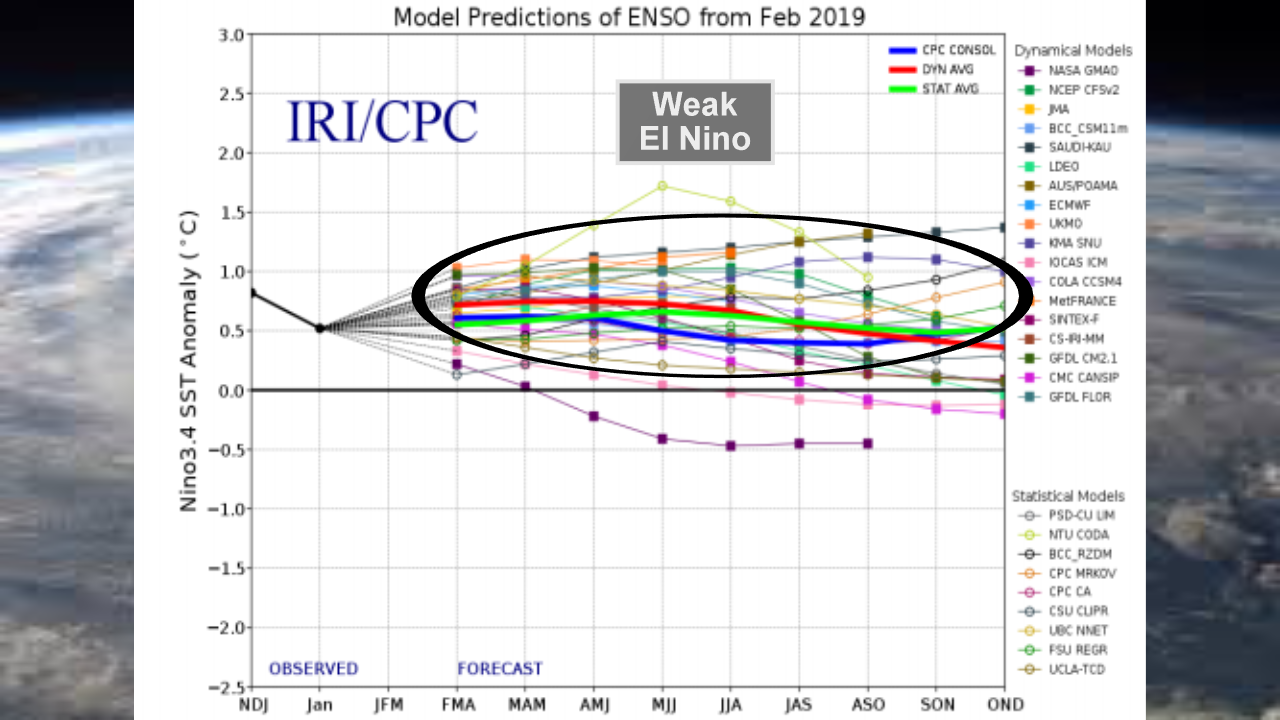
El Nino is here, so what's ahead for Michiana?
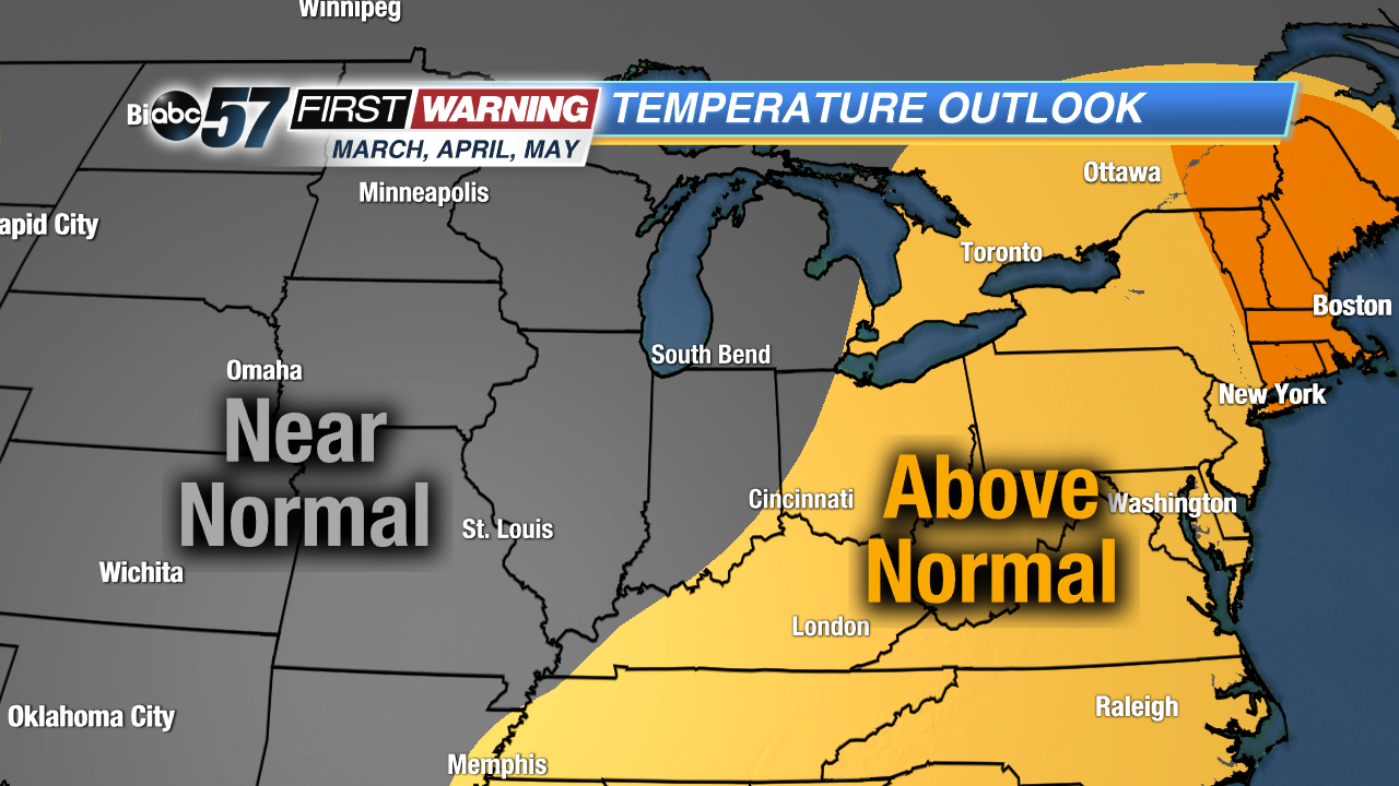
•March: highs in the 40s and 50s and lows in the mid-20s and lower 30s during March, highs in the mid-50s to mid-60s and lows in the low 30s
•April: highs in the mid-50s to mid-60s and lows in the low 30s to low 40s
•May: highs in the mid-60s to mid-70s and lows in the low 40s to low 50s
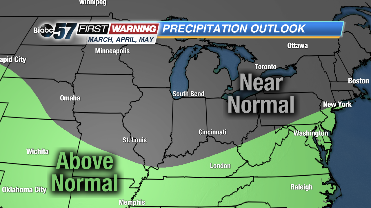
Of course, we will likely have cold and warm days mixed in, but the pattern doesn't scream "super cold" or "super warm." Similarly, Michiana is in the "near normal" category for precipitation. That means:•March: near 2.4" of total precipitation (about 7" of that liquid would be snow)
•April: near 3.2" of total precipitation (about 1" of that liquid would be snow)
•May: near 3.8" of total precipitation
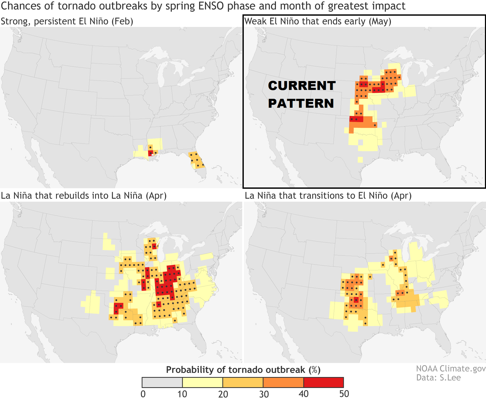
But what about things other than just temperatures and precipitation? Namely, severe weather and tornadoes. Unfortunately, it's quite difficult to break down the overall impacts that an El Niño or La Niña has on tornadoes in the Midwest. However, there have been studies that have attempted to make some connections.
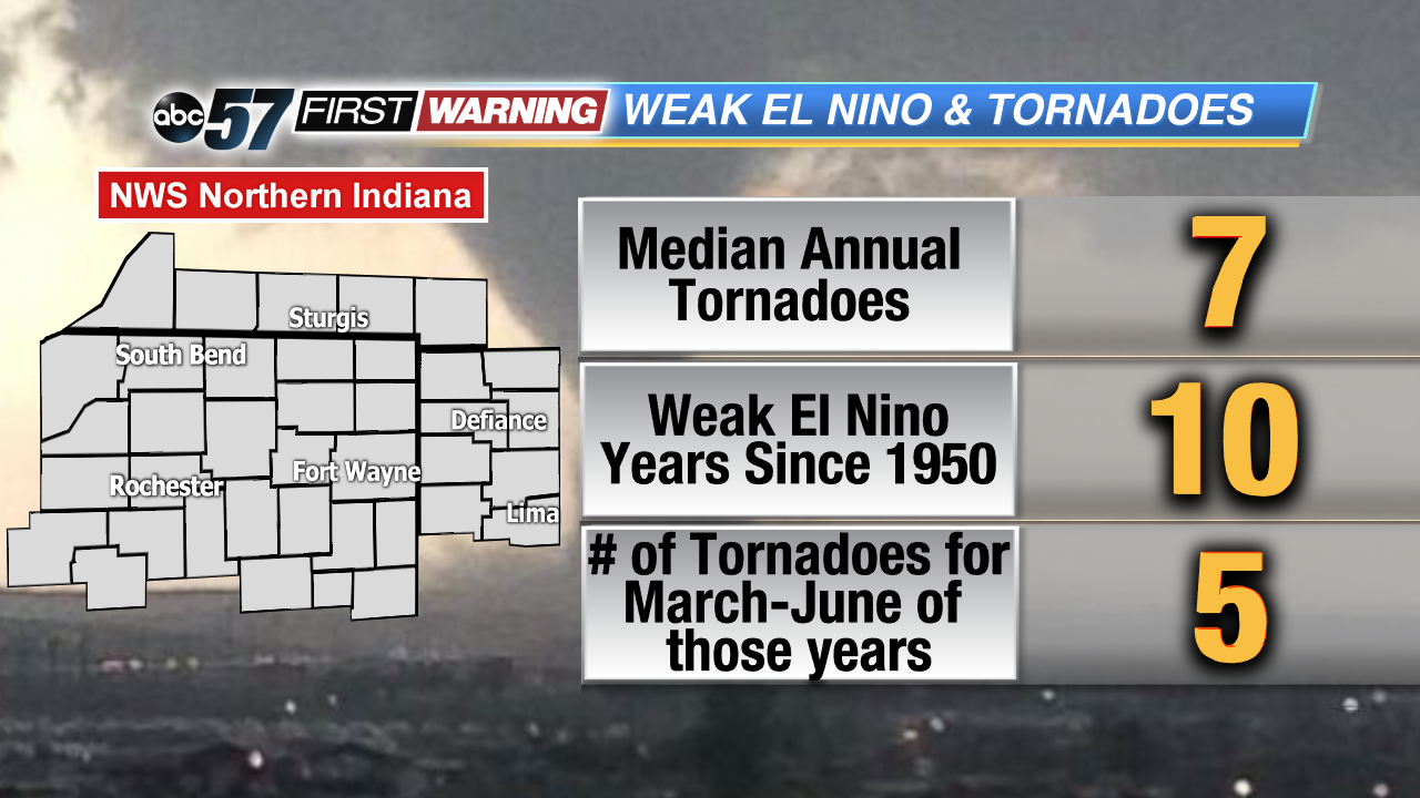
One study was summed up and discussed here. The conclusions that were drawn show that La Niña years and years in which La Niña transitions to El Niño are the worst when it comes to tornado outbreaks in the United States. However, weak El Niño years oftentimes can lead to plenty of severe weather and tornadoes, especially in May. It's important to note that findings aren't all exactly the same. A blog write-up from climate.gov breaks down multiple studies and shows that overall, El Niño years produce less in the way of both tornadoes and hailstorms. That is true not only for Michiana, but the entire country. On the flip side, the write-up shows that La Niña years typically see more hail and tornado activity for the Southern Plains, Lower Mississippi Valley and Middle Mississippi Valley. Again, there is so much out there that can be looked into. Predicting severe weather using climate variables such as El Niño vs. La Niña is nowhere near a perfect science.We did find something interesting regarding El Niño and tornadoes in Michiana. Looking back to 1950, there have been 10 years in which a weak El Niño was the dominant phase. During the months of March, April, May, and June of those years, tornado activity was higher than normal across Northern Indiana, Southern Michigan and Northwest. Typically, that geographical region sees 7 tornadoes in an entire year. However, during the 10 weak El Niño years, the region averaged 5 tornadoes just during the four-month stretch of March to June. That may suggest that severe weather is more probable during the springtime in Michiana when a weak El Niño is in effect.

