ABC57 First Warning Neighborhood Weather Forecast
Wednesday, August 11th, 2021
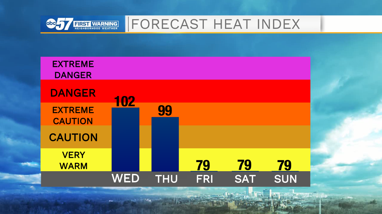
The hot and very humid weather continues today and Thursday as the heat index will climb near 100F both days.
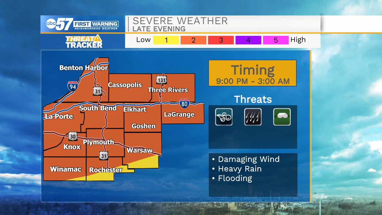
A quick round of scattered thunderstorms are possible late this morning. Another line of storms moves in late this evening, after 9pm. It could be severe with damaging wind and heavy rain being the main threats. A line of storms moves through late Thursday as well, bringing another chance of strong storms. Thankfully we cool back down into the low 80s for Friday through the weekend.
Today: Extreme heat, partly cloudy, isolated thunderstorms. High 90.
Tonight: Scattered storms early, strong to severe possible. Low 74.
Thursday: Extreme heat, partly cloudy, scattered thunderstorms late. High 90.
Friday: Partly cloudy. High 82.