
-
1:06

Marshall County Humane Society reschedules Dog Egg Hunt
-
2:01

Martin Luther King Dream Center hosts MLK March in South Bend
-
1:54

South Bend Cubs opener postponed by weather, but fans still find...
-
2:01

Sights and sounds from South Bend Cubs Opening Day
-
1:32

NIPSCO ’flatly rejected’ further negotiations, USW workers...
-
3:36

The art of groundskeeping at Four Winds Field
-
3:32

The history behind America’s only ballpark synagogue turned...
-
1:59

South Bend opens season against Quad Cities in familiar Midwest...
-
4:21

South Bend Cubs owner discusses $48M stadium expansion, changes...
-
3:19

A look into the new South Bend Cubs 2026 roster
-
5:17

Expansion goes beyond Four Winds Field, new restaurants, bars,...
-
6:18

What’s new this season? South Bend Cubs unveil major improvements...

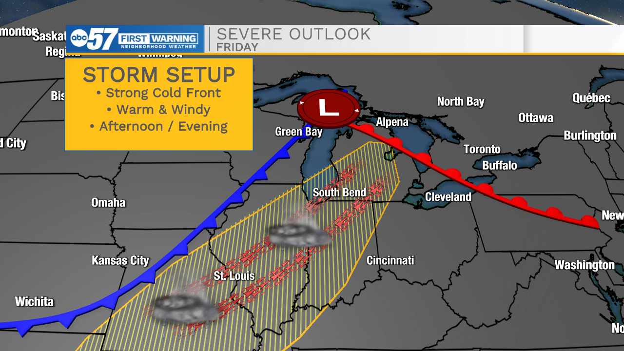
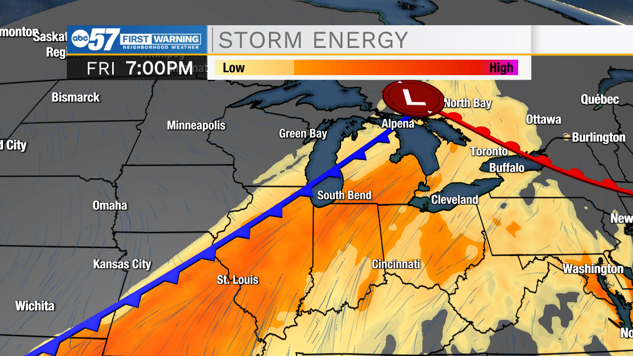
Fair and mild to start the week, then showers and storms. Wednesday brings passing rain showers but the focus is on Friday's storm threat. Temperatures warm, humidity rises and wind gusts, ahead of a strong cold front Friday. This increase the potential for thunderstorms and severe weather Friday. Exact detail as of Monday are vague, but the potential is there for storms, and this will be the focus the rest of the week. The weekend is mild again with high in the 60s.
Tonight: Clear. Low 48.
Tuesday: Mostly sunny. High 68.
Wednesday: Rain showers. High 68.
Thursday: Partly cloudy. High 82.
Sign up for the ABC 57 Newsletter