
-
1:06

Marshall County Humane Society reschedules Dog Egg Hunt
-
2:01

Martin Luther King Dream Center hosts MLK March in South Bend
-
1:54

South Bend Cubs opener postponed by weather, but fans still find...
-
2:01

Sights and sounds from South Bend Cubs Opening Day
-
1:32

NIPSCO ’flatly rejected’ further negotiations, USW workers...
-
3:36

The art of groundskeeping at Four Winds Field
-
3:32

The history behind America’s only ballpark synagogue turned...
-
1:59

South Bend opens season against Quad Cities in familiar Midwest...
-
4:21

South Bend Cubs owner discusses $48M stadium expansion, changes...
-
3:19

A look into the new South Bend Cubs 2026 roster
-
5:17

Expansion goes beyond Four Winds Field, new restaurants, bars,...
-
6:18

What’s new this season? South Bend Cubs unveil major improvements...

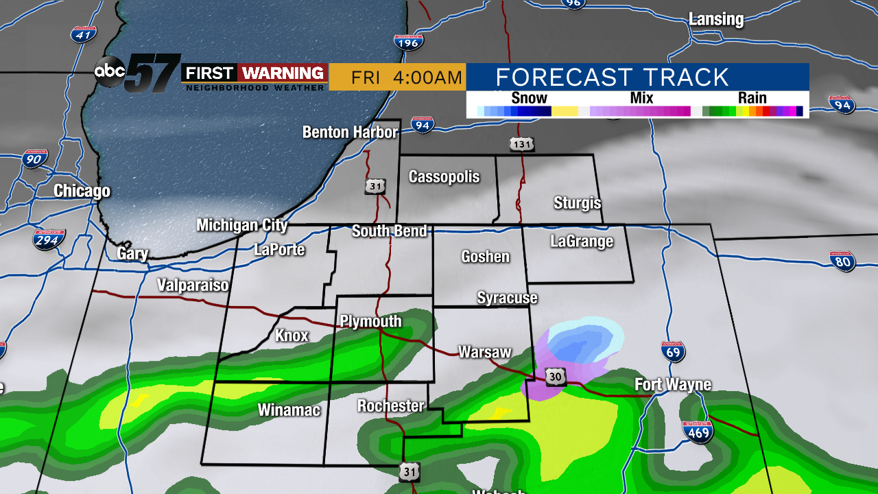
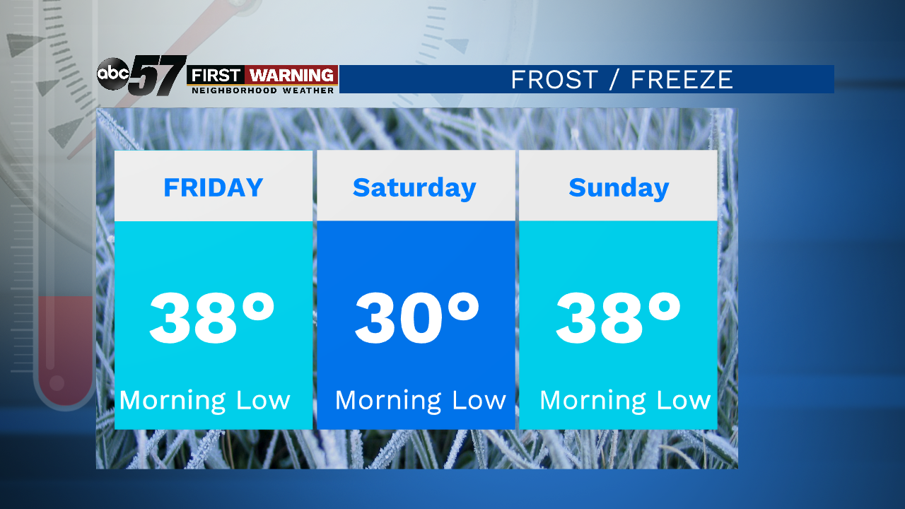
Fair weather last through Thursday, along with highs near 60, then a chilly blast to end the week. Rain and even a few snowflakes are possible Thursday night into Friday morning but Friday after the early morning is dry. Two records to watch, the coldest high for Friday is 43° (1960) and the record low for Saturday 27° (1947). The forecast will be close to these marks, the greatest threat being a damaging frost/freeze to plants Saturday morning. This may not be the last freeze as chilly nights last into early next week.Rain is still likely Mother's Day
Tonight: Mostly clear. Low of 40.
Thursday: Mostly sunny. High of 60.
Friday: Early AM showers, breezy. High of 46.
Saturday: Mostly sunny. High of 52.
Sign up for the ABC 57 Newsletter