
-
2:44

Warmer, breezier, and cloudier than yesterday
-
0:46

Crowds gather for Fins and Feathers Fest at La Porte City Fairgrounds
-
0:46

Paramount School of Excellence hosts teacher fair
-
2:30

Voting advocacy, peaceful demonstrations and donations: South...
-
2:04

Warming to start the week, Showers and storms by Tuesday
-
2:10

Cool, but calm, today
-
1:23

City of South Bend presents an ’Age-Friendly Plan’ to better...
-
0:54

South Bend Venues Parks and Arts hosts ’Adult Recess’
-
2:27

Why Aneyas Williams turned down the transfer portal and stayed...
-
2:21

Bourbon community rallies around Triton boys’ basketball team...
-
5:02

Dave Matthews shares details about LLC bankruptcy filings
-
1:00

Warming up this weekend before more storms next week

A strong storm system will bring windy and rainy conditions overnight and a big drop in temperatures through Tuesday. Gusts may top 40 mph overnight, through Tuesday morning.
Winter is hear and will be staying for the foreseeable future. Tuesday will be breezy with falling temperatures, falling below freezing by evening. Highs are unlikely to top 32 degrees for the next two weeks. With colder temps comes the increased chance of snow. At this time only light accumulation is expected through Thursday.
Tonight: Windy with rain showers overnight, temps 55 to 35. 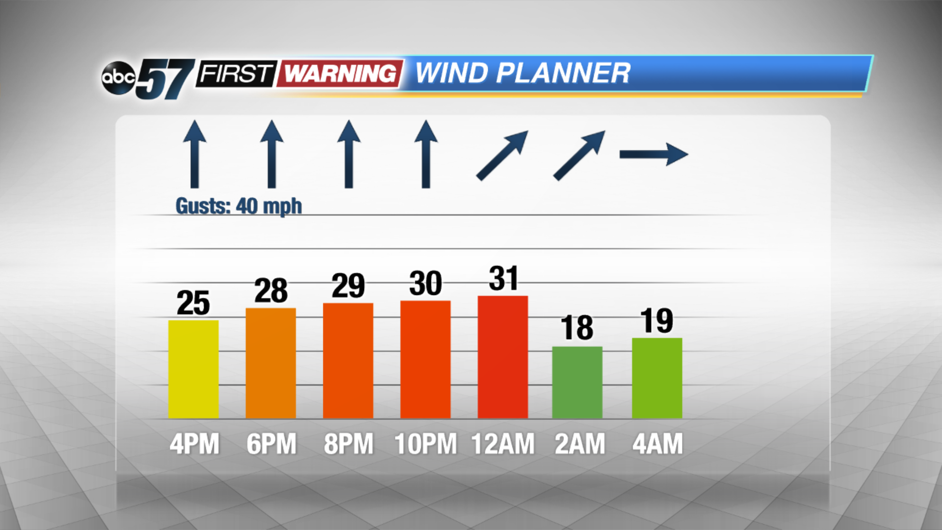 Windy overnight Monday into Tuesday
Tuesday: Partly cloudy and breezy, temps 38 to 28, falling through the afternoon.
Wednesday: Mostly cloudy, chance of lake effect snow, high of 32.
Thursday: Lake effect snow showers, high of 28.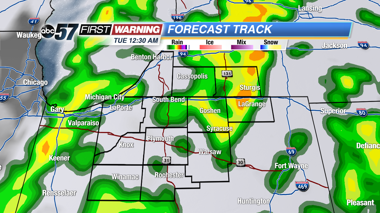 Rain most likely overnight Monday