
-
1:24

Storm track timing could be shifting
-
0:57

The Unity Gardens brought music, food, and crafts for their Westside...
-
1:50

Quiet evening, Storms after Midnight
-
0:57

Deer Creek Hunt Club throws a skeet shoot event for Deputy Jon...
-
1:44

Two rounds of storms Monday
-
1:07

Mini heat wave starts out the door
-
2:23

La Porte community rallies for Sammy Strong Benefit, raising...
-
1:57

The Potawatomi Zoo opens its gates to Zoo Nights Live
-
2:50

Carson Kvapil wins his first O’Reilly Auto Parts Series win...
-
1:10

William Tuffs honored as the only Indiana man who took part of...
-
0:50

Beacon Health held a Health and Wellness fair for the community
-
1:03

Warm conditions start overnight

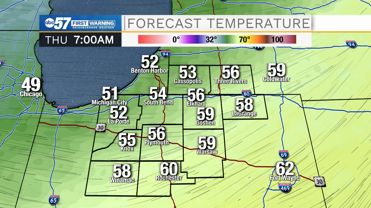
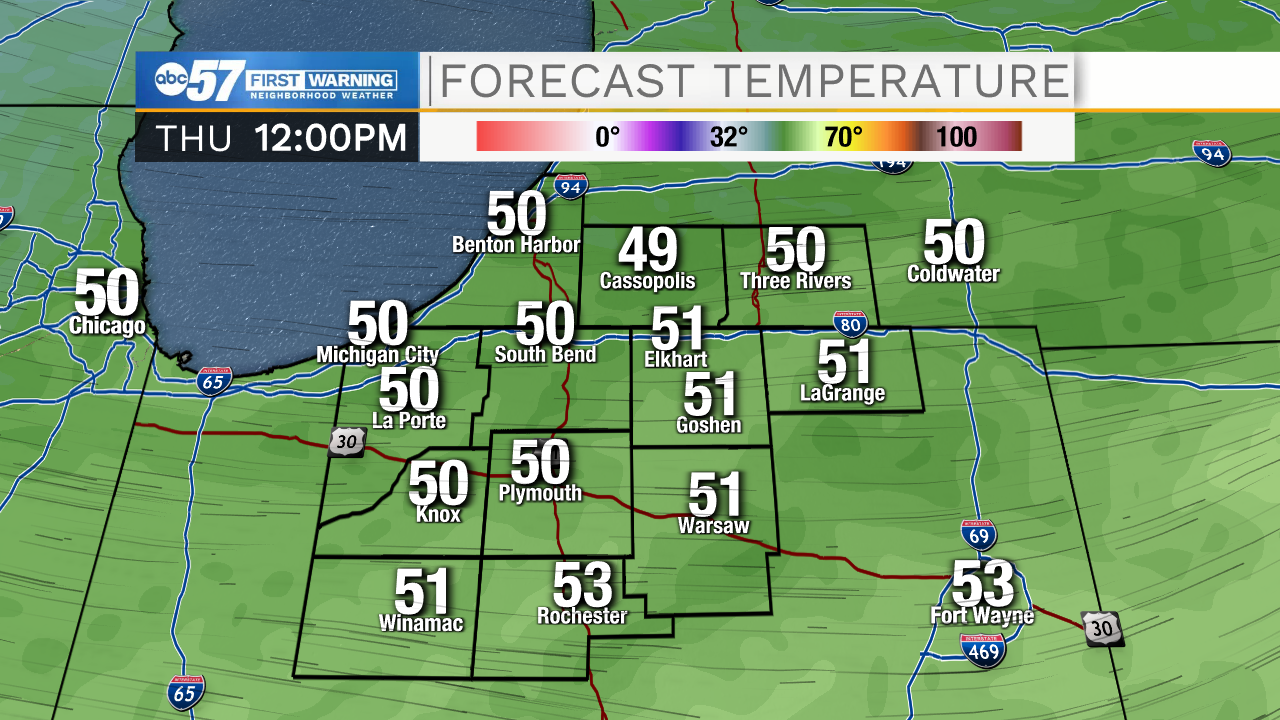
The cold air surges early Thursday morning. The earlier arrival will still drop temperatures but they will no longer fall through the day Thursday. Instead temperature range between 50 and 55 before dropping into the mid-30s early Friday. Frost is possible Friday morning. The weekend is cooler but near normal for mid-October with highs in the upper 50s. Next week’s forecast is sketchy at best with a lot of turbulence in the models. Plan for rain early next week.
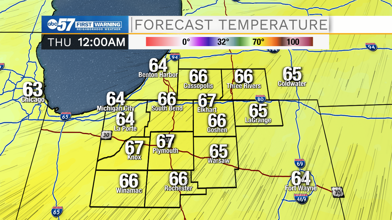
Tonight: Mostly cloudy, chance of showers. Breezy. Low 50.
Thursday: A chance of showers. Breezy. Temps range 50 to 55.
Friday: Mostly sunny. High 56.
Saturday: Partly cloudy. 58
Sign up for the ABC 57 Newsletter