Few rounds of snow and then extreme cold

-
2:00

Annual Studebaker car show takes over Ironwood Plaza
-
0:55

Beautiful weekend expected
-
1:05

Truly wonderful conditions
-
0:41

One person left with serious injuries after high-speed pursuit...
-
2:15

Fort Wayne Tin Caps put an end to the SB Cubs winning streak
-
1:21

This weekend is the annual Hall of Heroes Comic Con
-
0:46

Elkhart Police Department respond to shots fired call at the...
-
3:55

ABC57 speaks with Cass County Commissioners, Judge and Interim...
-
2:48

Common Council to consider appeal options following South Bend...
-
0:52

South Bend seniors explore local parks, event centers, and available...
-
1:51

Mentone Egg Fest celebrates 80th year
-
4:58

New reactions after Notre Dame releases findings of priest sex...

Lake effect snow showers have made roads slick this morning. Make sure you’re giving yourself an extra 5-10 minutes for your commute. It is bitterly cold so pack on the layers. Some schools have 2-hr delays, you can find that full list here. We’ll be tracking road conditions closely all morning on ABC 57 Morning News.
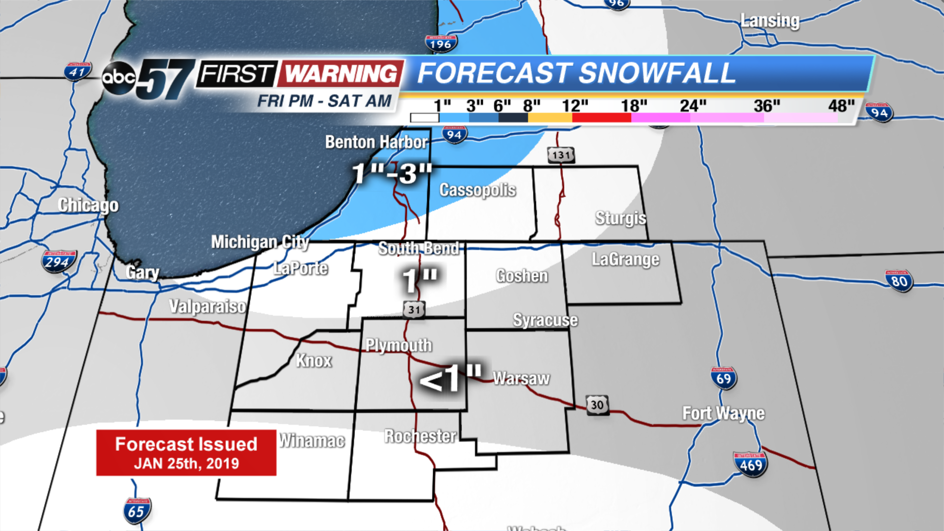
A few light snow showers move in later this evening lasting into Saturday morning, adding an additional 1-3” of snow. Daytime highs remain mainly in the teens but the true arctic air moves in after a snowy system on Monday. Daytime highs will likely be subzero by the middle of the week with overnight lows well below zero.
Today: Morning snow showers, mostly cloudy. High of 10.
Tonight: Few snow showers, low of 4.
Saturday: Morning flurries, mostly cloudy. High of 18.
Sunday: Chance of snow, mostly cloudy. High of 18.