Few scattered showers Sunday; rain and wind risks tonight


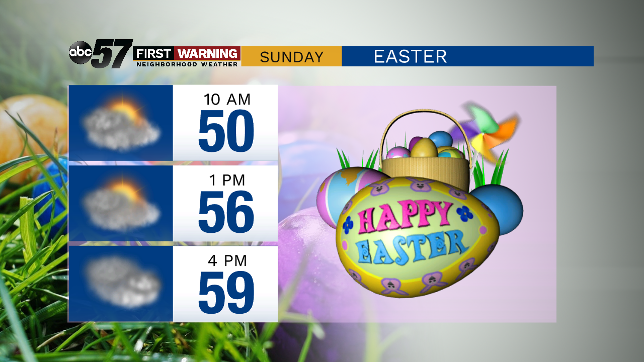
Scattered showers are possible throughout Easter Sunday, but are the most likely after 4 PM. The day is mostly cloudy and dry. Afternoon temperatures warm near 60.
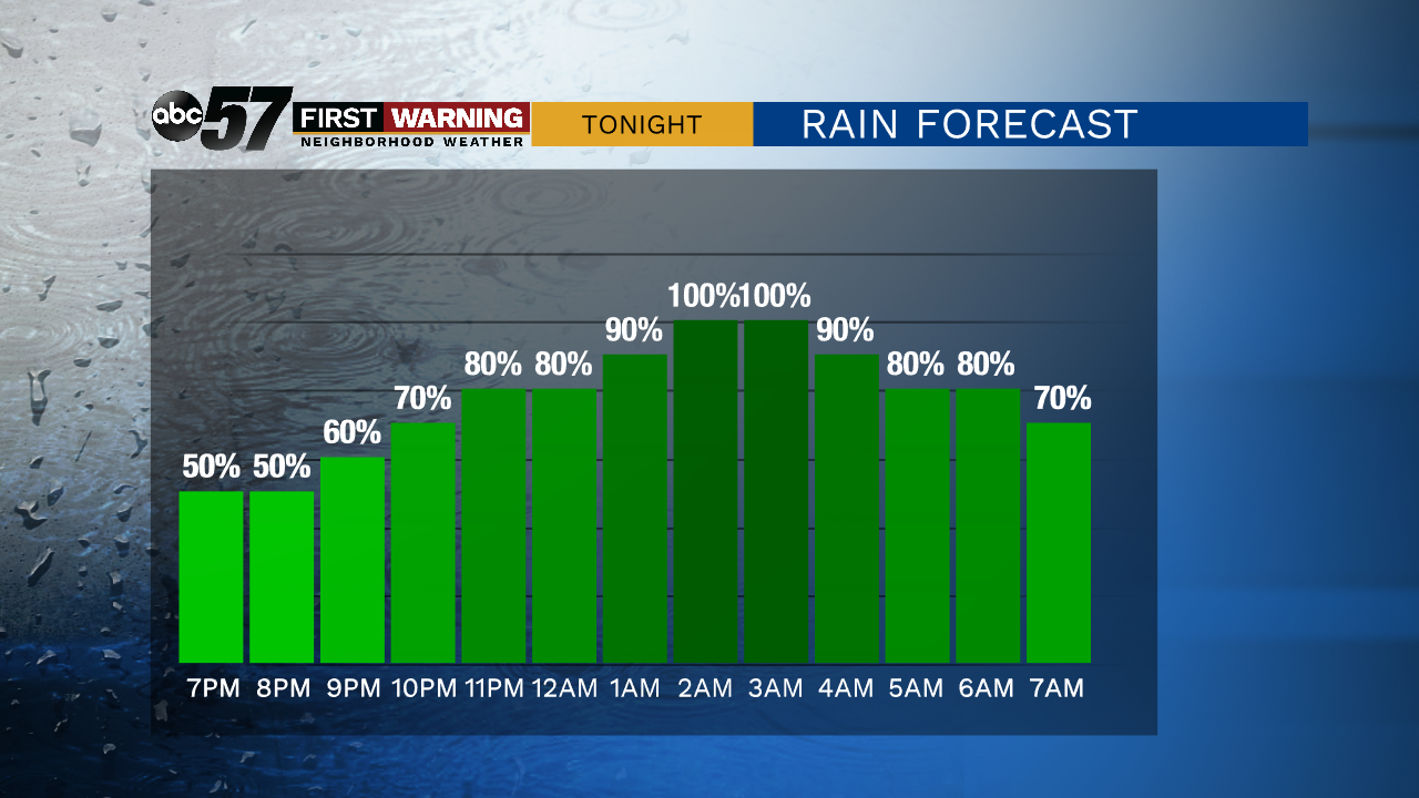
Chances for rain pick up this evening, and rain is likely throughout the night. A few thunderstorms are possible overnight. As temperatures drop, a few snowflakes may mix in with the rain.
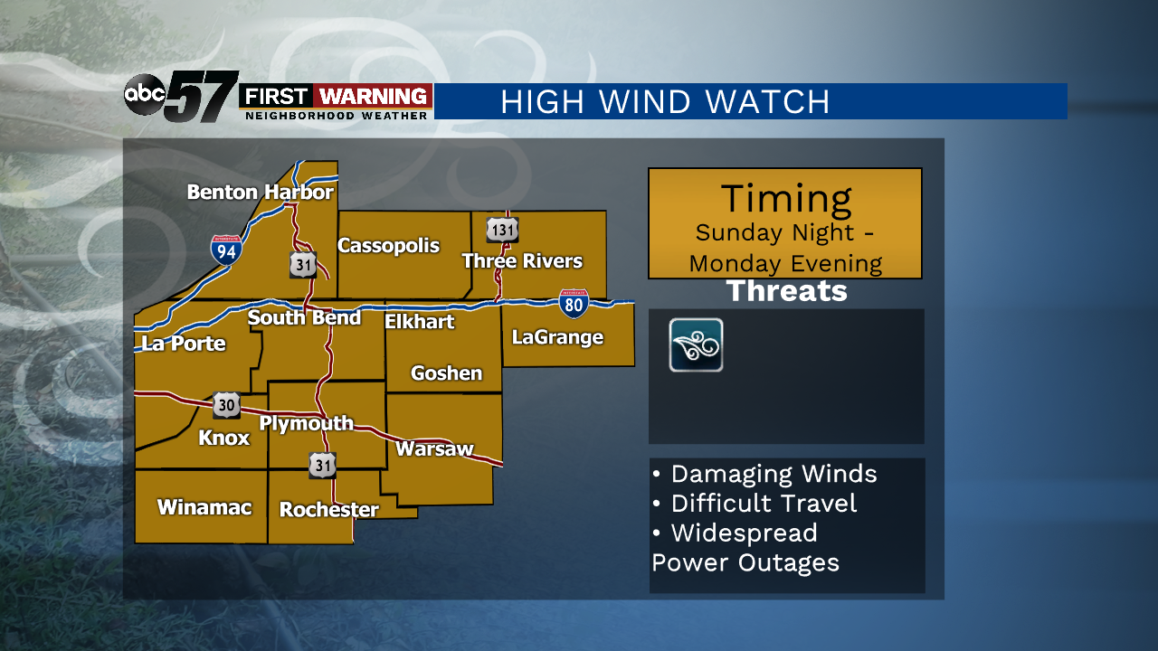
As the front passes early Monday morning, temperatures drop and wind picks up. There is a high wind watch, as winds could occasionally gust up to 50 mph Monday. Be sure outside objects (trash cans, tents, patio furniture) are secure.
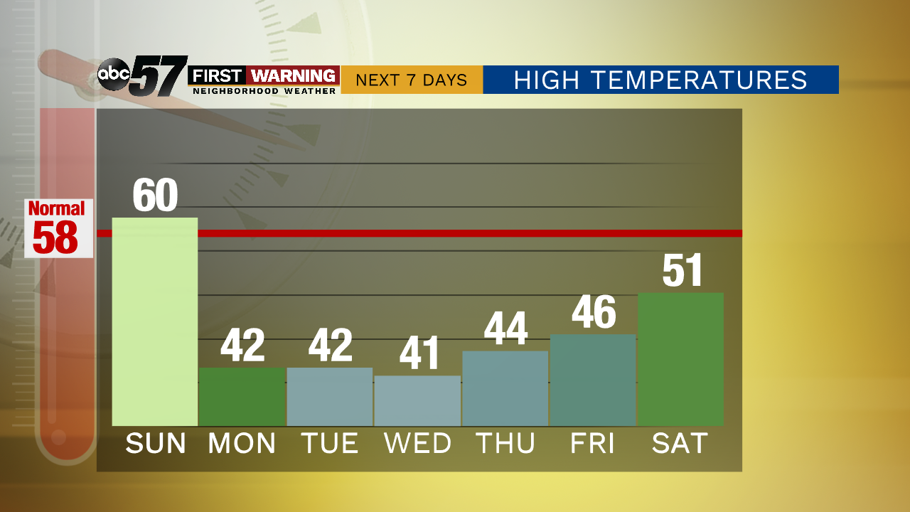
The rest of the week will be cool with highs in the low to mid 40s, but will stay relatively dry.
Today: Mostly cloudy. Scattered afternoon showers. High 60.
Tonight: Rain, chance thunderstorms. Low 39.
Monday: Showers early. Windy and mostly cloudy. High 42.
Tuesday: Partly cloudy. High 42.