
-
1:23

Eviction Sealing Program launched in Portage Township
-
2:37

Merit Board votes to defer backpay decision as internal investigation...
-
3:30

Sweeping changes to Hoosier education as new laws go into effect
-
3:27

Protestors call for day of action in response to “One big beautiful...
-
1:22

Warmer Wednesday with storm chances creeping back in
-
2:12

County fair season arrives in Michiana
-
1:55

Looking at a dry and sunny start to the new month
-
4:03

La Porte woman loses job and home after reporting mold in apartment
-
0:59

Fever’s Clark selected as first captain of July 19 WNBA All-Star...
-
0:39

More details released in officer involved shooting in Niles
-
3:19

Gunfire Erupts at Late Night Teen Party in South Bend
-
3:13

BHDPS seeking legislative change to help end mobile nuisance...

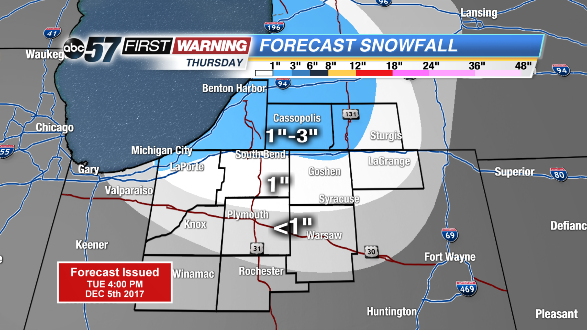
Winter is here to stay as the forecast stays near or below freezing for the next two weeks. Wednesday will still be breezy but the wind does gradually calm into the evening. Lake effect snow is likely to start Wednesday night and last through Thursday. Lake effect zones will see measurable snowfall of one inch or more, some could see up to three inches. The next focus for widespread snow will be Saturday.
Tonight: Partly cloudy, breezy, low 24.
![]()
Wednesday: Mostly cloudy, breezy, chance of lake effect snow, high of 34.
Thursday: Lake effect snow showers, high of 28.
Friday: Partly cloudy, highs in the upper 20s.
Sign up for the ABC 57 Newsletter