
-
0:58

Chilly and sunny Tuesday ahead
-
0:41

Elkhart police investigating Monday night shooting
-
3:47

Elkhart Police Department accepting applications to Citizens...
-
0:52

A slight warm-up but chilly weather still dominates
-
1:09

Bitterly cold out the door
-
3:03

Looking to younger generations to keep Dyngus Day thriving
-
3:06

Even as rivers recede, Marshall County still dealing with flooding
-
3:29

Michigan fans gather in Indianapolis ahead of National Championship...
-
3:22

Hamlet local and tow truck driver describes US 30 crash site...
-
4:28

Dyngus Day celebrations highlight voter turnout, transparency
-
4:54

Now-disbanded St. Joseph County Metro Homicide Unit investigator...
-
0:52

Shots fired on Sunnymede Avenue Saturday, cars and homes struck

Another foggy start for Michiana with areas of dense fog developing later this morning. Freezing fog and freezing drizzle are both possible early this morning, so watch out for areas of black ice. Fog sticks around through today with times of light rain and drizzle through tonight. Periods of heavier rain move in tomorrow with more fog in the forecast as snow melts. Highs reach into the middle 40s today and low 50s by tomorrow.
We are still watching a potential winter storm for Friday. Right now it looks like the heaviest snow will be to our east in Ohio but if the track of the storm shifts, it will greatly change the path of heaviest snow. Lake effect snow develops behind the system for Saturday.
Today: Fog and drizzle, high of 46. 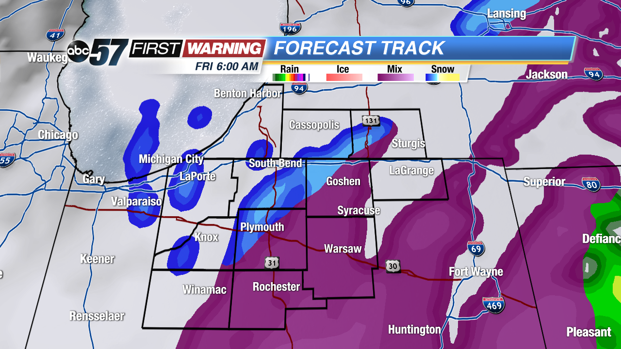 Wintry mix and snow Friday morning
Tonight: Fog and light rain, low 45.
Thursday: Rain and fog, highs near 50.
Friday: Snow showers, high of 30.