
-
2:16

More sunshine today with a severe risk tomorrow
-
0:32

Granger residents share input on proposed S.R. 23 roundabout
-
2:59

Seven local boards unanimously approve fire territory merger...
-
2:05

JobSpark helps inspire career exploration for middle school students
-
2:01

MPHPL launches new bookmobile to extend library access
-
2:17

Will Pauling shines, Jadarian Price shows versatility at Notre...
-
2:55

Notre Dame’s Pro Day gives 16 seniors one more shot to impress...
-
2:57

South Bend residents voice concerns over proposed pedestrian...
-
3:03

Prices at the pump continue to rise across Michiana
-
1:35

Warming up before storms arrive Thursday
-
1:06

Alliance for the Great Lakes publishes ’Data Center Playbook’
-
2:06

Staying sunny until Thursday

Rain ending but staying damp/humid overnight with fog likely by Wednesday morning. Delays are possible.
Foggy start to Wednesday, after the fog fades out warm and sunny pattern begins and lasts for a week. Highs will peak near 90 Thursday and remain warm through next week, with highs running ten degrees above normal. Little chance for any rain until a pattern change, possibly next Wednesday or Thursday.
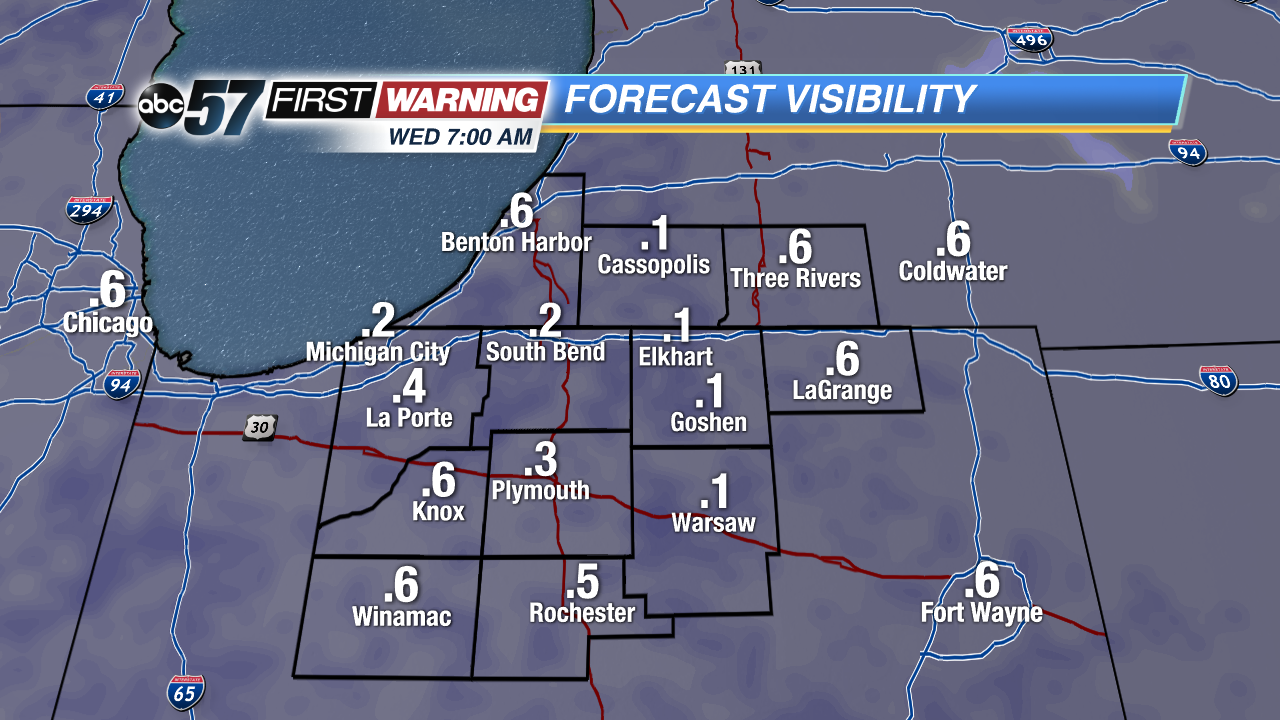 Low visibility could cause delays Wednesday AM
Tonight: Mostly to partly cloudy with fog developing, low 62.
Wednesday: Morning fog then mostly sunny, high of 84.
Thursday: Mostly sunny, highs in the upper 80s.
Friday: Sunny, highs in the mid-80s.
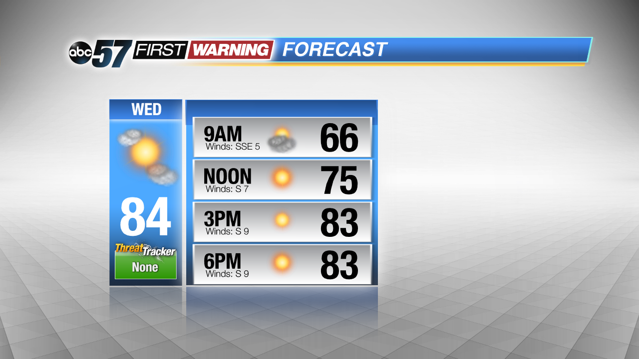 Skies clear the rest of Wednesday
Sign up for the ABC 57 Newsletter