
-
2:34

From Niles to South Bend: Jays 2 Keeps the Spirit Alive for basketball...
-
0:46

44th annual Tri Kappa Antique Show boosts charities and scholarships
-
1:48

Scattered showers this evening, Much cooler overnight
-
1:50

Showers and storms this afternoon
-
0:20

One person injured in shooting
-
0:36

Eddies Circuit Robotics holds competition Saturday
-
0:32

21st annual Nappanee Model Train Show
-
0:38

Local boys basketball team headed to IHSAA state finals
-
3:49

Midwest Meowfest brings kitten advocacy to attendees, new homes...
-
1:52

Mild tonight, showers tomorrow
-
1:43

Pleasant to start the weekend
-
3:06

Pulaski County weighs stricter solar rules amid resident concerns

Steady snow continues through Friday evening. Final totals of a foot or more are still likely for extreme Northern Indiana and Southwest Michigan. As temperatures drop, snow packed roads will stay slick into Saturday morning.
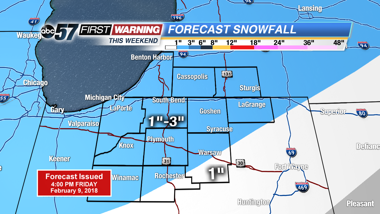
The snowy pattern continues this weekend but total accumulation of one to three inches Saturday and Sunday is nothing compared to Friday’s snowfall. Temperatures remain cold with highs in the mid-20s and lows in the teens. Sunshine returns to start next week, with highs warming above freezing.
Today: Heavy snow, highs near 30.
Tonight: Scattered snow showers, low of 18.
Saturday: Scattered snow showers, high of 27.
Sunday: AM snow showers, highs in the middle 20s.
Sign up for the ABC 57 Newsletter